
Very strong M7.1 earthquake hits Kermadec Islands, New Zealand
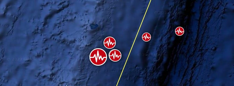
Image credit: TW/SAM, Google
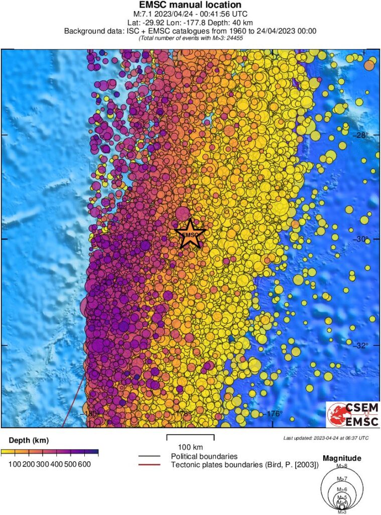
A very strong earthquake registered by the USGS as M7.1 hit the Kermadec Islands region, New Zealand at 00:41 UTC on April 24, 2023. The agency is reporting a depth of 49 km (30 miles). EMCS is reporting M7.1 at a depth of 40 km (24.8 miles).
The epicenter was located 921.1 km (572.3 miles) NNE of Hicks Bay, Gisborne, New Zealand, and 1014.8 km (630.6 miles) SSW of Nuku‘alofa, Tongatapu, Tonga.
The USGS issued a Green alert for shaking-related fatalities and economic losses. There is a low likelihood of casualties and damage.
Overall, the population in this region resides in structures that are highly resistant to earthquake shaking, though some vulnerable structures exist. The predominant vulnerable building types are reinforced masonry and unreinforced brick with timber floor construction.
Small tsunami waves were registered at Raoul Island:
                  GAUGE      TIME OF   MAXIMUM     WAVE
                         COORDINATES   MEASURE   TSUNAMI   PERIOD
    GAUGE LOCATION        LAT   LON     (UTC)     HEIGHT    (MIN)
    -------------------------------------------------------------
    RAOUL IS BOAT COVE   29.3S 177.9W    0054   0.09M/ 0.3FT  06
    FISHING ROCK RAOUL   29.3S 177.9W    0057   0.11M/ 0.4FT  06
The quake was preceded by M4.9 at 16:24 UTC and M5.0 at 16:51 UTC on April 23, and followed by M5.4 at 01:05 UTC, M5.3 at 01:51 UTC, and M4.9 at 07:28 UTC.
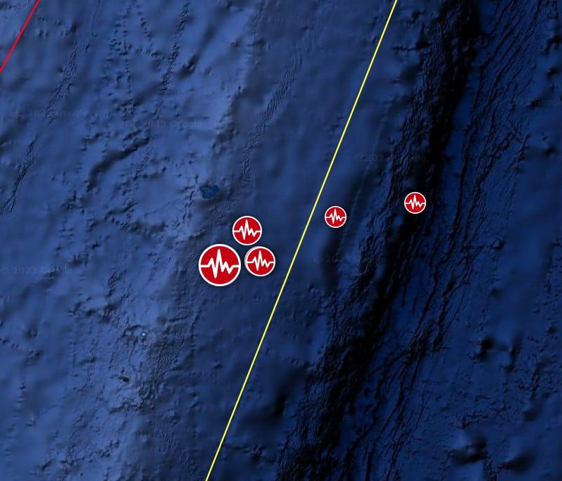
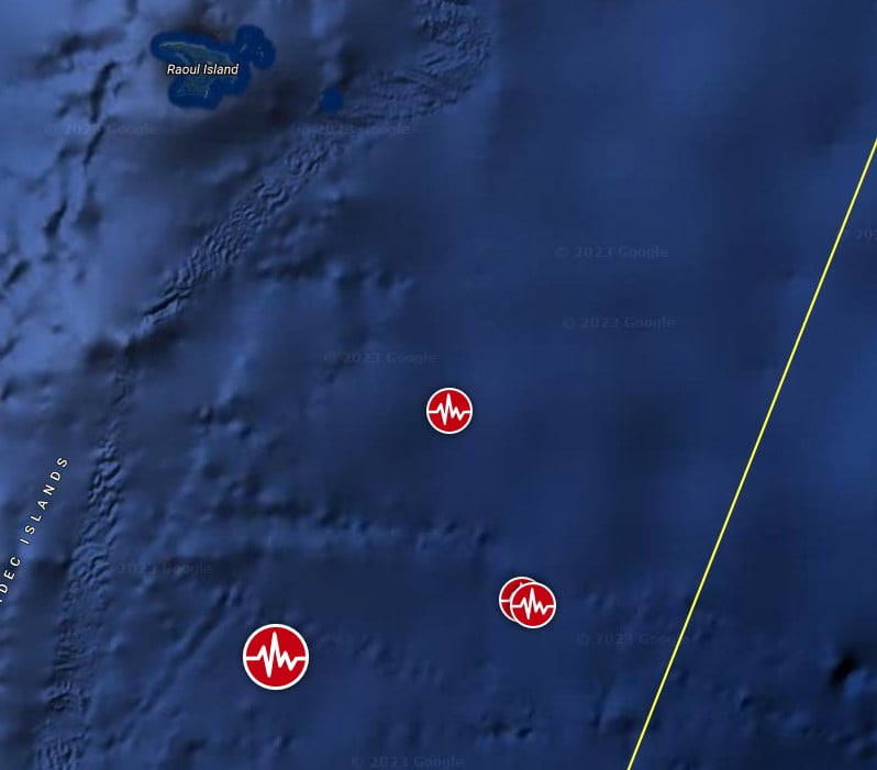
Regional seismicity
I'm a dedicated researcher, journalist, and editor at The Watchers. With over 20 years of experience in the media industry, I specialize in hard science news, focusing on extreme weather, seismic and volcanic activity, space weather, and astronomy, including near-Earth objects and planetary defense strategies. You can reach me at teo /at/ watchers.news.
Commenting rules and guidelines
We value the thoughts and opinions of our readers and welcome healthy discussions on our website. In order to maintain a respectful and positive community, we ask that all commenters follow these rules.