
Category 5 Tropical Cyclone “Ilsa” makes landfall in Western Australia, setting the country’s new landfall wind speed record
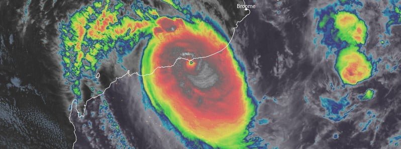
Featured image: Tropical Cyclone "Ilsa" at 16:00 UTC on April 13, 2023. Credit: JMA/Himawari-9, RAMMB/CIRA, The Watchers
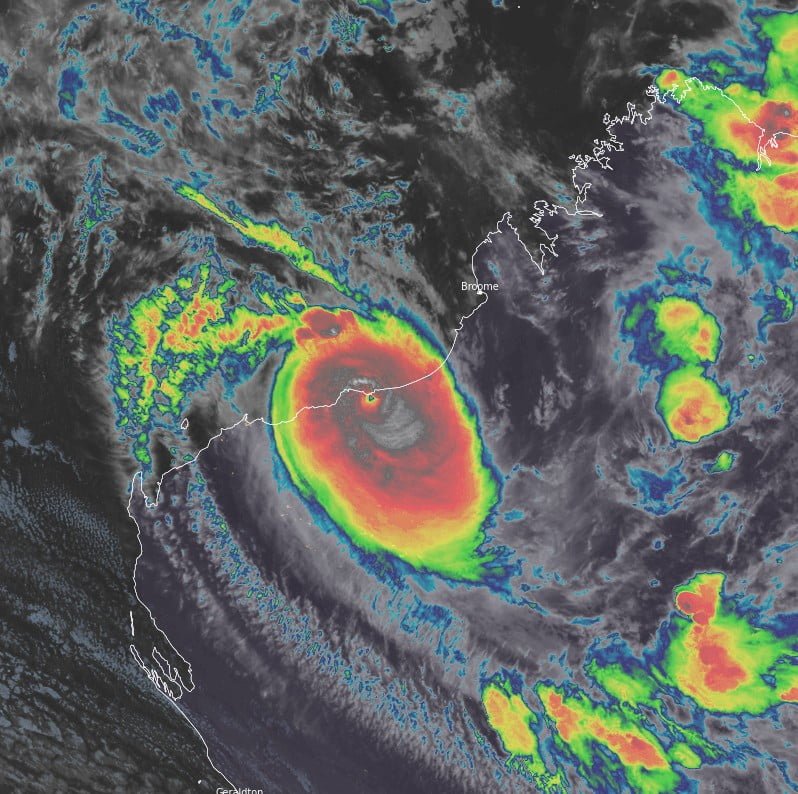
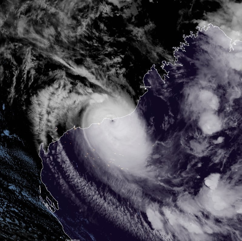
Tropical Cyclone “Ilsa” made landfall as a Category 5 system in a sparsely populated area of Western Australia around 16:00 UTC on April 13, 2023 (00:00 LT on April 14), as the strongest cyclone to hit the region in 14 years.
With a 10-minute sustained wind speed of 218 km/h (135 mph) registered at Bedout Island, Ilsa has set Australia’s new wind speed record at landfall. The previous record was 194 km/h (120 mph), set in 2007 by Tropical Cyclone “George”, also at Bedout Island.
Ilsa had one-minute sustained winds of 240 km/h (149 mph), and three-second sustained winds of 295 km/h (183 mph), both new records.
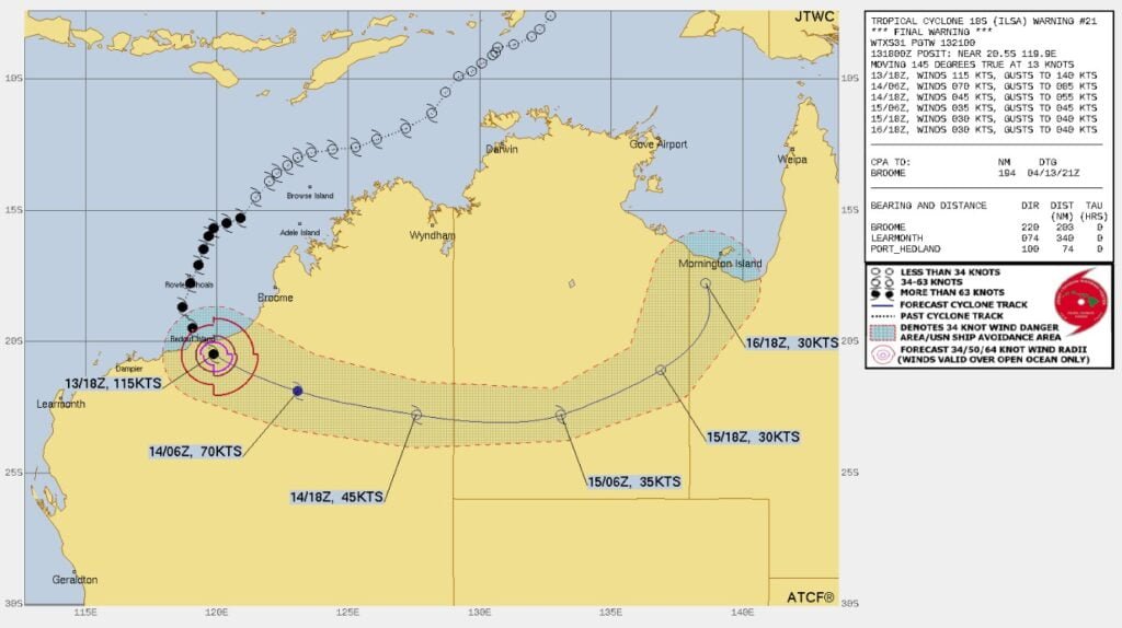
The cyclone made landfall about 100 km (62 miles) north of Port Hedland, a city with the world’s largest export site for iron ore, but only minor destruction was reported as most vessels were moved farther west ahead of landfall.
There have been no reports of injury to people and critical infrastructure was not damaged.
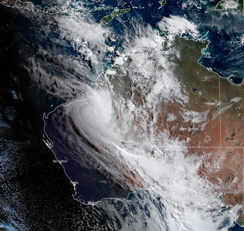
Ilsa weakened into a Category 3 system by 08:00 LT on April 14 (00:00 UTC) and to Category 1 by 17:00 LT (09:00 UTC). At the time, its center was located 155 km (96 miles) NE of Parnngurr and 380 km (236 miles) W of Kiwirrkurra.
The system is expected to weaken below cyclone intensity over the next few hours as it moves over interior Western Australia.
The remnants of Ilsa are expected to move into southern parts of the Northern Territory on Saturday morning (LT).
Hazards
DAMAGING WINDS with gusts to 100 km/h (62 mph) are occurring over central and western parts of the North Interior district, including Kunawarritji. DAMAGING WINDS may reach Kiwirrkurra later tonight.
DAMAGING WINDS from the remnants of Ilsa are possible across southern parts of the Northern Territory on Saturday, April 15.
HEAVY RAINFALL which may lead to FLASH FLOODING is possible through the central and eastern North Interior district this evening, extending into southern parts of the Northern Territory on Saturday. Six-hourly rainfall totals between 50 mm and 100 mm (2 – 4 inches) are possible.
I'm a dedicated researcher, journalist, and editor at The Watchers. With over 20 years of experience in the media industry, I specialize in hard science news, focusing on extreme weather, seismic and volcanic activity, space weather, and astronomy, including near-Earth objects and planetary defense strategies. You can reach me at teo /at/ watchers.news.
Commenting rules and guidelines
We value the thoughts and opinions of our readers and welcome healthy discussions on our website. In order to maintain a respectful and positive community, we ask that all commenters follow these rules.