
Tropical Cyclone Warning issued for the coast of Western Australia and Northern Territory
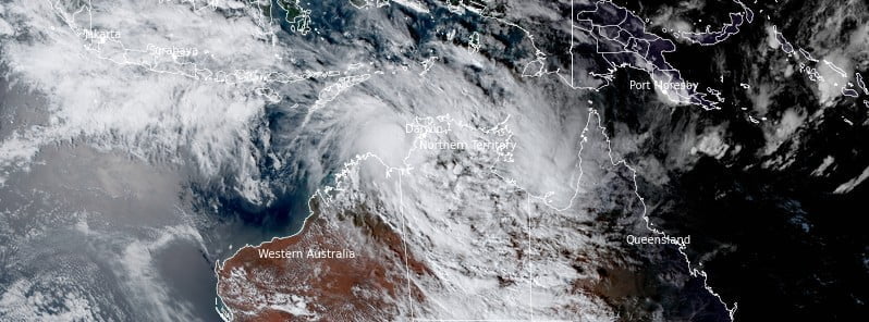
Image credit: JMA/Himawari-8, RAMMB/CIRA, The Watchers. Acquired at 08:00 UTC on December 22, 2022
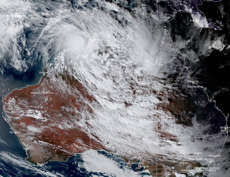
A new tropical cyclone is brewing over the Timor Sea, near the coast of Australia’s Northern Territory and Western Australia. As a result, the Australian Bureau of Meteorology has issued a Tropical Cyclone Warning for the coast of Western Australia and the Northern Territory.
- At 09:00 UTC on December 22, the JTWC designated the storm as Tropical Cyclone 06S
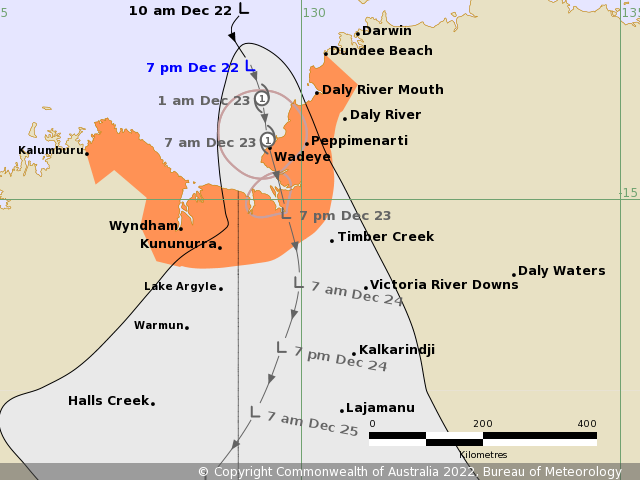
- The system is expected to reach Category 1 strength on the Australian cyclone scale around 01:00 LT on December 23
- Landfall is expected around 07:00 LT on December 1 near or over Wadeye, Northern Territory
At 09:00 UTC on December 22, Tropical Low 06S was located about 155 km (96 miles) north-northwest of Wadeye, NT.
The system had maximum 10-minute sustained winds of 55 km/h (35 mph), with gusts up to 85 km/h (50 mph), and maximum 1-minute sustained winds of 65 km/h (40 mph).
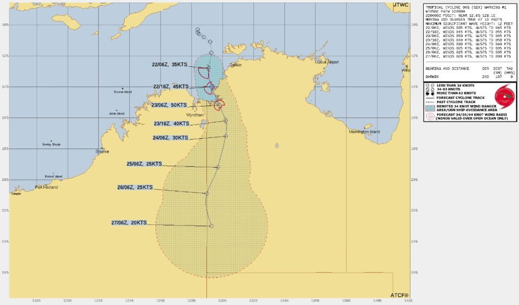
The minimum central barometric pressure at 09:00 UTC was 996 hPa, and the system was moving SSE at 11 km/h (6.9 mph).
“A tropical low located west of Darwin is deepening as it moves southwards into the Joseph Bonaparte Gulf,” BOM forecasters said at 09:00 UTC (19:30 ACST) on December 22.1
“The low is forecast to intensify into a tropical cyclone tonight before crossing the coast on Friday [December 23].”
Hazards
Gales with gusts to 90 km/h (55 mph) may develop overnight tonight between Dundee Beach south to the NT/WA border. Wind gusts to 120 km/h (75 mph) may develop near Wadeye before sunrise Friday as the tropical cyclone approaches.1
Gales with gusts to 90 km/h (55 mph) may develop between the NT/WA border and Wyndham during Friday, December 23, and possibly further west towards Kalumburu if the system tracks further west than expected.
Heavy rainfall is likely to develop from tonight over the Daly district, extending into the Gregory and east Kimberley districts on Friday.
Severe thunderstorms are also possible tonight and during Friday, with heavy rainfall and damaging wind gusts possible.
Tides will be higher than normal between Dundee Beach and Wyndham. Large waves may produce minor flooding in low-lying coastal areas on Friday.
Recommended action
NTES advises:
- People in Wadeye and surrounding areas should take action to complete preparations
- Check your household plan
- Listen for the next advice
DFES (WA) advises:
People in or near Wyndham, Kununurra, and to the Northern Territory border need to prepare for cyclonic weather and organize an emergency kit including a first aid kit, torch, portable radio, spare batteries, food, and water.
References:
1 Tropical Cyclone Forecast Track Map – BOM – 09:00 UTC on December 22, 2022
I'm a dedicated researcher, journalist, and editor at The Watchers. With over 20 years of experience in the media industry, I specialize in hard science news, focusing on extreme weather, seismic and volcanic activity, space weather, and astronomy, including near-Earth objects and planetary defense strategies. You can reach me at teo /at/ watchers.news.
Commenting rules and guidelines
We value the thoughts and opinions of our readers and welcome healthy discussions on our website. In order to maintain a respectful and positive community, we ask that all commenters follow these rules.