
Maysak becomes strongest typhoon of the year, heads toward South Korea after lashing Okinawa
Featured image: Typhoon "Maysak" at 08:00 UTC on September 1, 2020. Credit: JMA/Himawari-8, RAMMB/CIRA
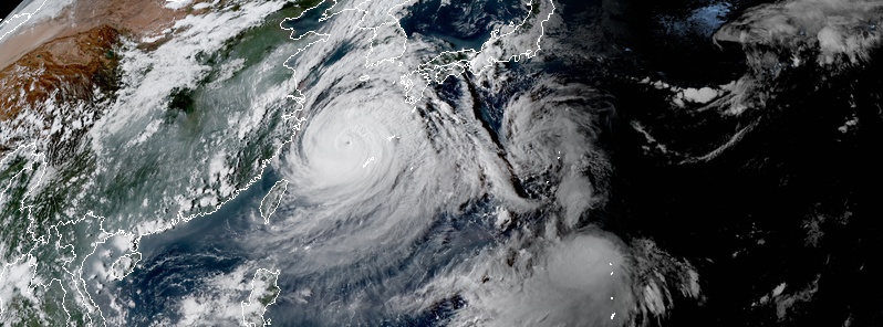
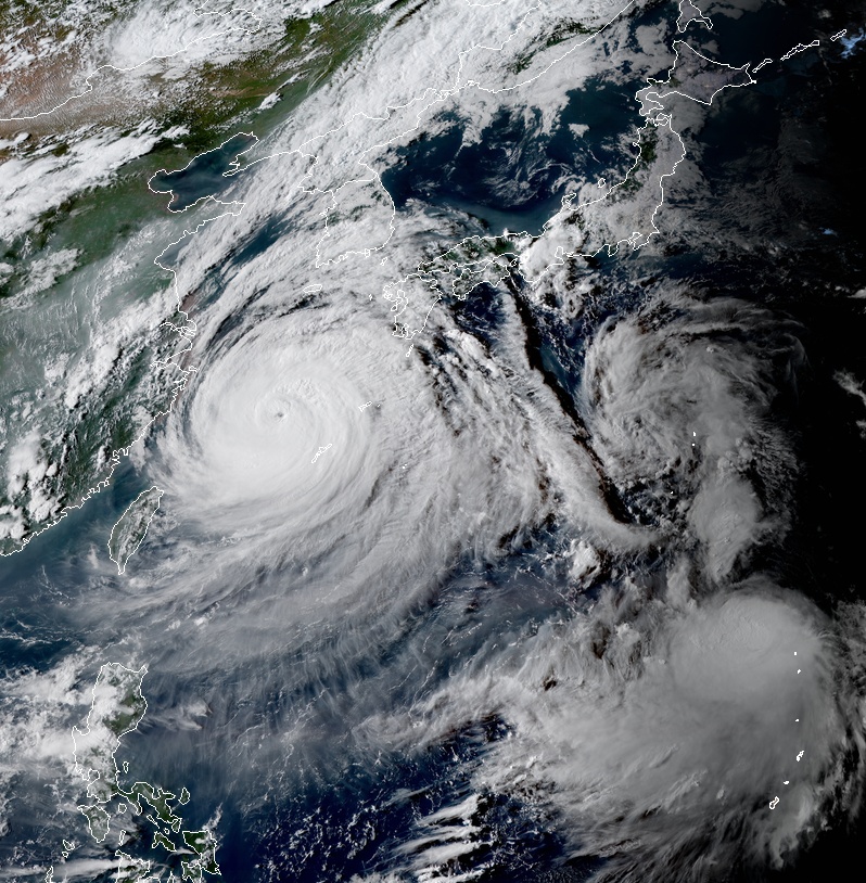
Typhoon "Maysak" became the strongest typhoon of the year on August 31, 2020, with its eye passing very close to Kume Island, Okinawa Prefecture, Japan. The storm is moving towards the Korean Peninsula, with landfall expected near Busan, South Korea on September 2. Another powerful typhoon — Haishen — is expected to move toward Japan later this week, and possibly impact Kyushu around September 6 before it approaches the Korean Peninsula.
Maysak intensified to Category 4 hurricane equivalent on August 31, becoming the strongest typhoon of the year so far. According to the Japan Meteorological Agency (JMA), Maysak's central pressure was around 940 hPa, which is nearly the same as Hurricane "Laura" at the time of landfall in Louisiana, U.S.
Kumejima airport recorded the strongest wind gust at 196 km/h (121 mph) and 225 mm (8.8 inches) of rain in 24 hours.
At least 5 people have been injured and more than 30 000 households lost power.
In Okinawa's capital Naha, where peak gust of 157 km/h (98 mph) was measured, a wall of a building was ripped off, damaging two cars parked nearby. Many buildings had their roofs blown off, more than 250 flights have been canceled and many bus and ferry services temporarily canceled.
Maysak is now moving towards the north and is expected to pass very close to Kyushu before it makes landfall in South Korea on September 2 as one of the strongest typhoons to hit the country on record. Only 5 other Category 2+ typhoons have made landfall in South Korea since 1959.
The country is still recovering from this year's record-long monsoon which caused destructive flooding and left more than 40 people dead.
After moving over South Korea, Maysak is forecast to reach North Korea — which was hit by Typhoon "Bavi" last week, one of the country's three strongest typhoons on record.
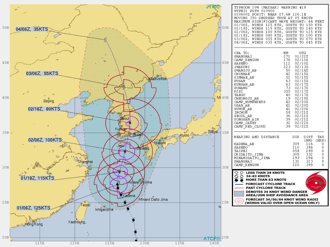
At 07:00 UTC September 1, Maysak's center was located about 110 kilometers (70 miles) northwest of Kume Island, Okinawa.
Its maximum 10-minute sustained winds were at 175 km/h (110 mph), maximum 1-minute sustained winds at 230 km/h (145 mph), with gusts to 250 km/h (155 mph). The minimum central barometric pressure was 935 hPa, and the system was moving northward at 13 km/h (8 mph).
Typhoon "Maysak" at 08:00 UTC on September 1, 2020. Credit: JMA/Himawari-8, RAMMB/CIRA
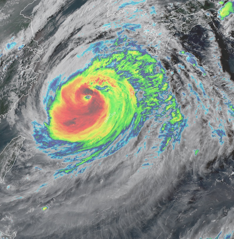
"Animated multispectral satellite imagery depicts spiral banding wrapping tightly into an approximately 18 km (11.5 miles) diameter eye," JTWC forecasters noted.
The environment continues to be favorable with robust, radial outflow aloft, low vertical wind shear, warm sea surface temperatures, and continued high ocean heat content. Maysak is tracking under the combined steering influence of two subtropical ridges and is currently rounding the primary steering ridge axis positioned to the east.
The system will track poleward after rounding the axis of the steering ridge and will begin weakening due to decreasing sea surface temperatures and increasing vertical wind shear over the next 3 days.
By 21:00 UTC on September 1, Maysak will weaken to 215 km/h (130 mph), and further to 185 km/h (115 mph) by 09:00 UTC on September 2 due to the degrading environmental conditions.
Furthermore, analysis of the eyewall structure in microwave imagery suggests that an eyewall replacement cycle is likely, which will also contribute to the weakening trend over the next 24 to 48 hours.
After tracking generally northward over the next 24 hours, the system will make landfall on the southern coast of South Korea, west of the city of Busan. It will then continue to weaken to 150 km/h (90 mph) by 21:00 UTC on September 2 as it moves inland due to the frictional effects of land and very high vertical wind shear.
The system will begin the extratropical transition as it becomes embedded in the baroclinic zone at that time.
Another potentially catastrophic typhoon — Haishen — is expected to strengthen on its way toward Kyushu and the Korean Peninsula over the next couple of days.
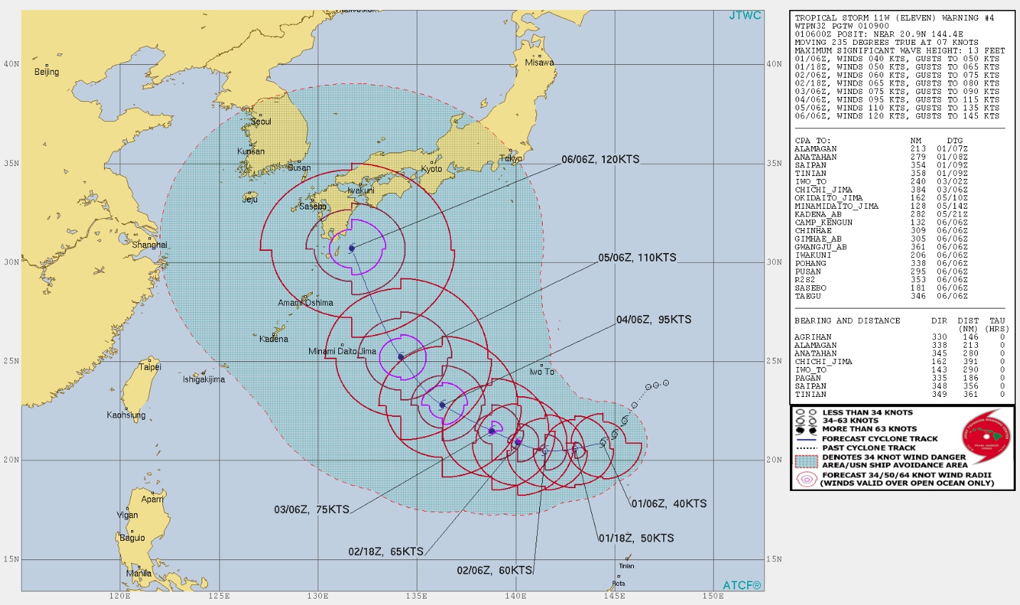
We'll have more about that system in another report. For now, take a look at JTWC's forecast track and the GFS forecast model:
I'm a dedicated researcher, journalist, and editor at The Watchers. With over 20 years of experience in the media industry, I specialize in hard science news, focusing on extreme weather, seismic and volcanic activity, space weather, and astronomy, including near-Earth objects and planetary defense strategies. You can reach me at teo /at/ watchers.news.
Commenting rules and guidelines
We value the thoughts and opinions of our readers and welcome healthy discussions on our website. In order to maintain a respectful and positive community, we ask that all commenters follow these rules.