
Cold outbreak smashes hundreds of records in U.S., heavy snow continues for central region
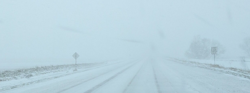
Image credit: Sioux County Sheriff
A severe cold outbreak has gripped wide swaths of the U.S., breaking hundreds of all-time records, particularly the worst-hit states in the Midwest. According to the National Weather Service (NWS), heavy snow will continue in the Central Rockies before streaking across the Central Plains to Upstate New York through Friday, April 17, 2020. A few record lows are also forecast from the Front Range of the Rockies into the Midwest through Saturday, April 18.
Snowfall and temperatures hit record levels in several cities across the central and northern portions of the country.
In 7 days to April 16, the NOAA daily records summary shows that the U.S. had 88 high maximum records, 107 high minimum, 338 low maximum, 235 low minimum, 318 precipitation, and 165 snowfall.
In 30 days to April 16, NOAA registered 1 644 daily high maximum records, 1 684 high minimum, 1 082 low maximum, 754 low minimum, 1 815 precipitation, and 463 snowfall.
In 7 days to April 16, U.S. had 5 monthly high maximum records, 3 high minimum, 6 low maximum, 5 low minimum, 24 precipitation, and 6 snowfall.
In 30 days to April 16, U.S. broke 134 high maximum temperatures, 149 high minimum, 71 low maximum, 43 low minimum, 52 precipitation, and 13 snowfall.

In Wisconsin, Eu Claire saw 19.6 cm (7.7 inches) of snow, breaking the previous daily record for April 12 which was 17.8 cm (7 inches) set in 1962. It also became the snowiest Easter on record for the city, smashing the previous snowiest Easter set in 1929 at 14 cm (5.5 inches).
In Iowa, several towns saw record amounts of snowfall. Ringsted registered 27.9 cm (11 inches), Rock Valley had 17.8 (7 inches), Hull 16.5 cm (6.5 inches), and Rock Rapids 21.2 cm (8.3 inches).
Nearby Sioux Falls received 19.6 cm (5.2 inches), the most snowfall on any date in the city since 1893. Sioux City registered 9.4 cm (3.7 inches), a record for April 12 and the second-most Easter snow.
Would you believe we had record snowfall in some areas today?
For Sioux Falls, we didn't just set a new daily record for April 12th, but also for ANY #EasterSunday in our period of record (back to 1893).
This is also only the 6th Easter with measurable snowfall! pic.twitter.com/McfTrciS03
— NWS Sioux Falls (@NWSSiouxFalls) April 13, 2020
Make it stop!
Heavy snow now falling in Sioux Falls! pic.twitter.com/Xl0MGsd4j1
— Matthew Dux (@MatthewDux) April 12, 2020
A picture from one of our patrol vehicle cameras shows why you should avoid unnecessary travel today; please stay home and stay safe. pic.twitter.com/wX9hKMD2nY
— Sioux County Sheriff (@siouxcosheriff) April 12, 2020
Denver's Monday morning low temperature of -8.9 °C (16 °F) broke the city's record for coldest April 13. The previous record was -8/3 °C (17 °F) set in 1933. The all-time record for coldest high temperature also occurred on Monday as the past record of -2/8 °C (27 °F) set in 1933 was beaten by -3.9 °C (25 °F).
This season, Boulder has had 341 cm (134.3 inches) of snow– the fifth most snow on record.
Boulder has had 134.3" of snow this season which is now the 5th most on record. #cowx pic.twitter.com/fpiEbBaMtq
— NWS Boulder (@NWSBoulder) April 14, 2020
In Wyoming, Gilette had a low of -15.6 °C (4 F) on Monday morning as well, smashing the past daily record low of -12.8 °C (9 °F) set in 1997 in books dating back to 1902.
Record low temp of 4 F at 4 miles ESE of Gillette, #WYwx, this morning; breaks old record of 9 F set in 1997. pic.twitter.com/jrUbO8lUYB
— NWS Rapid City (@NWSRapidCity) April 13, 2020
Heavy snow is expected to continue impacting the central Rockies through Thursday, April 16, before streaking across the Central Plains to Upstate New York through Friday, April 17. Below normal temperatures with a few record lows are predicted from the Front Range of the Rockies into the Midwest through Saturday, April 18.
"Low pressure over the Central High Plains will move slowly out to the Middle Mississippi Valley by Friday morning and to the Northern Mid-Atlantic Coast by Saturday," said NWS.
"As this system exits into the Central Plains, a stripe of light to moderate wet snow is possible from Nebraska to parts of the Northeast by Friday evening and into parts of New England overnight Friday."
"By Friday night a mix of rain and snow is forecast to enter the Mid-Atlantic and Northeast," NWS continued.
The next big thing in the world of weather for us will be this cold front. It drives in rain and could end as some snow flakes. pic.twitter.com/2xHnzKqzkg
— Jim Caldwell (@JimWKYT) April 16, 2020
All good , just invite Greta over with a few shovels