
Tropical Cyclone “Belna” forecast to make landfall between Mahajanga and Cape Saint-Andre, Madagascar
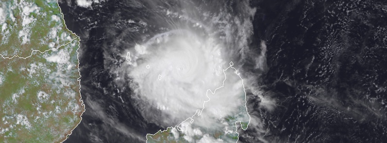
Featured image: Tropical Cyclone "Belna" at 11:00 UTC on December 8, 2019. Credit: Meteosat-8, UW-CIMSS
Tropical Cyclone "Belna" is expected to make landfall between Mahajanga and Cape Saint-Andre, Madagascar just before 18:00 UTC on December 9, 2019, with maximum sustained winds up to 170 km/h (105 mph) and gusts to 205 km/h (130 mph). Depending on the location of landfall, the maximum storm surge could reach 3 m (10 feet) near the impact point. Additionally, torrential rains are awaited on the regions of the landfall, locally exceeding 300 mm (11.8 inches).
At 06:00 UTC on December 8, the center of Belna is located about 300 km (185 miles) W of the northern tip of Madagascar and 180 km (112 miles) NE of Mayotte.
Its maximum sustained winds were 165 km/h (103 mph) and gusts to 205 km/h (130 mph), according to the JTWC.
The cyclone is moving SSW at 11 km/h (7 mph) with a central pressure of 977 hPa.
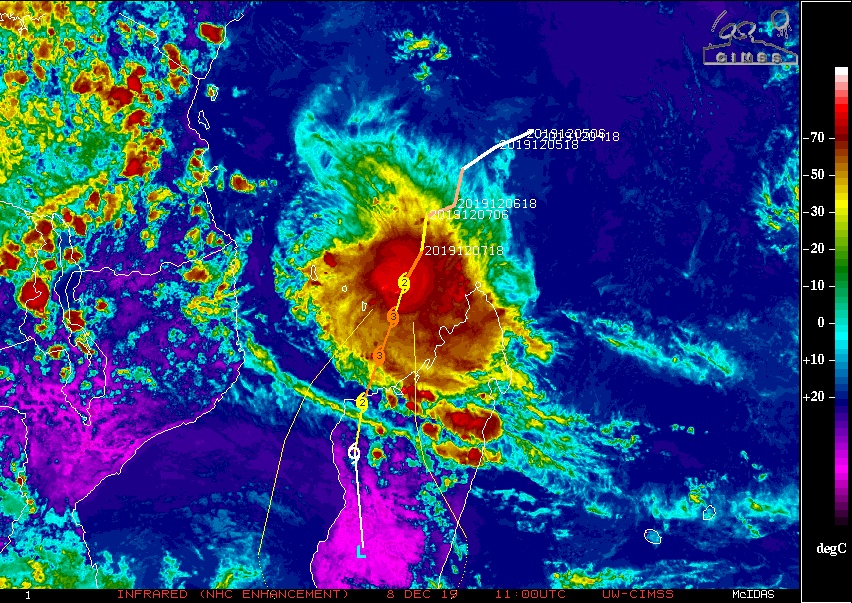
Belna should keep tracking south-southwestward over the next hours, with a mid-level ridge building in the east of the system while weakness in the subtropical ridge arrives in the south, RSMC La Reunion said.
Later today, the center of Belna will pass around 80 km (50 miles) east of Mayotte, according to the current forecast track.
Landfall on Madagascar is expected between Mahajanga and Cape Saint-Andre. After that, uncertainty in track significantly increases due to the passage over land.
After a brief weakening phase, best explained by a northerly constraint at 300 hPa, environmental conditions today remain conducive for development.
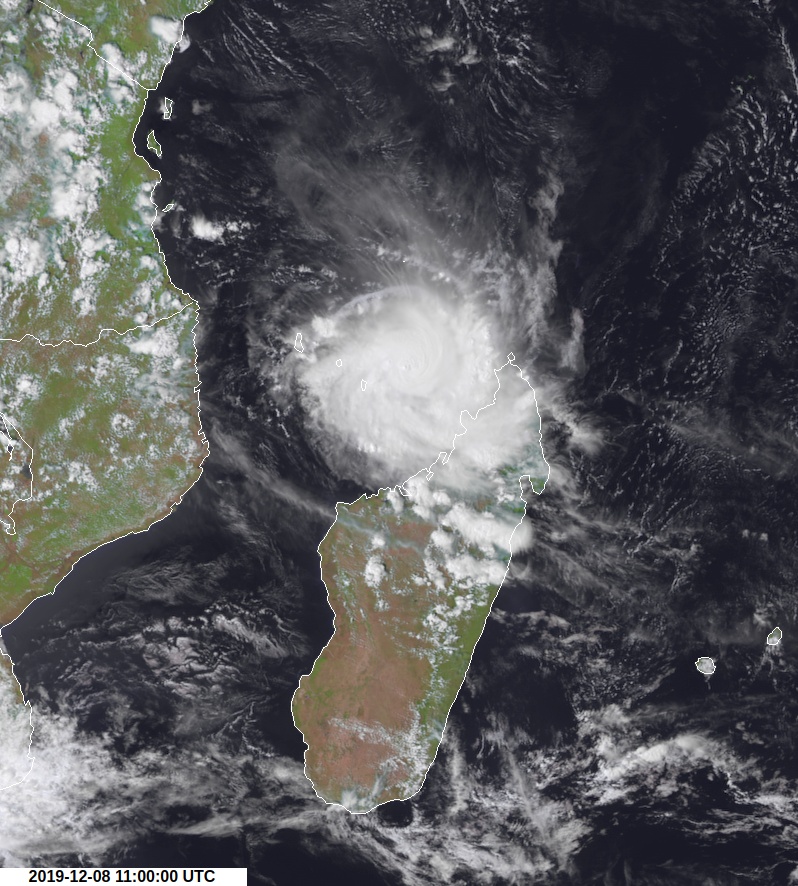
Tropical Cyclone "Belna" at 11:00 UTC on December 8, 2019. Credit: Meteosat-8, UW-CIMSS
Intensification should resume shortly and keep on until its likely landfall on Madagascar, likely reaching intense tropical cyclone status.
Northwestern Madagascan coast, where landfall is expected, is particularly vulnerable to the storm surge. Depending on the location of landfall, the maximum storm surge could reach 3 m (10 feet) near the impact point.
Additionally, torrential rains are awaited on the regions of the landfall, locally exceeding 300 mm (11.8 inches).
Inhabitants from the northern and western Malagasy coasts are invited to monitor closely the evolution of the cyclone. The inhabitants of the north-western Madagascan coast should begin preparing for a possible landfall.
.gif)
I'm a dedicated researcher, journalist, and editor at The Watchers. With over 20 years of experience in the media industry, I specialize in hard science news, focusing on extreme weather, seismic and volcanic activity, space weather, and astronomy, including near-Earth objects and planetary defense strategies. You can reach me at teo /at/ watchers.news.
Commenting rules and guidelines
We value the thoughts and opinions of our readers and welcome healthy discussions on our website. In order to maintain a respectful and positive community, we ask that all commenters follow these rules.