
Submarine eruption at Lateiki (Metis Shoal), Tonga
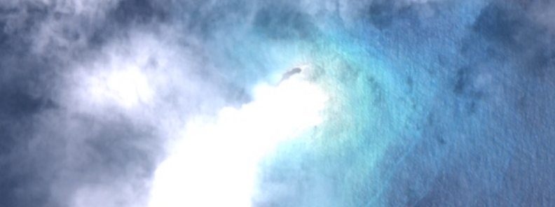
Image credit: Lateiki (Metis Shoal) as seen by ESA/Sentinel-2 on October 15, 2019
The Aviation Color Code for Lateiki volcano, previously known as Matis Shoal, was raised to Orange at 21:20 UTC on October 14, 2019, after several observations confirmed eruption in progress.
Real Tonga pilots flying between Tongatapu and Vava'u observed the intermittent plumes rising to 4.6 -5.2 km (15 000 – 17 000 feet) above sea level and drifting N on October 14. Ash in the plumes was not identifiable, according to the Wellington Volcanic Ash Advisory Centre (VAAC).
New Zealand's GeoNet and the Wellington VAAC, a department of NZ Met Service say there is currently no risk to flights in the area.
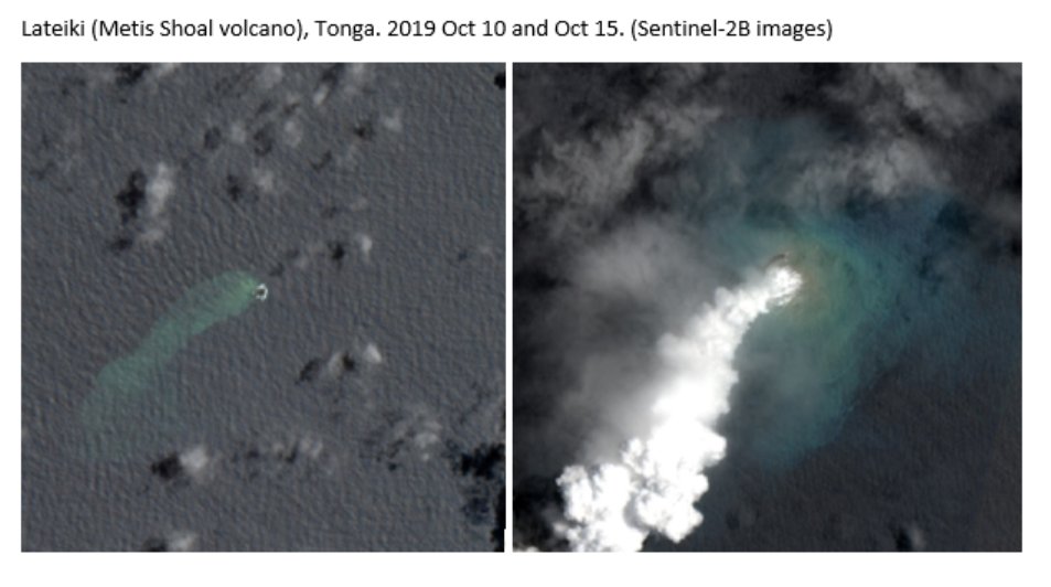
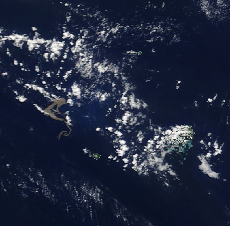
The Metis Shoal in #Tonga has erupted, sending a plume of smoke 3 miles high into the sky. As spotted by @mfordNZ, it was captured by #Sentinel2 on 15 October.
Check out this before/after animation of the eruption #activeearth pic.twitter.com/ZsCxe5RWQA
— Copernicus EU (@CopernicusEU) October 17, 2019
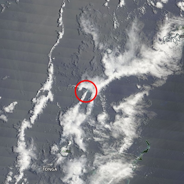
Eruption at Lateiki (Metis Shoal) as seen by NASA Terra/MODIS on October 16, 2019
"There's no volcanic ash, just steam, and smoke," Met Service meteorologist Tamara Vuksa said. "We only warn airmen about ash, so we've put out a notice to inform people, but there's no need to issue flight warnings."
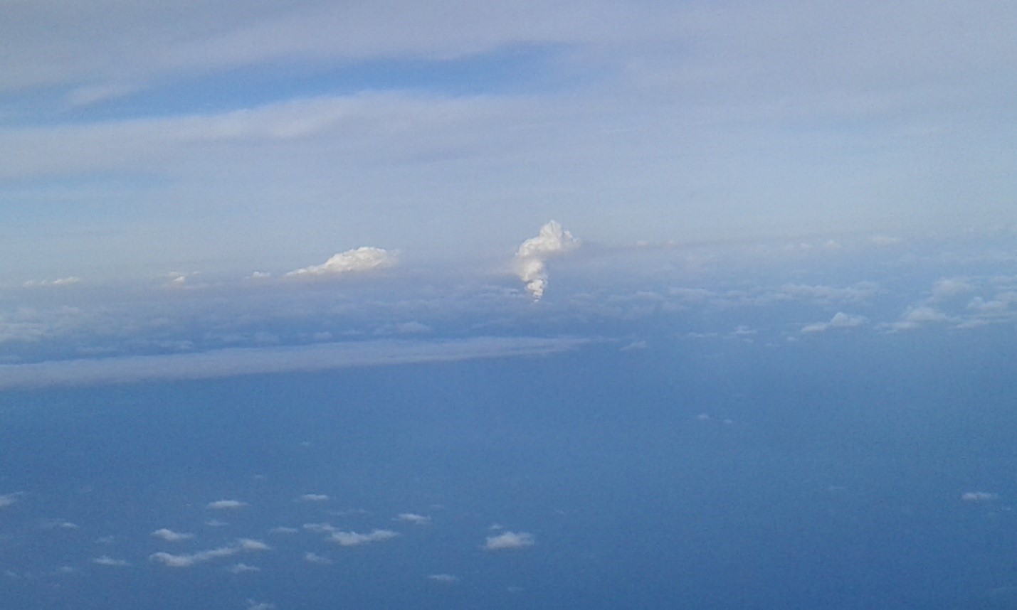
Image credit: Tonga Meteorological Service
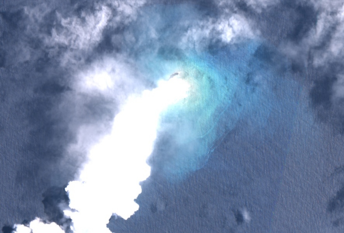
Lateiki (Metis Shoal) as seen by ESA/Sentinel-2 on October 15, 2019
The volcano is likely the source of a massive amount of floating pumice detected in August 2019, suggesting the eruption is at least in its third month.
Pumice and discolored sea as observed by NASA Terra/MODIS on August 10, 2019
The last confirmed eruption of this volcano (VEI 2) started on June 6, 1995, and ended on June 23 (± 2 days).
Geological summary
Metis Shoal, a submarine volcano midway between the islands of Kao and Late, has produced a series of ephemeral islands since the first confirmed activity in the mid-19th century.
An island, perhaps not in eruption, was reported in 1781 and subsequently was eroded away.
During periods of inactivity following 20th century eruptions, waves have been observed to break on rocky reefs or sandy banks with depths of 10 m (33 feet) or less. Dacitic tuff cones formed during the first 20th century eruptions in 1967 and 1979 were soon eroded beneath the sea surface.
An eruption in 1995 produced an island with a diameter of 280 m (920 feet) and a height of 43 m (140 feet) following growth of a lava dome above the surface.
I'm a dedicated researcher, journalist, and editor at The Watchers. With over 20 years of experience in the media industry, I specialize in hard science news, focusing on extreme weather, seismic and volcanic activity, space weather, and astronomy, including near-Earth objects and planetary defense strategies. You can reach me at teo /at/ watchers.news.
Commenting rules and guidelines
We value the thoughts and opinions of our readers and welcome healthy discussions on our website. In order to maintain a respectful and positive community, we ask that all commenters follow these rules.