Underwater eruption near Fonualei Island, Tonga
A new underwater eruption took place near Fonualei island in the Tonga archipelago on August 7, 2019.
The eruption was first reported on August 7 when large clouds were observed 'on the horizon at the location of Fonualei volcano.' "The plume continued to get larger over the next few hours. It seemed to pause and then erupt again," an observer told Volcano Discovery.
The next information about the eruption came on August 15 after catamaran Sail Surf ROAM, en route to Fiji, encountered volcanic rocks completely covering the ocean surface at location 18 55' S 175 21' W. The crew reported entering the pumice at 08:00 UTC (19:00 local time).
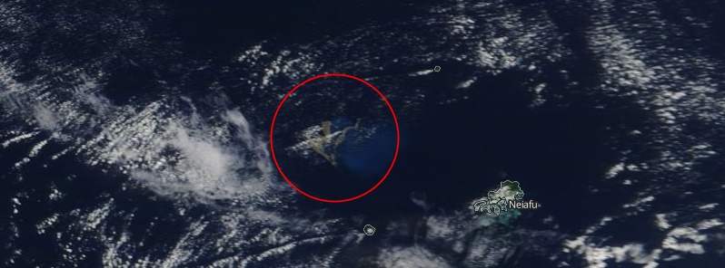
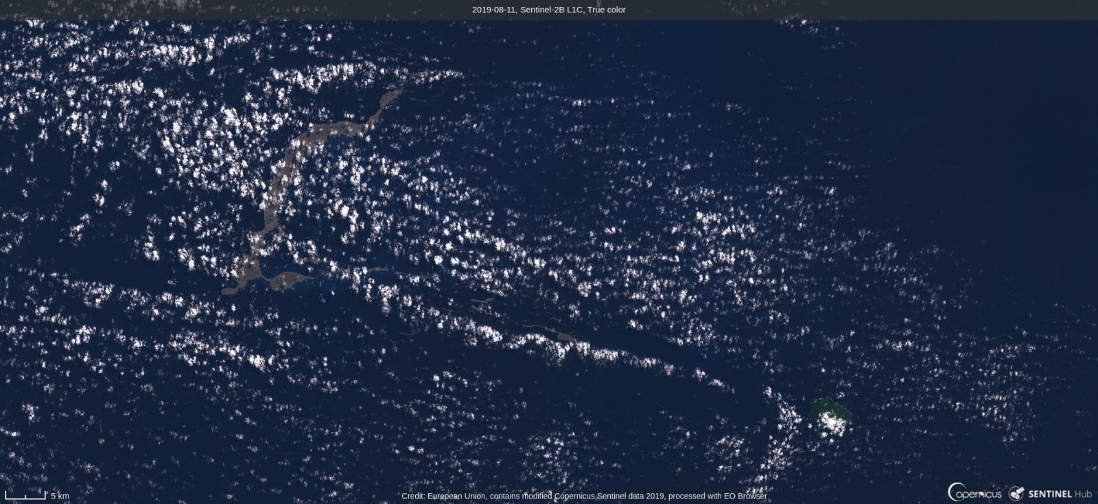
Pumice and discolored sea as observed by NASA Terra/MODIS on August 9, 2019
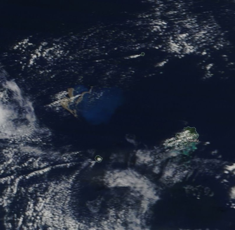
Pumice and discolored sea as observed by NASA Terra/MODIS on August 10, 2019
"Rubble slick made up of rocks from marble to basketball size such that water was not visible," ROAM crew reported on their Facebook page.
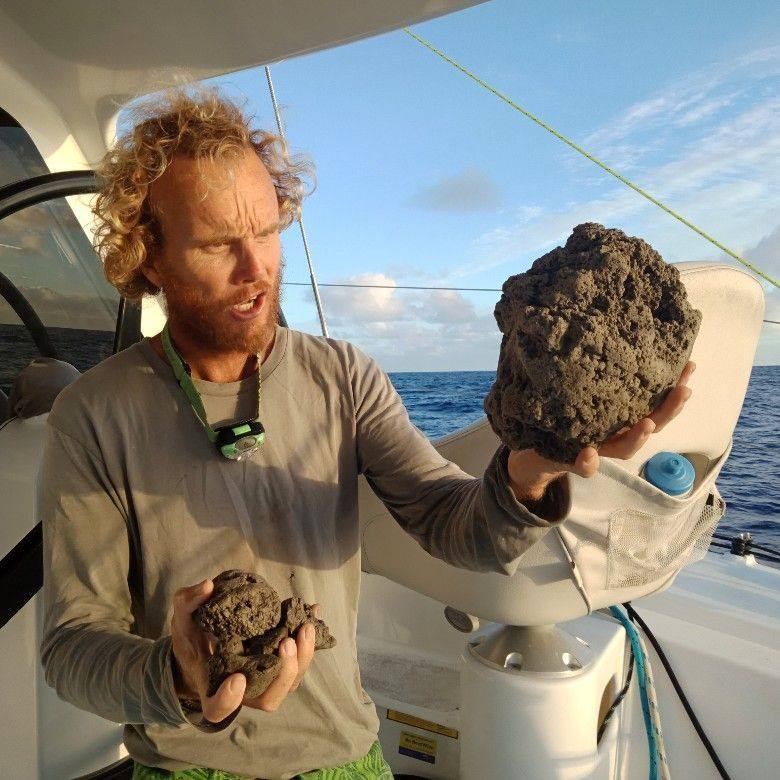
Image credit: Sail Surf ROAM
Description of the event, as reported by ROAM:
We had heard the previous day on email of "pumice fields" 50 NM North of Vava'u. We saw none as we rounded North of Vava'u earlier in the day on our route ex Bora Bora.
Sailing on 255T we started seeing some floating rocks of random sizes (marbles to tennis balls) from position 18 46' S 174 55'W. We reduced sail to slow our speed.At position 18 50' S 175 05' W we had faint but distinct smell of sulfur. TWD = 115T at the time had us down wind of Home Reef charted as area of volcanic activity.
We continued sailing at reduced speed on 250T.
At position 18 54'S 175 19'W we started to see and strike larger floating rocks. We took down all sail. Allowing the boat to continue on bare poles at 2-3kts on COG 255T. As we could no longer smell the sulfur we assumed we would be soon clear of the rubble so elected to continue at slowest speed.
At approx 0700hrs UTC (1900 local) 15/8/19 at position 18 55' S 175 21' W we entered a total rock rubble slick made up of pumice stones from marble to basketball size. The waves were knocked back to almost calm and the boat was slowed to 1kt. The rubble slick went as far as we could see in the moonlight and with our spotlight. We made a turn to starboard and managed to sail clear of the rubble slick under Staysail. We had entered it approx 200m and the edge could be made out in the partial moonlight back to the
NE. It was extensive in all other directions.In the slick our steering became temporarily/partially fouled by rocks jamming between rudders and hull. Our speed log was also inturupted but thankfully this morning both functioning as normal.
Once clear of the rubble we acted with caution and retraced our course under 3rd reef main and staysail before turning south and then west.
Other vessels in the imidiate area were notified and we remained in touch to update one another on our status and that of the conditions in our area.
My intention was to return to the East and sail around the windward side of Home Reef and surrounding charted areas of volcanic activity some 35NM to our SE. The two other yachts I informed of the rubble slick found clear water going South and turning west from 19 00' S 175 05' W so we followed them.
We have since cleared all sign of volcanic rock and continuing to Fiji. Location of source of volcanic activity unknown. Please warn yachts sailing Vava'u to Fiji.
The following video was recorded by Rachel Mackie as she sailed through the pumice field:
Geological summary
A submarine volcano along the Tofua volcanic arc was first observed in September 2001. The newly discovered volcano lies NW of the island of Vava'u about 35 km (21.7 miles) S of Fonualei and 60 km (37.3 miles) NE of Late volcano. The site of the eruption is along a NNE-SSW-trending submarine plateau with an approximate bathymetric depth of 300 m (984 feet). T-phase waves were recorded on 27-28 September 2001, and on the 27th local fishermen observed an ash-rich eruption column that rose above the sea surface. No eruptive activity was reported after the 28th, but water discoloration was documented during the following month. In early November rafts and strandings of dacitic pumice were reported along the coast of Kadavu and Viti Levu in the Fiji Islands. The depth of the summit of the submarine cone following the eruption determined to be 40 m (131 feet) during a 2007 survey; the crater of the 2001 eruption was breached to the E. (GVP)
Featured image: Pumice and discolored sea on August 9, 2019. Credit: NASA Terra/MODIS
Commenting rules and guidelines
We value the thoughts and opinions of our readers and welcome healthy discussions on our website. In order to maintain a respectful and positive community, we ask that all commenters follow these rules.