
Very strong M7.3 earthquake hits Tonga Islands region, Tsunami Advisory issued
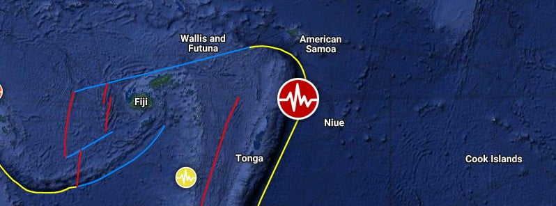
Image credit: TW/SAM, Google
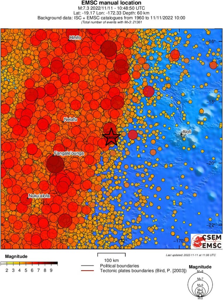
A very strong earthquake, registered by the USGS as M7.3, hit the Tonga Islands region at 10:48 UTC on November 11, 2022. The agency is reporting a depth of 24.8 km (15.4 miles). EMSC is reporting M7.3 at a depth of 60 km (37 miles).
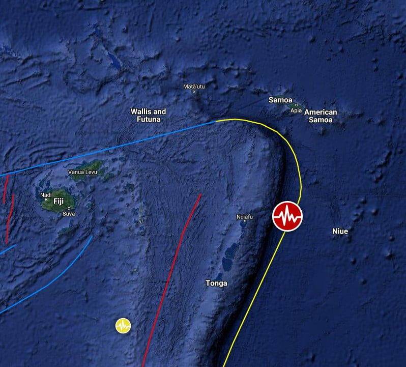
The epicenter was located about 220.9 km (137.3 miles) ESE of Neiafu (population 4 320), Tonga, and 575.5 km (357.6 miles) SSW of Pago Pago (population 11 500), American Samoa.
27 000 people are estimated to have felt light shaking.
Based on the preliminary earthquake parameters, hazardous tsunami waves are possible for coasts located within 300 km (180 miles) of the earthquake epicenter, NWS PTWC said.
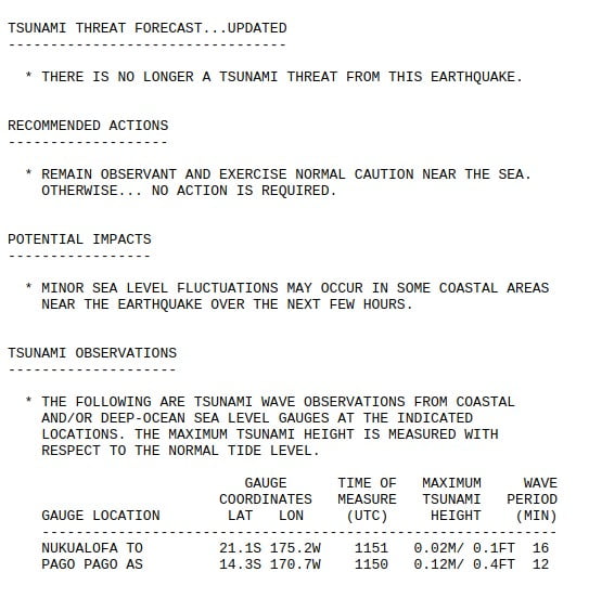
Based on all available data, the tsunami threat from this earthquake has now passed, PTWC said at 12:22 UTC.
The USGS issued a Green alert for shaking-related fatalities and economic losses. There is a low likelihood of casualties and damage.
Overall, the population in this region resides in structures that are highly vulnerable to earthquake shaking, though some resistant structures exist. The predominant vulnerable building types are unknown/miscellaneous types and wood construction.
Recent earthquakes in this area have caused secondary hazards such as tsunamis that might have contributed to losses.
Regional seismicity
I'm a dedicated researcher, journalist, and editor at The Watchers. With over 20 years of experience in the media industry, I specialize in hard science news, focusing on extreme weather, seismic and volcanic activity, space weather, and astronomy, including near-Earth objects and planetary defense strategies. You can reach me at teo /at/ watchers.news.
Commenting rules and guidelines
We value the thoughts and opinions of our readers and welcome healthy discussions on our website. In order to maintain a respectful and positive community, we ask that all commenters follow these rules.