
Super Typhoon “Wutip” becomes the strongest February typhoon in West Pacific Ocean
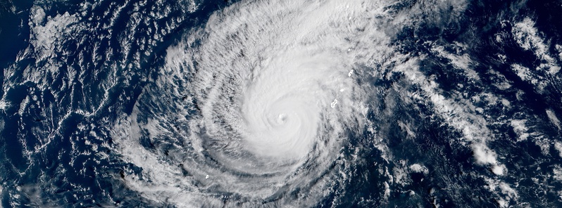
Featured image: Super Typhoon "Wutip" on February 23, 2019. Credit: JMA/Himawari-8, RAMMB/CIRA, TW
Typhoon "Wutip" underwent rapid intensification on February 23, 2019, peaking as Category 4 super typhoon with maximum sustained winds of 250 km/h (155 mph) and central pressure of 925 hPa.
This made Wutip the strongest February typhoon in the western Pacific Ocean, surpassing Super Typhoon "Higos" which hit 241 km/h (150 mph) on February 10, 2015, and the strongest February tropical cyclone anywhere north of the equator.
According to NOAA’s Historical Hurricane Tracks database, only seven January and February Category 4 or Category 5 typhoons have been recorded in the Northwest Pacific since records began in the late 1940s, WeatherUnderground's Dr. Jeff Masters notes.
Wutip tied with Super Typhoon "Rose" of January 1957 as the second strongest typhoon to form in these two months. The only stronger typhoon ever observed so early in the year was Super Typhoon "Ophelia" – which peaked as a Category 5 storm with 257 km/h (160 mph) winds on January 13, 1958.
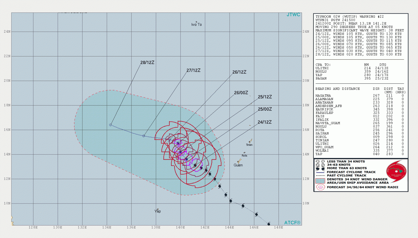
Wutip passed about 112 km (180 miles) southwest of Guam on February 23. It dumped 125 – 305 mm (5 – 12 inches) of rain by Saturday afternoon (local time) with another 75 – 127 mm (3 – 5 inches) expected.
At 15:00 UTC on February 24, the center of Typhoon "Wutip" was located about 400 km (250 miles) east of Guam. It was moving WNW at 10 km/h (6 mph) with maximum sustained winds near 193 km/h (120 mph).
Wutip is expected to weaken over the next few days, and will likely be downgraded to a tropical storm by Tuesday, February 26.
I'm a dedicated researcher, journalist, and editor at The Watchers. With over 20 years of experience in the media industry, I specialize in hard science news, focusing on extreme weather, seismic and volcanic activity, space weather, and astronomy, including near-Earth objects and planetary defense strategies. You can reach me at teo /at/ watchers.news.
Commenting rules and guidelines
We value the thoughts and opinions of our readers and welcome healthy discussions on our website. In order to maintain a respectful and positive community, we ask that all commenters follow these rules.