
Super Typhoon Sinlaku cripples power, roads and key infrastructure on Saipan and Tinian
Super Typhoon Sinlaku struck the Northern Mariana Islands late on April 14, 2026, bringing sustained winds near 241 km/h (150 mph) at peak impact and unusually slow movement that kept destructive conditions over populated islands for hours. The islands of Saipan and Tinian sustained widespread infrastructure damage, prolonged utility outages, blocked roads, and flooding, with officials warning that full restoration in some hard-hit areas could take days to weeks.
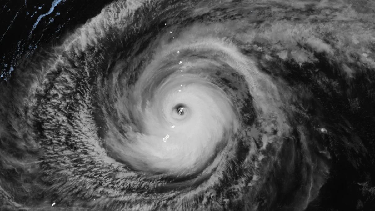
Super Typhoon Sinlaku making landfall over Tinian and Saipan at 13:50 UTC on April 14, 2026. Credit: JMA/Himawari-9, RAMMB/CIRA, The Watchers
Super Typhoon Sinlaku made landfall over the Commonwealth of the Northern Mariana Islands (CNMI) late on April 14 local time after becoming the strongest tropical cyclone on Earth so far this year. The storm struck with sustained winds near 241 km/h (150 mph) at peak impact and moved unusually slowly through the area, prolonging destructive wind, rain, and coastal impacts across populated islands.
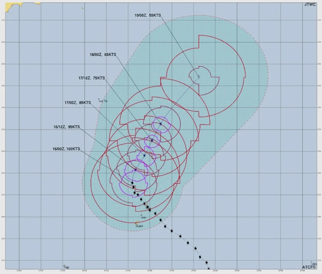
Weak steering currents kept the storm over or near the southern CNMI for hours, extending exposure to typhoon-force winds and repeated strong gusts across the islands. By 10:00 ChST (00:00 UTC) on April 16, the center was still about 274 km (170 miles) north-northwest of Saipan, moving north at just 5 km/h (3 mph), while tropical storm-force winds continued across the commonwealth.
Associated Press field reporting and local officials described widespread power and water outages in Saipan (population 43 285), major road blockages from debris and downed trees, damaged roofs, toppled utility poles, and severe flooding inside the island’s hospital.
Officials warned that restoration of electricity and water in some of the hardest-hit communities could take days to weeks as crews begin clearing roads and restoring access.
Debris, floodwater, and fallen trees blocked key routes across Saipan, slowing damage assessments and delaying emergency response. The combination of prolonged wind loading and saturated ground raised the risk of falling trees, unstable structures, and contaminated standing water during the early recovery phase.
Residents in Tinian (population 2 044) reported homes damaged or torn apart and extensive tree loss. Recovery there is expected to be complex because infrastructure resilience was already under strain following Typhoon Mawar in 2023.
Flight operations were disrupted across the CNMI during the storm, with cancellations stranding travelers, but a full official assessment of conditions at Saipan International Airport had not yet been released as of April 16.
Rota remained under a Typhoon Warning on April 16 as Sinlaku moved north. Conditions across the southern CNMI improved through the day, but tropical storm-force winds continued over parts of the commonwealth, and hazardous marine conditions remained in place.
Guam avoided the most destructive conditions, and NWS Guam canceled the Tropical Storm Warning and Typhoon Watch for Guam at 11:00 ChST on April 16 after damaging sustained winds were no longer expected. Breezy conditions and strong gusts continued, while rough seas and coastal hazards persisted in northern waters.
More than 1 000 people sheltered across Guam and the CNMI during the storm. No fatalities had been confirmed as of April 16. Federal emergency assistance was activated under FEMA’s emergency declaration for the CNMI, with recovery operations expected to accelerate as wind conditions continue improving.
References:
1 NWS Guam Public Advisory #28A – NWS/Guam – April 16, 2026
2 Typhoon 04W (Sinlaku) Warning #29 – JTWC – Issued at 03:00 UTC on April 16, 2026
3 Super Typhoon Sinlaku pounds remote US islands in the Pacific Ocean with ferocious winds – AP – April 15–16, 2026
I'm a dedicated researcher, journalist, and editor at The Watchers. With over 20 years of experience in the media industry, I specialize in hard science news, focusing on extreme weather, seismic and volcanic activity, space weather, and astronomy, including near-Earth objects and planetary defense strategies. You can reach me at teo /at/ watchers.news.
Commenting rules and guidelines
We value the thoughts and opinions of our readers and welcome healthy discussions on our website. In order to maintain a respectful and positive community, we ask that all commenters follow these rules.