
Tropical Storm “Dora” forms near the southwestern coast of Mexico
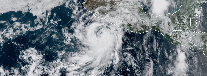
Image credit: Tropical Storm "Dora" at 16:15 UTC on June 25, 2017 - NOAA GOES-16, UW-CIMSS
Tropical Storm "Dora" formed 09:00 UTC on Sunday, June 25, 2017 near the coast of southwestern Mexico as the fourth named storm of the 2017 Pacific hurricane season. The system is tracking WNW and is not expected to make a landfall. However, heavy rains are possible along coastal sections of the Mexican states of Oaxaca, Guerrero, and Michoacan through Monday.
Tropical Depression Four-E (04E) formed 03:00 UTC today (June 25) when it was located about 290 km (180 miles) S of Acapulco, Mexico. At the time, its maximum sustained winds were 45 km/h (30 mph). The depression continued organizing and by 09:00 UTC strengthened into Tropical Storm "Dora."
At 15:00 UTC on June 25, the center of Tropical Storm "Dora" was located 295 km (180 miles) SW of Acapulco and was tracking WNW and 19 km/h (12 mph). This general motion is expected to continue over the next 48 hours. On the forecast track, the center of Dora is expected to move parallel to but remain offshore of the coast of Mexico.
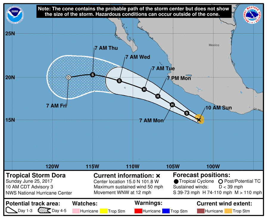
Satellite images indicate that the maximum sustained winds have increased to near 85 km/h (50 mph) with higher gusts. Additional strengthening is forecast during the next day or so, and Dora could become a hurricane on Monday.
There are no coastal watches or warnings in effect.
Tropical Storm "Dora" at 16:15 UTC on June 25, 2017 – NOAA GOES-16, UW-CIMSS
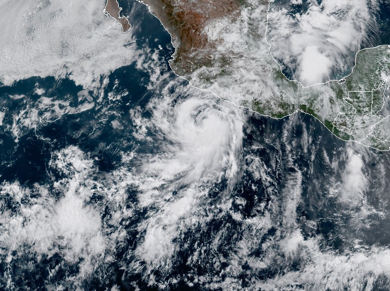
Tropical Storm "Dora" at 16:15 UTC on June 25, 2017. Credit: NOAA GOES-16, CIRA RAMMB
Although Dora is forecast to remain offshore, the outer bands of the tropical cyclone could bring locally heavy rains to portions of coastal southwestern Mexico during the next couple of days.
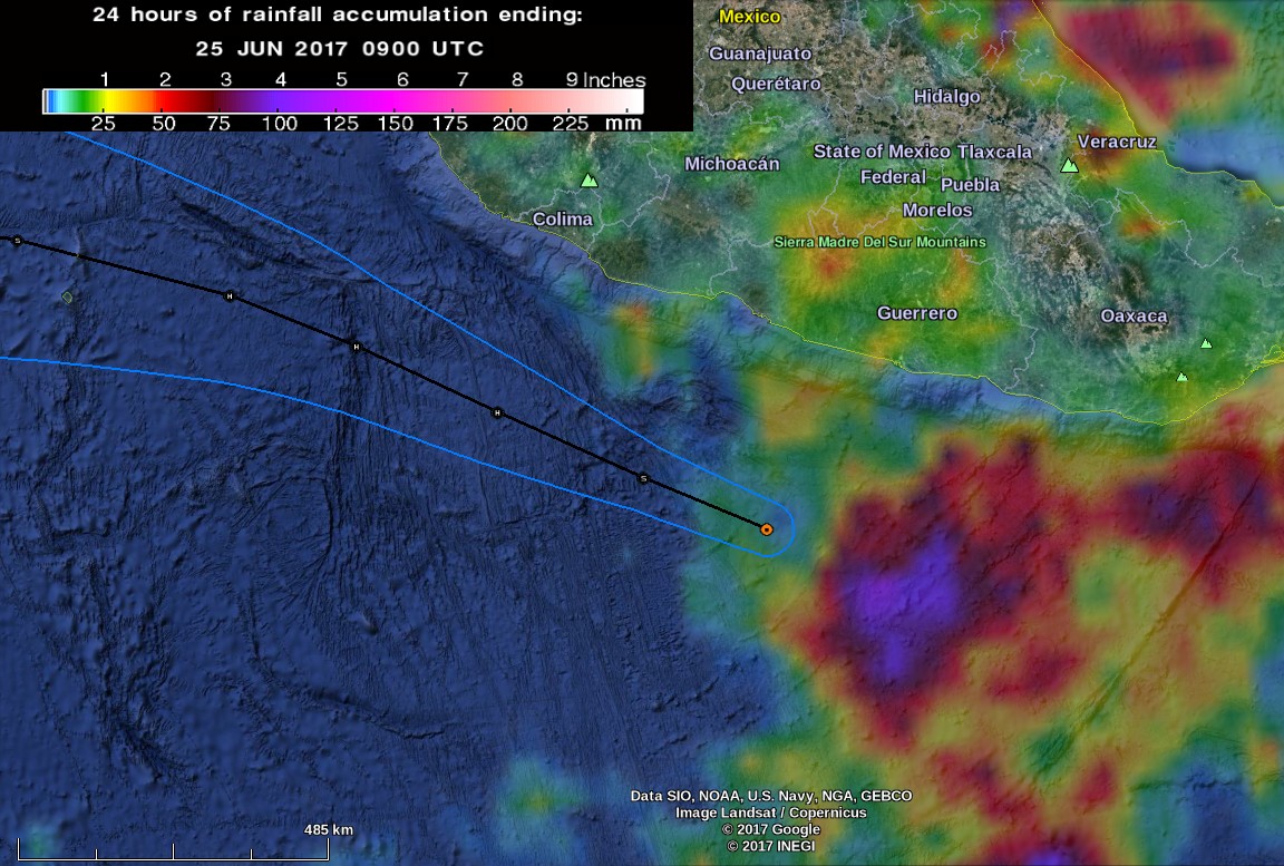
Tropical Storm Dora – 24 hours of rainfall accumulation by 09:00 UTC on June 25, 2017. Credit: NASA/JAXA GPM, NOAA NWS NHC
Dora is expected to produce rain accumulations of 25.4 to 76.2 mm (1 to 3 inches) with isolated maximum amounts of 127 mm (5 inches) along coastal sections of the Mexican states of Oaxaca, Guerrero, and Michoacan through Monday.
I'm a dedicated researcher, journalist, and editor at The Watchers. With over 20 years of experience in the media industry, I specialize in hard science news, focusing on extreme weather, seismic and volcanic activity, space weather, and astronomy, including near-Earth objects and planetary defense strategies. You can reach me at teo /at/ watchers.news.
Commenting rules and guidelines
We value the thoughts and opinions of our readers and welcome healthy discussions on our website. In order to maintain a respectful and positive community, we ask that all commenters follow these rules.