
New tropical depression formed southeast of Guam
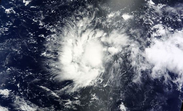
Featured image: Terra/MODIS satellite image taken at 00:40 UTC on July 11, 2014. (Credit: LANCE Rapid Response/MODIS)
Ninth tropical depression is formed southeast of Guam. The Joint Typhoon Warning Center (JTWC) expects TD 09W to move past the southern islands of the Marianas and gradually strengthen into a typhoon as it tracks to the west or northwest through the Pacific Ocean.
Residents of Taiwan, the southern Ryukyu Islands, including Okinawa, and eastern China, including Shanghai, should pay attention to further development of Tropical Depression 09W.
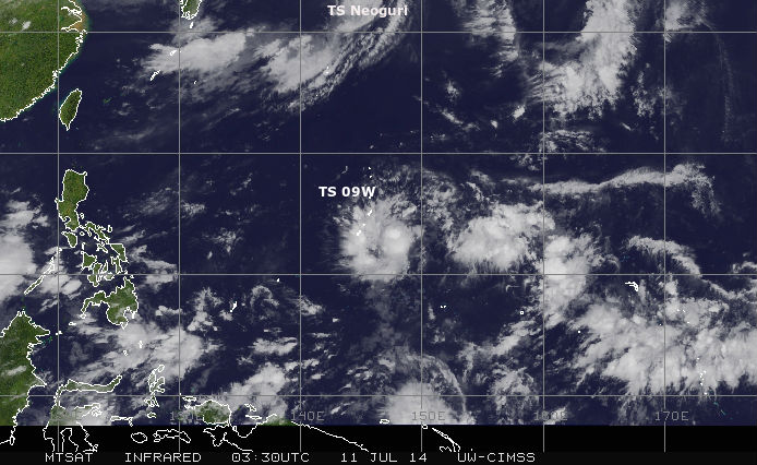
MTSAT IR satellite image of TD09W at 03:30 UTC on July 11, 2014. (Credit: NOAA/UW-CIMSS)
.gif)
MTSAT visible satellite image of TD09W at 07:01 UTC on July 11, 2014. (Credit: NOAA/UW-CIMSS)
According to latest report by JTWC, the center of TD 09W is located approximately 224 nm east- southeast of Andersen AFB, Guam, and is moving west-northwestward at 25 km/h (15.5 mph). Low vertical wind shear and high sea surface temperatures (30-32 C) will allow the rapid development. This new system will be given the name Rammasun once JMA develops it to a Tropical Storm.
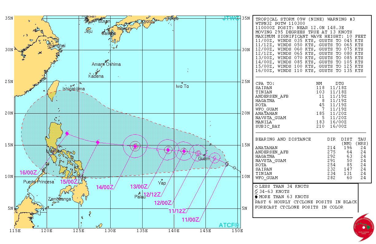
TD 09W forecast track by JTWC (Credit: JTWC)
Low pressure System 92W formed into Tropical Depression 9w late on July 10, 2014. Visible Infrared Imaging Radiometer Suite (VIIRS) instrument aboard NASA-NOAA's Suomi NPP satellite saw extremely cold cloud top temperatures near -80 C (-112 F). Temperatures that cold in Tropical Depression 09W are indicative of thunderstorms reaching high in the troposphere, and they are capable of producing heavy rain.
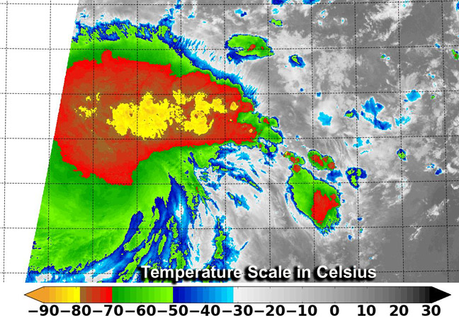
Infrared satellite image from the VIIRS instrument aboard NASA-NOAA's Suomi NPP satellite taken at 14:48 UTC on July 10, 2014 shows cold cloud top temperatures in newborn Tropical Depression 9w. (Credit: NOAA/Suomi NPP)
The cyclone is expected to continue tracking generally west-northwestward. Favorable conditions are expected to persist, allowing the system to gradually intensify. The cyclone is expected to reach a full-fledged typhoon status after the next 36 hours.
Satellite Animations
- Storm-Centered Infrared (MTSAT2; NOAA/SSD)
- Storm-Centered Infrared (Aviation Color Enhancement) (MTSAT2; NOAA/SSD)
- Storm-Centered Water Vapor (MTSAT2; NOAA/SSD)
- Storm-Centered Visible (MTSAT2; NOAA/SSD)
- Storm-Centered Visible (Colorized) (MTSAT2; NOAA/SSD)
- Storm-Centered Infrared (MTSAT2; CIMSS)
- Storm-Centered Enhanced Infrared (MTSAT2; CIMSS)
- Storm-Centered Water Vapor (MTSAT2; CIMSS)
- Storm-Centered Visible (MTSAT2; CIMSS)
- Tropical West Pacific Infrared (MTSAT2; NOAA)
- Tropical West Pacific Enhanced Infrared (MTSAT2; NOAA)
- Tropical West Pacific Water Vapor (MTSAT2; NOAA)
- Tropical West Pacific Visible (MTSAT2; NOAA)
Commenting rules and guidelines
We value the thoughts and opinions of our readers and welcome healthy discussions on our website. In order to maintain a respectful and positive community, we ask that all commenters follow these rules.