
Eye of Typhoon “Mawar” grazes northern Guam with Category 4 force
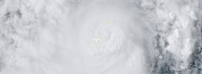
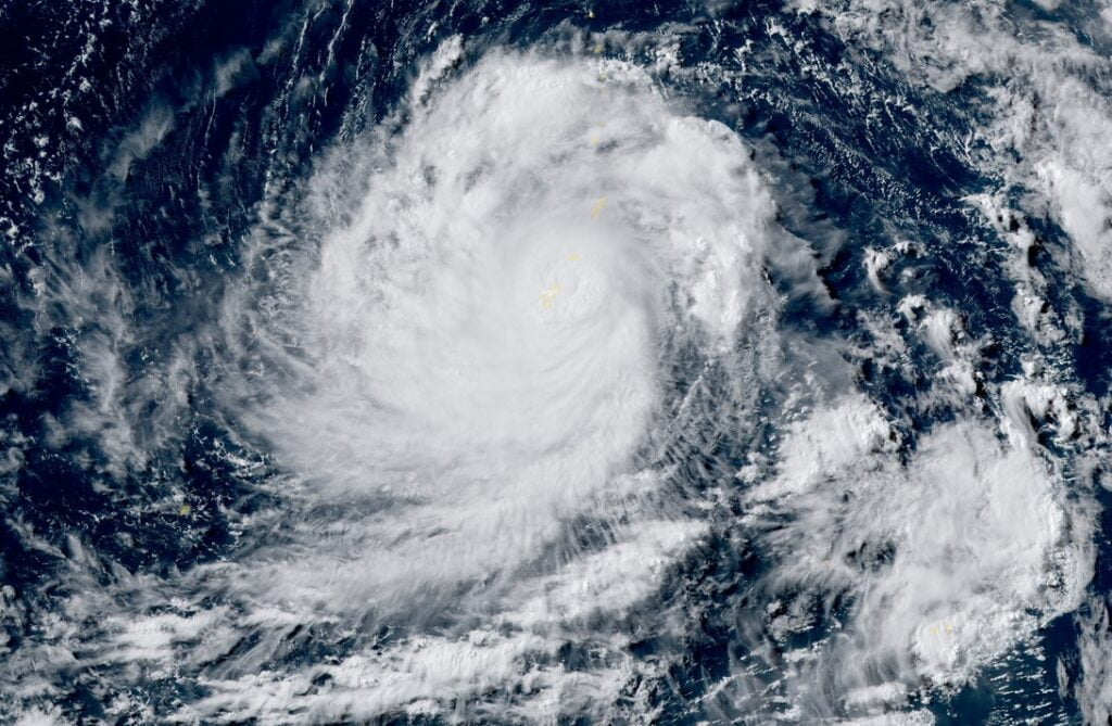
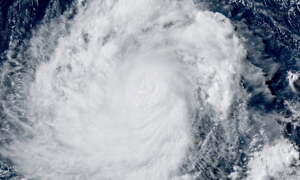
Featured image: Typhoon "Mawar" at 06:00 UTC on May 24, 2023. Credit: JMA/Himawari-9, RAMMB/CIRA, The Watchers
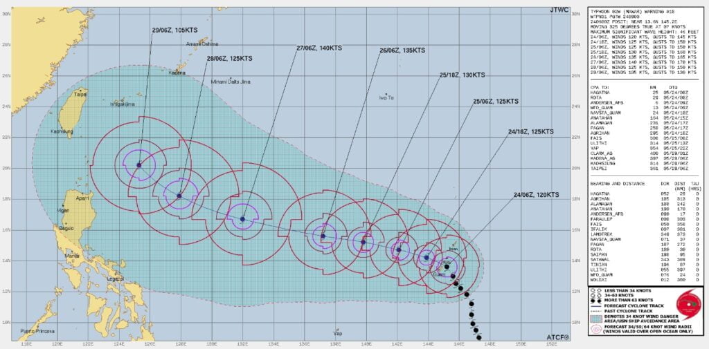
The southern eyewall of Category 4 Typhoon “Mawar” grazed the northern tip of Guam at around 08:00 UTC on May 24, 2023, with maximum sustained winds of 220 km/h (140 mph). This made Mawar the 15th typhoon of at least Category 4 intensity to pass within 110 km (70 miles) of Guam in records since WWII.
Typhoon “Mawar” has made its closest point of approach to Guam, with most of its eye passing through the Rota Channel between Guam and Rota. Its southern eyewall, however, grazed the northern tip of the island, near Anderson Air Force Base.
The typhoon caused widespread power cuts, affecting 98% of Guam Power Authority customers, and a major internet outage.
Landon Aydlett, a National Weather Service meteorologist in Guam, said Mawar’s winds were so fierce that the building the weather service office is in was vibrating.
“This is an extremely dangerous and life-threatening situation,” he said. “There will be a swath of tornado-like damage.”
As Mawar moves away from the islands, the conditions will improve and damage assessments begin.
After moving away from Guam, Mawar is expected to peak at Category 5 Super Typhoon strength in the Philippine Sea, before it weakens near northern Philippines, Taiwan, and southern Japan (Ryukyu Islands).
I'm a dedicated researcher, journalist, and editor at The Watchers. With over 20 years of experience in the media industry, I specialize in hard science news, focusing on extreme weather, seismic and volcanic activity, space weather, and astronomy, including near-Earth objects and planetary defense strategies. You can reach me at teo /at/ watchers.news.
Commenting rules and guidelines
We value the thoughts and opinions of our readers and welcome healthy discussions on our website. In order to maintain a respectful and positive community, we ask that all commenters follow these rules.