
Typhoon “Mawar” forecast to move near or over Guam and Rota
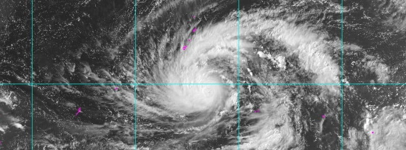
Featured image: Typhoon "Mawar" at 06:00 UTC on May 22, 2023. Credit: JMA/Himawari-9
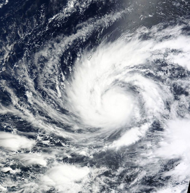
Tropical Cyclone “Mawar” formed on May 19, 2023, SSW of Chuuk Islands as the second named storm of the 2023 Pacific typhoon season. On May 21, Mawar became the season’s first typhoon. The latest forecast track shows a westward bend in the vicinity of the Marianas with passage near or over Guam and Rota where a Typhoon Warning is now in effect.
At 00:00 UTC on May 22, the center of Typhoon “Mawar” was located about 200 km (125 miles) NNW of Satawal. The system had maximum 10-minute sustained winds of 130 km/h (80 mph), with gusts up to 185 km/h (115 mph), and maximum 1-minute sustained winds of 155 km/h (100 mph).
The minimum central barometric pressure at the time was 975 hPa and the system was moving NNW at 11 km/h (6.9 mph).
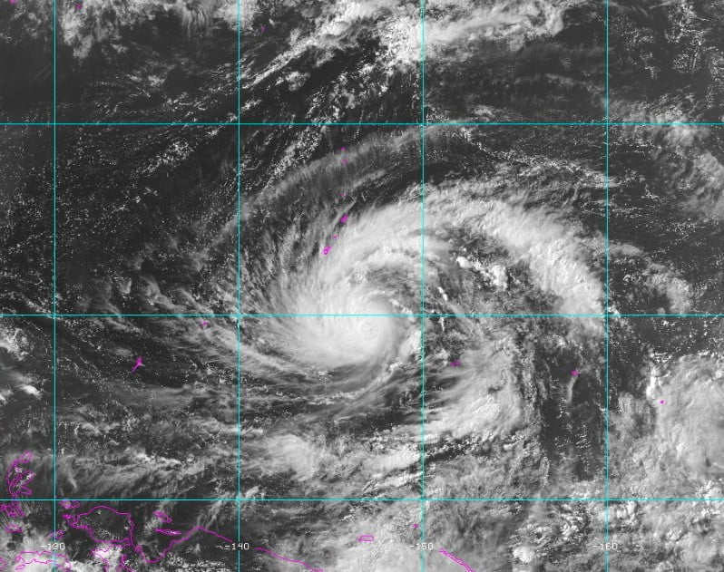
Animated Multispectral Satellite Imagery (MSI) depicts what appears to be the beginning of an eye feature, JTWC said at 03:00 UTC on May 22, adding that it appears to be trying to form just under the central dense overcast on the last couple of MSI loops.
The latest radar images coming from Guam indicate rainbands are remaining offshore at the current time. There appears to be minimal dry-air entraining into the system from the south. However, the system has cocooned itself in a well-protected marsupial pouch of warm, moist air with warm sea surface temperatures below and low to moderate vertical wind shear.
According to the JTWC, Typhoon “Mawar” is expected to continue on the same north-northwest track and intensify along the route toward the Mariana Islands. The system will continue to steadily intensify as it tracks to the north-northwest under the influence of the northeast ridge. The environment surrounding the typhoon will remain favorable for the forecast duration (5 days), characterized by warm sea surface temperatures (SSTs), robust outflow aloft, and negating any negative effects of limited dry-air entrainment.
Due to the favorable environment, Mawar will continue developing into a more intense system over the next several days, fueled by robust outflow aloft and warm SSTs, and reach a peak intensity of 185 km/h (125 mph) just before reaching the islands of Guam and Rota.
After it moves through the Rota Channel, the northeast ridge to the east will reorient and build further northeast of the system, forcing Mawar to move on a more flattened west-northwestward course.
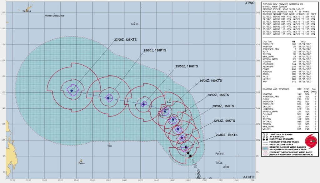
By 03:00 UTC on May 27, Mawar will have ample running space and plenty of deep ocean heat content (OHC) in the Philippine Sea to continue gaining intensity and reach a peak of 230 km/h (145 mph), just shy of super-typhoon strength.
The National Weather Service (NWS) office in Tiyan, Guam, has issued a Typhoon Warning for Guam and Rota. Residents are advised to prepare for damaging winds of 65 km/h (39 mph) or more within the next 24 hours, with typhoon-force winds expected by Wednesday morning (LT), May 24.
Furthermore, a Tropical Storm Warning has been issued for Saipan and Tinian, where damaging winds of 65 km/h (39 mph) or more are expected within the next 24 hours.
A Typhoon Watch remains in effect for Saipan and Tinian, indicating that typhoon-force winds are possible if Typhoon Mawar takes a northward turn.
Residents in the affected areas are urged to stay informed about the latest weather developments and to follow any instructions or warnings issued by local authorities. Taking necessary precautions and preparedness measures during this time is crucial for ensuring the safety and well-being of everyone in the path of the typhoon.
References:
1 Typhoon 02W (Mawar) Warning #09 – Issued by JTWC at 03:00 UTC on May 22, 2023
2 Typhoon Mawar (02W) Advisory Number 9 – National Weather Service Tiyan GU – 04:09 UTC on May 22, 2023
I'm a dedicated researcher, journalist, and editor at The Watchers. With over 20 years of experience in the media industry, I specialize in hard science news, focusing on extreme weather, seismic and volcanic activity, space weather, and astronomy, including near-Earth objects and planetary defense strategies. You can reach me at teo /at/ watchers.news.
Commenting rules and guidelines
We value the thoughts and opinions of our readers and welcome healthy discussions on our website. In order to maintain a respectful and positive community, we ask that all commenters follow these rules.