
Tropical Storm Dorian weakens while rapidly moving westward
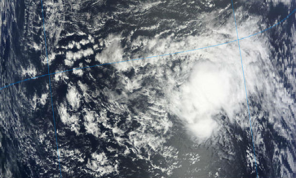
Featured image: Terra MODIS satellite image acquired at 13:40 UTC on July 26, 2013 (Credit: LANCE Rapid Response/MODIS)
Tropical disturbance in the middle of Atlantic ocean became fourth named storm of 2013 Atlantic hurricane season and was named Dorian. Under the influence of westerly shear and drier air, Tropical Storm Dorian became disorganized and it is expected to become even less organized in the days ahead. At this point, it looks like storm is unlikely to become a major hurricane. The system could degenerate into an open wave in the next 5 days.
.jpg)
GOES East Infrared Global Mosaic satellite image of Atlantic Ocean on July 27, 2013 at 00:45 UTC (Credit: NOAA/GOES/CIMSS)
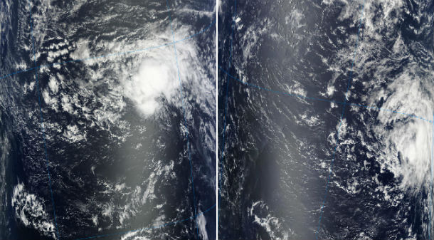
MODIS satellite image on July 26, 2013 – Terra MODIS at 13:45 UTC and Aqua MODIS at 16:45 UTC (Credit: LANCE Rapid Response/MODIS)
According to latest public advisory (#11) issued by US National Hurricane Center (NHC), the center of Tropical Storm Dorian (TS4) was located about 1135 miles (1830 km) E of the northern Leeward Islands. The system is moving westward at speed of 22 mph (35 km/h). Maximum sustained winds have decreased to near 45 mph (75 km/h). Sustained winds must reach 74 mph for the system to be classified as a hurricane.
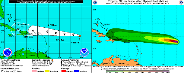
NHC's forecast track and tropical storm force wind speed probabilities map (Credit: NOAA/NHC)
Tropical storm force winds extend outward up to 70 miles (110 km) from the center. Estimated minimum central pressure is 1010 mb (29.83 inches).
Tropical Storm Dorian is moving rapidly westward, slightly to the south of the previous track. A strong low- to mid-level high pressure system to the north of Dorian is forecast to build westward with time by the global models. This should maintain a generally westward motion for the next several days.
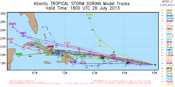
TS Dorian forecast track models – July 26, 2013 (Credit: UWM/Spaghetti)
Additional weakening is forecast during the next 48 hours. NHC noted that Dorian's disorganization is possibly due to a combination of southwesterly vertical wind shear and mid to upper-level dry air.
Dorian should track north of the Leeward Islands by July 28 and nearby to the north of Puerto Rico by July 29, 2013. It would pass somewhere between Hispaniola and the Turks and Caicos during the middle of next week.
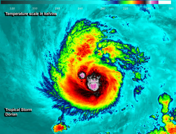
This night-time, infrared image of Tropical Storm Dorian was taken from the VIIRS instrument aboard the Suomi-NPP satellite on July 25, 2013 at 03:52 UTC. The red and purple areas are very high thunderstorms. (Credit: UWI-Madison/NASA-NOAA)
Satellite Animations
- Storm-Centered Infrared (GOES 13; NOAA/SSD)
- Storm-Centered Infrared (Aviation Color Enhancement) (GOES 13; NOAA/SSD)
- Storm-Centered Water Vapor (GOES 13; NOAA/SSD)
- Storm-Centered Visible (GOES 13; NOAA/SSD)
- Storm-Centered Visible (Colorized) (GOES 13; NOAA/SSD)
- Central Atlantic Infrared (GOES 13; NOAA/SSD)
- Central Atlantic Infrared (Aviation Color Enhancement) (GOES 13; NOAA/SSD)
- Central Atlantic Water Vapor (GOES 13; NOAA/SSD)
- Central Atlantic Visible (GOES 13; NOAA/SSD)
- Central Atlantic Visible (Colorized) (GOES 13; NOAA/SSD)
Commenting rules and guidelines
We value the thoughts and opinions of our readers and welcome healthy discussions on our website. In order to maintain a respectful and positive community, we ask that all commenters follow these rules.