
Chantal becomes third tropical storm of the 2013 Atlantic Hurricane Season
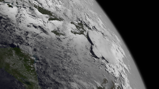
Featured image: GOES East satellite captured TS Chantal at 19:45 UTC on July 8, 2013. (Credit: NOAA/GOES)
Tropical Storm Chantal is heading for the Caribbean and is moving through the Lesser Antilles Islands, south of Puerto Rico, the Dominican Republic and Haiti this week. Tropical Storm Chantal is expected to turn northwest towards the Bahamas and off the coast of southeastern Florida by July 12, 2013.
Strong easterly wave started to developed on July 3, 2013 off the African coast and by July 7, 2013 it developed into tropical depression. By July 8, 2013 it developed into tropical storm approaching Lesser Antilles Islands.
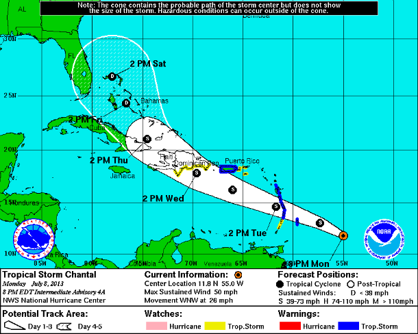
NHC's forecast track (Credit: NOAA/NHC)
According to latest public advisory issued by US National Hurricane Center (NHC) at 21:00 UTC on July 8, 2013, the center of Tropical Storm Chantal was located near latitude 11.8N and longitude 53.9W, about 390 miles (630 km) ESE of Barbados. Chantal is moving toward the west-northwest near 26 mph (43 km/h) and this general motion is expected to continue for the next couple of days. The center of Chantal should reach the Lesser Antilles early on July 9, 2013 and move into the eastern Caribbean Sea later during the day and be near the Dominican Republic on July 10, 2013.
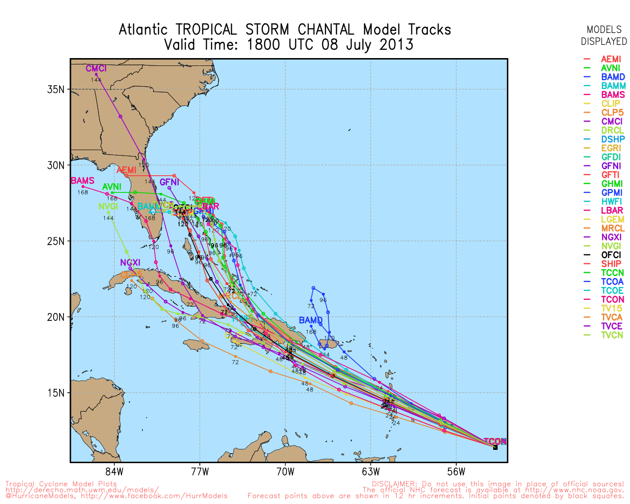
Spaghetti forecast track (Credit: UWM)
Maximum sustained winds are near 45 mph (5 km/h) with higher gusts. Tropical-storm-force winds extend outward up to 60 miles (95 km) from the center. The estimated minimum central pressure is 1005 mb (29.68 inches). Some strengthening is forecast during the next 48 hours.
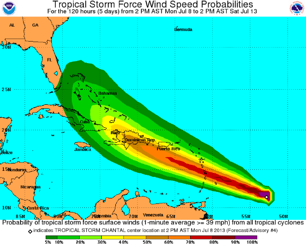
5-day tropical storm force wind speed probabilities map (Credit: NOAA/NHC)
Visible and water vapor imagery continue to indicate an increase in the upper-level anticyclonic outflow pattern. Environmental conditions are favorable for at least some slight strengthening before the quick forward speed of the cyclone brings it into the influence of the mountainous terrain of Hispaniola and Cuba in about three days.
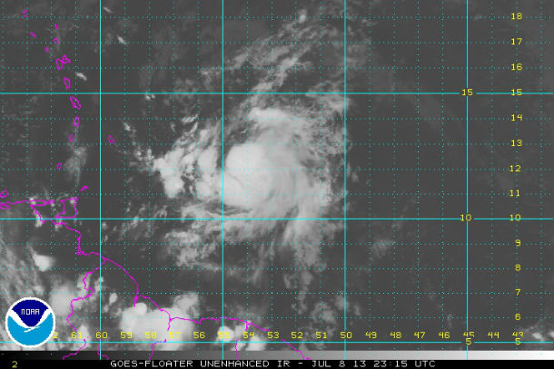
GOES East Infrared image of TS Chantal taken at 23:15 UTC on July 8, 2013 (Credit: NOAA/NHC)
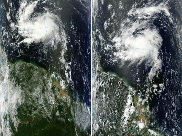
MODIS satellite images of TS Chantal – Terra at 13:55 UTC on July 8, 2013 and Aqua at 16:55 UTC on July 8, 2013 (Credit: LANCE/MODIS Rapid Response)
Chantal is expected to be near hurricane strength before it reaches Hispaniola. After Chantal moves past Hispaniola, the cyclone should be affected by moderate to strong westerly vertical wind shear associated with an upper-level trough across Florida, which is expected to further enhance the weakening process.
A Tropical Storm Warning has been issued for Puerto Rico, Barbados, Dominica, St. Lucia, Martinique and Guadeloupe. A tropical storm watch has been issued for the St. Vincent, U.S. Virgin Islands, Vieques and Culebra and southern coast of Dominican Republic from Cabo Engano to the border with Haiti.
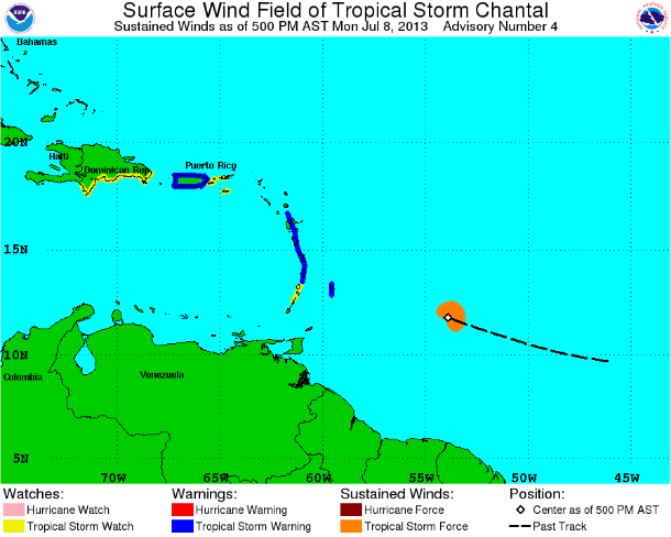
TS Chantal warnings and watches (Credit: NOAA/NHC)
A storm surge will raise water levels by as much as 1 to 3 feet above normal tide levels in the Leeward Islands, Windward Islands and Puerto Rico. Near the coast, the surge will be accompanied by dangerous waves. Chantal is expected to produce rain accumulations of 2 to 4 inches over the Leeward and Windward Islands with maximum amounts of 6 inches possible.
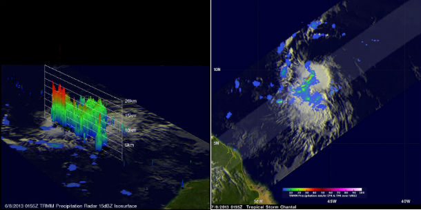
The simulated 3-D view, looking from the west, uses TRMM's Precipitation Radar (PR) instrument to show the very powerful storms near Chantal's center of circulation that were reaching heights of over 15.0km (~9.3 miles). The most intense rain was falling at a rate of over 115.5 mm/hr (~4.5 inches) near Chantal's center of circulation. (NASA/TRMM/ Hal Pierce (SSAI/NASA GSFC) Caption by Steve Lang (SSAI/NASA GSFC))
Satellite Animations
- Storm-Centered Infrared (GOES 13; NOAA/SSD)
- Storm-Centered Infrared (Aviation Color Enhancement) (GOES 13; NOAA/SSD)
- Storm-Centered Water Vapor (GOES 13; NOAA/SSD)
- Storm-Centered Visible (GOES 13; NOAA/SSD)
- Storm-Centered Visible (Colorized) (GOES 13; NOAA/SSD)
- Central Atlantic Infrared (GOES 13; NOAA/SSD)
- Central Atlantic Infrared (Aviation Color Enhancement) (GOES 13; NOAA/SSD)
- Central Atlantic Water Vapor (GOES 13; NOAA/SSD)
- Central Atlantic Visible (GOES 13; NOAA/SSD)
- Central Atlantic Visible (Colorized) (GOES 13; NOAA/SSD)
How we can save to peoples to storm?
Science cant help us?