
New activity with ash emissions and lava fountaining at Pavlof volcano, Alaska
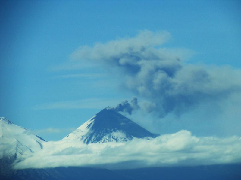
Image credit: Aerial view of Pavlof volcano on June 7, 2013. (Photo courtesy of Theo Chesley/AVO)
Current eruptive episode at Pavlof volcano, Alaska began on May 13, 2013 with ash emissions continuing through May 28, 2013 at which time the volcano remain calm. Activity renewed on June 4, 2013. Such pauses are common during eruptive episodes of Pavlof, which often last weeks to months.

Aerial view of Pavlof volcano, June 7, 2013. (Photo courtesy of Theo Chesley/AVO)
New ash emissions, accompanied by seismic tremor and explosion signals were recorded on June 4, 2013 and still continue. Elevated surface temperatures near the volcano's vent have been observed in overnight satellite images since June 4, consistent with lava effusion and fountaining.

Backscattered electron image of ash erupted from Pavlof volcano, collected in Sand Point on the night of 5/18 to 5/19 by Sand Point resident Kathleen Harper. The ash is composed almost exclusively of juvenile vesicular glassy particles with few crystals. (Image courtesy of AVO/USGS)
Satellite images from June 9, 2013 show an ash plume extending 20 kilometers (12 miles) southeast of the volcano. Views from June 7, 2013 from Cold Bay showed an ash plume rising a few thousand feet above the volcano.


NOAA ARL Ash Trajectory Forecasts
AVO raised Volcano Alert Level from Advisory to Watch and Aviation Color Code from Yellow to Orange. The current activity at Pavlof volcano could become more vigorous with little warning, and AVO continues to monitor the volcano closely.

Current seismic recording from Pavlof volcano (PVV station, AVO)
At Cleveland volcano, Alaska as of June 9, 2013 nothing unusual was observed in satellite images over the past day, and no other reports of activity were recived, AVO stated in the latest report. AVO had raised the Aviation Color Code for Cleveland volcano to Yellow and the Volcano Alert Level to Advisory.
Source: Alaska Volcano Observatory

Earlier reporting
Nothing on Watchers was published in the last 24 hours. These are older articles.
- On October 22, 2017, a single flash of lightning stretched 515 miles from eastern Texas to near Kansas City, a distance that takes eight hours to drive, and nobody realized how far it had gone until scientists went back through the satellite data years later Epicenter
- CPC posts a slight risk of heavy rain from the Gulf Coast to the Northeast urban corridor November 25-29, and a moderate risk of West Coast wind and Sierra snow on November 25
- Florida's east coast faces a moderate flash flood risk Wednesday through Friday, with 4 to 8 inches of rain forecast and the St. Johns River near Cocoa already in major flood at 17.13 feet
- Cyclone Akvan to make landfall between Nellore and Visakhapatnam around noon on November 20, IMD forecasts 120-130 km/h winds gusting to 145
