
Shallow M 5.8 hit Northern Territory, Australia
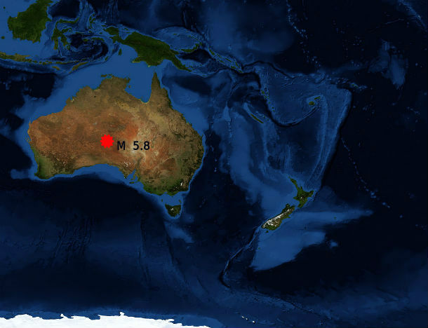
Image credit: NASA/MODIS/BlueMarble/Reto Stöckli
Shallow earthquake registered as M 5.8 (USGS/EMSC) occurred in the desert region near Yulara at the border of South Australia and Northern Territory on June 9, 2013 at 14:22 UTC. The epicenter was located 316 km (196 miles) SW of Alice Springs, Australia at coordinates 25.966°S 131.976°E. The epicenter was at depth of 3 -10 km.
.jpg)
USGS shakemap (Credit: USGS)
Geoscience Australia reported M 5.7 at depth of 0 km. There were no reports of damage. This area is sparsely populated.
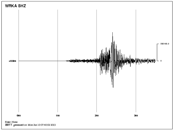
Warakurna (WA) seismogram record (14:22:28 – 14:25:58 UTC) (Credit: WRKA-BHZ/Geoscience Australia)
This unpopulated area was shaking last year when M 6.1 shook Ngarutjara. Very strong M 6.7 at depth of 3 km hit Tennant Creek in 1988. Seismic activity at this location has remained at above average levels since then. Three M 6+ earthquakes near Tennant Creek in 1988 produced 35 km of surface rupture in the Precambrian shield. Although these earthquakes are among the largest ever recorded on the Australian continent, there is no record of M 5+ earthquakes prior to 1987. Small earthquakes are still occurring and there is a possibility of stronger earthquakes in the area.
Earthquake activity and level of risk in Australia
Australia is seismically active and earthquakes pose a substantial risk. Australia's earthquake activity is moderate to high. The level of the earthquake hazard of Australia's more active regions is roughly comparable to that of well known seismic zones in central USA. The largest earthquake that can occur in Australia is not yet known but is expected to be above Richter Magnitude 7. Earthquakes offshore southeastern Australia have exceeded M 7 and different magnitudes calculations for the onshore Meeberrie WA earthquake in 1941 ranged from 6.9 to 7.2. (QUAKES)
Tectonic setting
.jpg)
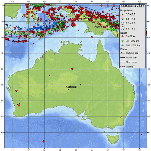
Australia earthquake map shows earthquakes greater than Magnitude 4 (Credit: QUAKES)
Australia is found within the Indo-Australian tectonic plate. Most seismic activity in the region occurs at the boundaries of this plate with adjoining plates. This is called inter-plate seismicity. However, a significant amount of earthquake activity occurs within the plate – both under the continent, and under the surrounding oceanic areas. This is called intra-plate activity, and the reasons for this kind of seismicity are not clearly understood.
Australia seismicity map 1900 – to present (Credit: USGS)
The line of earthquakes to the south and west of Australia occurs along the mid-ocean ridges, which are centres of sea-floor spreading. Earthquakes to the east and north of Australia are at destructive plate boundaries, where subduction of the sea floor is occurring. Australia is moving to the north north east at approximately 10 cm per year, hence the many earthquakes at the collision zone with the plates to the north of Australia. (UWA)
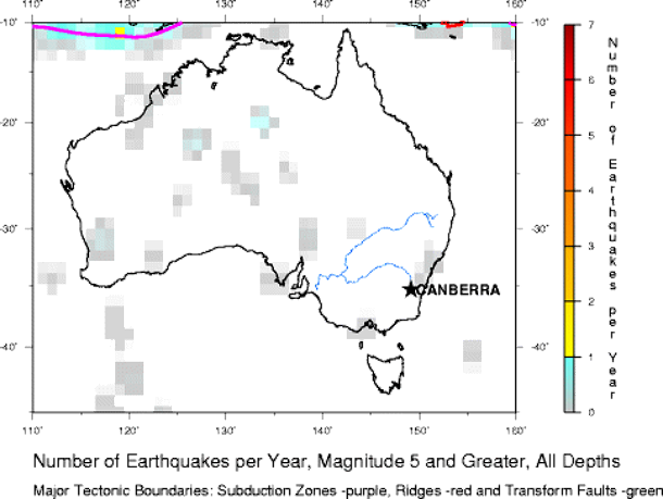
Earthquake density map (Credit: USGS)
Sources: Geoscience Australia, USGS, EMSC
Commenting rules and guidelines
We value the thoughts and opinions of our readers and welcome healthy discussions on our website. In order to maintain a respectful and positive community, we ask that all commenters follow these rules.