
Severe thunderstorm hits Sydney, lightning strikes injure 4, set 3 homes on fire, Australia
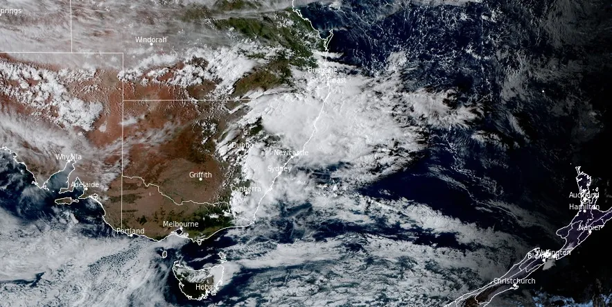
Image credit: JMA/Himawari-9. Acquired at 06:40 UTC on February 19, 2024
Severe storms hit NSW, Australia on February 19, 2024, causing injuries, transport shutdown, and flash flooding. The storms have resulted in four people injured by a lightning strike, significant transport disruptions, and the ignition of three houses. Sydney recorded up to 57 mm (2.24 inches) of rain, intensifying the risk of flash flooding across the state.
Parts of New South Wales (NSW), including Sydney, were hit by intense storms and heavy rainfall today, prompting severe thunderstorm warnings from the Bureau of Meteorology for various districts, including the Mid North Coast, Hunter, and Central Tablelands.
By 17:00 LT, Sydney experienced up to 57 mm (2.24 inches) of rainfall, with 48 mm (1.89 inches) falling in just one hour at Kings Langley. West of Coffs Harbour, rainfall reached up to 57 mm (2.24 inches) within an hour later in the afternoon.
The Weatherzone’s Total Lightning Network detected 210 000 strikes within a 200 km (120 miles) radius of Newcastle, between 05:00 and 11:00 AEDT.
At around 12:45 LT, a lightning strike injured four people who were hiding under a tree near the entrance to the Botanic Gardens of Sydney. The injured people have been taken to hospitals in serious but stable conditions. Additionally, lightning strikes have caused three houses in Sydney to catch fire amidst tens of thousands of lightning strikes recorded throughout the city.
The weather conditions have led to widespread transport disruptions, with all trains running between Gordon and North Sydney canceled due to severe weather damaging equipment.
Sydney Trains has advised commuters to delay travel or seek alternative transport options, including the Metro and local buses. Furthermore, the NSW State Emergency Service (SES) has been actively responding to the severe weather, conducting seven rescues after torrential rain caused flash flooding and receiving over 300 calls for assistance.
In addition to the severe weather impacting NSW, Western Australia is preparing for the effects of Ex-Tropical Cyclone “Lincoln,” which is moving toward the northwest coast from the Northern Territory. The ex-cyclone is forecast to bring strong winds and heavy rain, with Tennant Creek already receiving more than 138 mm (5.43 inches) of rain in the past 24 hours. Further rain, up to 180 mm (7.09 inches), and wind speeds reaching up to 90 km/h (56 mph) are expected in parts of the southern Gregory and northern Tanami districts.
As of 09:00 UTC on February 19, Lincoln’s remnants were moving slowly west across the Kimberley, bringing heavy rainfall to areas near its path, according to the Australian Bureau of Meteorology.
The system is forecast to reach waters west of the Kimberley and north of the Pilbara from Wednesday, February 21, and there is a High risk it could redevelop into a tropical cyclone from Thursday.
There is a chance it will strengthen into a severe tropical cyclone.
On Friday and over the weekend the cyclone could move towards the Pilbara coast, possibly impacting the coast from late Friday or Saturday. From Sunday Ex-Lincoln is likely to be weakening over land.
References:
1 Four people injured in lightning strike and trains cancelled as severe thunderstorms batter Sydney – news.com.au – Febraury 19, 2024
2 Four people hit by lightning, houses set alight, flood rescues as powerful storm sweeps across Sydney – ABC – February 19, 2024
3 Tropical cyclone forecast – BOM – 09:00 UTC, February 19, 2024
I'm a dedicated researcher, journalist, and editor at The Watchers. With over 20 years of experience in the media industry, I specialize in hard science news, focusing on extreme weather, seismic and volcanic activity, space weather, and astronomy, including near-Earth objects and planetary defense strategies. You can reach me at teo /at/ watchers.news.
Commenting rules and guidelines
We value the thoughts and opinions of our readers and welcome healthy discussions on our website. In order to maintain a respectful and positive community, we ask that all commenters follow these rules.