
Record-breaking rains and icy blasts hit Queensland and southeast Australia
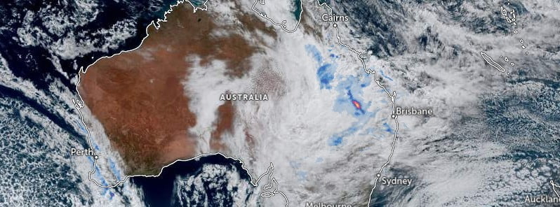
Image credit: JMA/Himawari-9, Zoom Earth, The Watchers. Acquired at 06:00 UTC on July 4, 2023
Outback Queensland was pounded by record-breaking rainfall, with some regions receiving up to 15 times their average monthly rainfall in just a few days. The unseasonal weather, brought about by a northwest cloud band since Friday, June 30, 2023, was accompanied by a cold blast that drastically reduced temperatures.
From Friday, a northwest cloud band led to heavy rains across Western QLD, causing towns like Mt Isa and Cloncurry to shatter their monthly rainfall records between Sunday and Monday.
The rainfall was intense, with Mt Isa airport recording an unseasonable 78.4 mm (3.1 inches) within a 24-hour period ending on Monday, July 3. This amount is about 13 times the average July rainfall, surpassing single-day rain records set nearly a century ago.
To the east of Mt Isa, Cloncurry also experienced significant rainfall, recording approximately 15 times their monthly July average of merely 4.3 mm (0.17 inches) after 64.4 mm (2.5 inches) fell in just 24 hours ending Monday. During the same period, Birdsville recorded 15.8 mm (0.62 inches) of rain, marking its heaviest July rain since 1998.
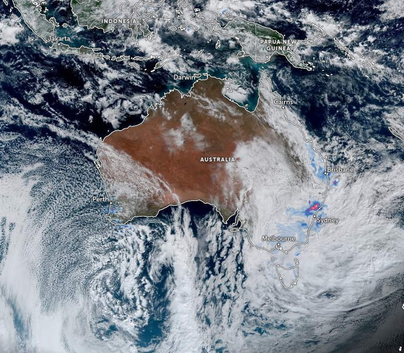
Helen Reid, a meteorologist with the Bureau of Meteorology, explained that this “unseasonable” rainfall was not finished and the weather system was moving into the southeast of Australia. She noted that this cloud band had previously brought rainfall to northern parts of Western Australia, then moved into the Northern Territory and Central Australia. Queensland is the latest state to experience this unusual weather pattern.
According to Reid, rainfall is expected to continue in the southeast while moving into New South Wales and Victoria. However, these southern states are unlikely to see as high rainfall figures. Reid also described the wet weather recorded in Sydney and New South Wales on Tuesday as “unusual”, as it came from the north of Australia, not from the south.
In addition to the extreme rainfall, a record-breaking cold snap swept over much of Australia throughout June. Perth experienced its coldest June in half a century, with an average maximum temperature of just 17.4 °C (63.3 °F). Forecasted temperatures for Perth this week hovered around 16 °C (60.8 °F) for Tuesday and Wednesday.
Other areas like Canberra, which recorded its coldest June day on record, are expected to see minimum temperatures of just 3 °C (37.4 °F). Meanwhile, cities like Hobart and Adelaide can expect temperatures as low as 4 °C (39.2 °F) and 7 °C (44.6 °F), respectively.
References:
1 Unseasonable wet spell battering outback Australia enters NSW – news.com.au – July 4, 2023
2 Rare July rain soaks far Western Queensland – Weatherzone – July 3, 2023
The Watchers team and our contributors bring the latest on extreme weather, earthquakes, volcanic eruptions, space weather, and all things science. We're all about making sense of the natural world and keeping you informed on what’s happening. Got a tip or a question? Hit us up using the form at newstips!
Commenting rules and guidelines
We value the thoughts and opinions of our readers and welcome healthy discussions on our website. In order to maintain a respectful and positive community, we ask that all commenters follow these rules.