·

Tropical Storm Andrea tracked by GOES East satellite

tropical-storm-andrea-tracked-by-goes-east-satellite

NOAA's GOES East satellite has captured imagery of the storms development in Gulf of Mexico in period from June 4-6, 2013. 

YouTube video


Source: VFS

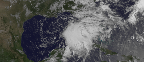
Featured image: Visible satellite image of TS Andrea by GOES East at 13:15 UTC on June 5, 2013. (Credit: NOAA/GOES)

Share:

Commenting rules and guidelines

We value the thoughts and opinions of our readers and welcome healthy discussions on our website. In order to maintain a respectful and positive community, we ask that all commenters follow these rules:

  • Treat others with kindness and respect.
  • Stay on topic and contribute to the conversation in a meaningful way.
  • Do not use abusive or hateful language.
  • Do not spam or promote unrelated products or services.
  • Do not post any personal information or content that is illegal, obscene, or otherwise inappropriate.

We reserve the right to remove any comments that violate these rules. By commenting on our website, you agree to abide by these guidelines. Thank you for helping to create a positive and welcoming environment for all.

Leave a reply

Your email address will not be published. Required fields are marked *