
Magnitude 6.0 deep earthquake hit Guerrero, Mexico
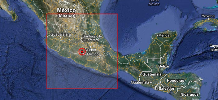
Image credit: EMSC + Google Earth
Deep earthquake with recorded magnitude 6.0 hit Guerrero, Mexico on November 15, 2012 at 09:20 UTC according to USGS. Epicenter was located 10 km (6 miles) E of Tlalchapa, Mexico and 17 km (10 miles) NW of Arcelia, Mexico at coordinates 18.407°N, 100.373°W. Recorded depth by USGS was 60.9 km (37.8 miles).
GDACS estimated that this earthquake can have a low humanitarian impact based on the magnitude and the affected population and their vulnerability. About 1 460 000 people within 100 km.
| Magnitude | 6.0 |
|---|---|
| Date-Time |
|
| Location | 18.407°N, 100.373°W |
| Depth | 60.9 km (37.8 miles) |
| Region | GUERRERO, MEXICO |
| Distances | 10 km (6 miles) E of Tlalchapa, Mexico 17 km (10 miles) NW of Arcelia, Mexico 31 km (19 miles) ENE of Ciudad Altamirano, Mexico 55 km (34 miles) W of Teloloapan, Mexico |
| Location Uncertainty | horizontal +/- 11.8 km (7.3 miles); depth +/- 7.9 km (4.9 miles) |
| Parameters | NST=518, Nph=540, Dmin=162.5 km, Rmss=1.2 sec, Gp= 40°, M-type=teleseismic moment magnitude (Mw), Version=7 |
| Source |
|
| Event ID | usc000dsyl |

I'm a dedicated researcher, journalist, and editor at The Watchers. With over 20 years of experience in the media industry, I specialize in hard science news, focusing on extreme weather, seismic and volcanic activity, space weather, and astronomy, including near-Earth objects and planetary defense strategies. You can reach me at teo /at/ watchers.news.
Commenting rules and guidelines
We value the thoughts and opinions of our readers and welcome healthy discussions on our website. In order to maintain a respectful and positive community, we ask that all commenters follow these rules.