
Magnitude 6.6 – Near east coast of Honshu, Japan
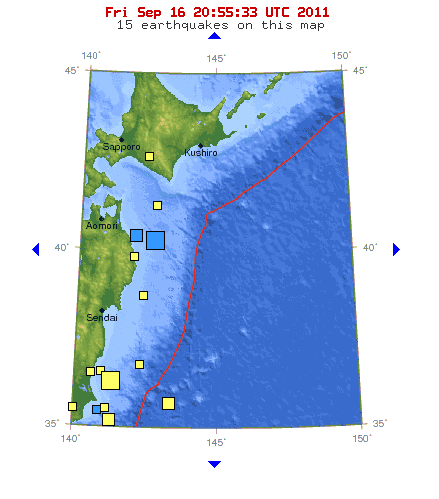
Image credit: TW
An earthquake magnitude 6.6 struck 108 km (67 miles) ESE of Hachinohe, 149 km (92 miles) ENE of Morioka, 177 km (109 miles) ESE of Aomori, Honshu, 574 km (356 miles) NNE of Tokyo (40.288°N, 142.727°E) according to USGS. Epicenter was 36.3 km (22.6 miles) deep.
Japanese JMA reports 6.3 at a depth of 20 km (12 miles).

GDACS has (based on its theoretical models) calculated a tsunami wave height of 0.1 meter for various eastern Honshu coastal locations. However … GDACS has based its calculations on the USGS data (6.6 @ 10 meter). Local JMA has based his tsunami calculations on their own values of 6.3 @ 20 km. JMA has not called any tsunami advisory or alert.

Satellite map of the greater epicenter area
Commenting rules and guidelines
We value the thoughts and opinions of our readers and welcome healthy discussions on our website. In order to maintain a respectful and positive community, we ask that all commenters follow these rules.