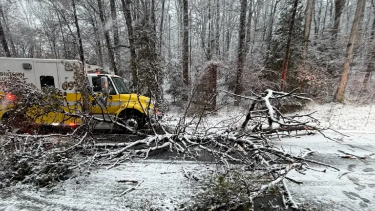
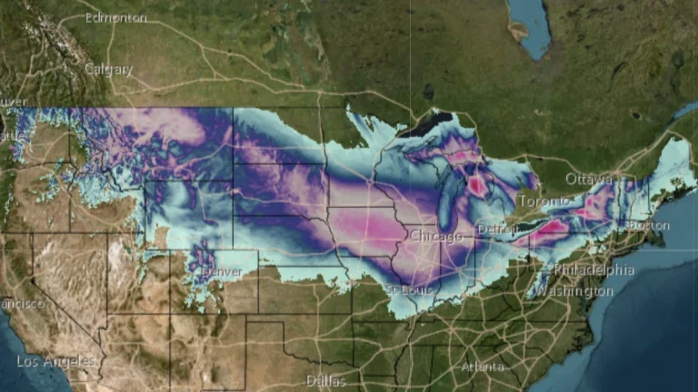
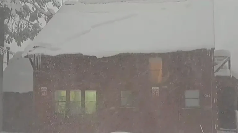
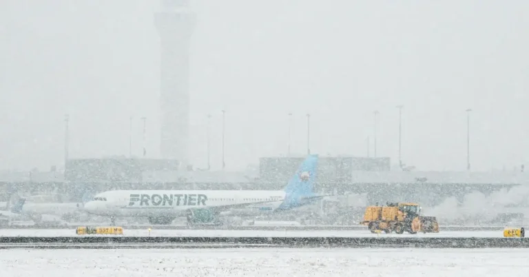
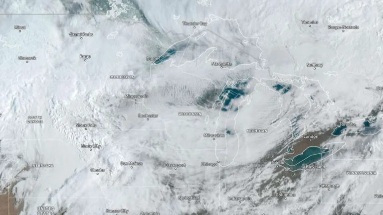
• Historic March blizzard buries parts of Michigan’s Upper Peninsula under up to 132 cm (52 inches) of snow

    A late-season blizzard affected northern Michigan between March 15 and 17, 2026, dropping up to 132.1 cm (52 inches) of snow in parts of the Upper Peninsula and breaking snowfall records at the National Weather Service office in Marquette. Governor Gretchen Whitmer declared a state of emergency on March 17 for seven counties in the Upper Peninsula and northern Lower Peninsula as heavy snow, ice, and strong winds disrupted travel and power service.

  • Late-February 2026 Nor’easter sets all-time snowfall records and leaves 650 000 without power across Northeast U.S.

    A rapidly intensifying Nor’easter brought record-breaking snowfall, hurricane-force winds, and major disruptions across the northeastern United States on February 23, 2026. Providence, Rhode Island, recorded 96.3 cm (37.9 inches) of snow, the highest single-storm total on record, while power outages peaked above 650 000 customers and more than 11 000 flights were canceled nationwide. Officials confirmed at least four storm-related fatalities in Maryland and Pennsylvania.

  • Two fatalities reported after tree collapses onto moving vehicle during Nor’easter in Maryland

    Two people were killed and another seriously injured after a large tree fell onto a moving vehicle in Calvert County, Maryland, at approximately 16:40 LT on February 22, 2026, during a powerful Nor’easter affecting the region. The incident occurred on Solomons Island Road (Route 2) near Aspen Woods Drive in Sunderland. The two victims were pronounced dead at the scene, and the third occupant was transported to a medical facility in critical condition.

  • Major Nor’easter produces hurricane-force gusts, up to 66 cm (24 inches) of snow and widespread outages across Northeast U.S.

    Heavy snow and strong winds continued across the northeastern United States on February 23, 2026, as a major Nor’easter that began February 22 produced blizzard conditions, widespread travel disruption, scattered power outages, and minor to moderate coastal flooding from the Chesapeake Bay to New England. Over 660 000 customers from Virginia to New York and Massachusetts are without power.

  • Two winter storms forecast to bring heavy mountain snow and rain to the Pacific Northwest

    Two frontal systems are forecast to bring widespread precipitation and heavy mountain snow to the Pacific Northwest between Tuesday and Thursday, January 6 and 8, 2026. The first, associated with a weakening atmospheric river, will bring rainfall to the region on Tuesday, followed by a second, stronger system on Wednesday and Thursday, January 7–8. Snowfall totals of 30–120 cm (12–48 inches) are expected across the Cascades and Olympic Mountains, with locally higher amounts above 1 500 m (5 000 feet).

  • Impossible travel, near blizzard conditions, and historic snowfall totals expected in parts of New Mexico and Colorado

    A severe winter storm impacting parts of Colorado and New Mexico is expected to bring additional heavy snowfall on Friday, November 8, 2024. Parts of the area had already accumulated 25 – 50 cm (10 – 20 inches) of snow by Thursday night, November 7, prompting the Colorado governor to declare a disaster emergency for what could be Denver’s most severe snowstorm in 30 years. Snowfall rates of 2.5 – 5 cm per hour (1 – 2 inches per hour) are anticipated to continue across the region, with total snow accumulations forecast to reach 30 – 120 cm (1 – 4 feet) in some areas.