
Ice storm causes power outages across Wisconsin as multi-system winter event impacts northern U.S.
Freezing rain and heavy snow impacted the Upper Midwest on April 2 and 3, 2026, with significant ice accumulation leading to power outages across Wisconsin and hazardous travel conditions across multiple states. Forecasts indicate continued wintry precipitation through April 5 as additional systems move across the region.
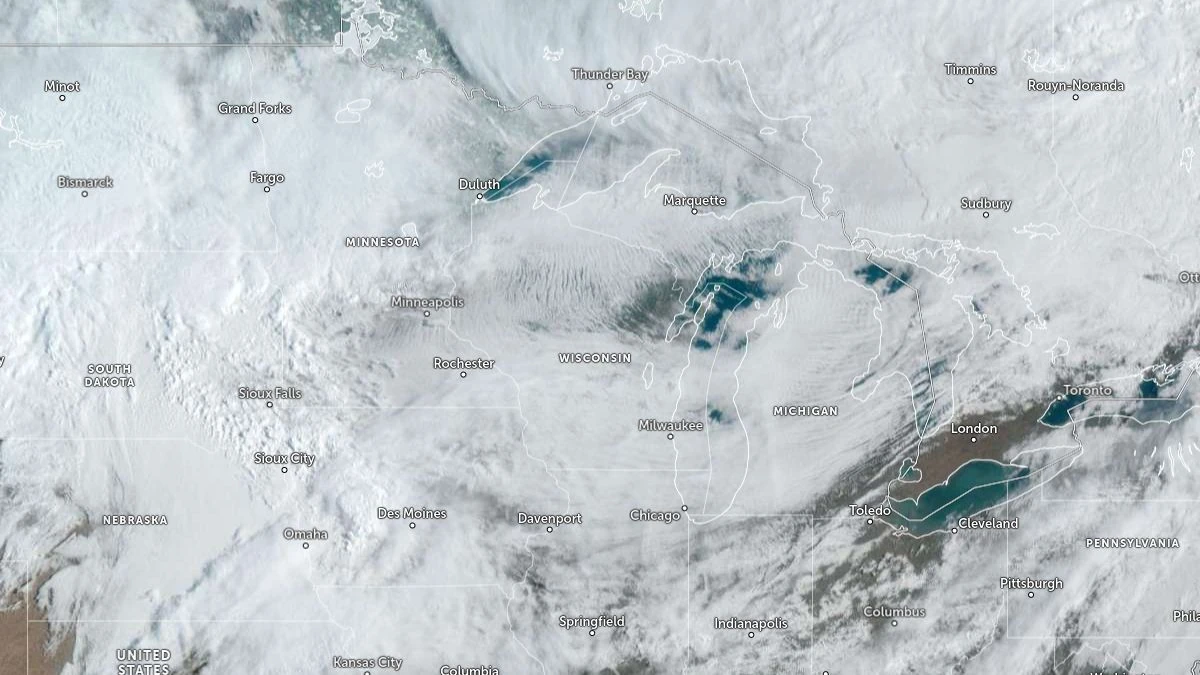
Image credit: NOAA/GOES-East, Zoom Earth, The Watchers. Acquired at 14:00 UTC on April 3, 2026
Freezing rain and heavy snow affected parts of the northern United States between April 2 and 3, as a series of low-pressure systems moved across the region, producing significant ice accretion and localized infrastructure disruption across the Upper Midwest.
Power outages were reported across Wisconsin, where the latest available data show 36 131 customers without electricity out of 2 908 667 tracked.
The highest concentrations were recorded in central and northeastern counties, including Portage with 14 773 outages, followed by Shawano, Marinette, Waupaca, Marathon, Menominee, Wood, and Kenosha. The spatial clustering of outages shows localized areas of heavier ice loading on trees and powerlines.
Ice accretion developed as surface temperatures remained near or below freezing while precipitation persisted, allowing freezing rain to accumulate on exposed infrastructure. Reported ice amounts reached approximately 12.7 mm (0.5 inches) in parts of Wisconsin, sufficient to cause tree damage and powerline stress.
Heavy snowfall accompanied the icing across parts of the northern Plains and Upper Midwest. Forecast totals exceed 30 cm (12 inches) in some areas, with localized higher accumulations possible. Snowfall rates in parts of the region may reach approximately 2.5 cm (1 inch) per hour, causing reduced visibility and hazardous road conditions.
Travel conditions deteriorated across affected regions due to a combination of snow-covered roads and ice-covered surfaces. The timing of the event during the Easter holiday period increased exposure, with higher traffic volumes across regional transportation corridors.
Forecast guidance from the National Weather Service (NWS) Weather Prediction Center (WPC) shows that the active pattern will continue through April 5, as additional low-pressure systems track across the northern United States.
Further snow, sleet, and freezing rain are expected from the northern Plains through the Upper Great Lakes and into northern New England, with Winter Storm Warnings and Winter Weather Advisories issued for parts of the affected region.
The same system is also producing thunderstorms across the central and southern United States.
Temperature contrasts across the system remain pronounced, with below-normal temperatures behind the cold front across the northern Plains and near- to above-normal conditions ahead of it. This thermal gradient continues to support mixed precipitation types, including snow, sleet, and freezing rain across transition zones.
Further infrastructure impacts remain possible where freezing rain persists, particularly in areas already affected by outages, as additional ice accretion may exacerbate stress on trees and powerlines.
References:
1 Short Range Forecast Discussion – NWS/WPC – April 3, 2026
I'm a dedicated researcher, journalist, and editor at The Watchers. With over 20 years of experience in the media industry, I specialize in hard science news, focusing on extreme weather, seismic and volcanic activity, space weather, and astronomy, including near-Earth objects and planetary defense strategies. You can reach me at teo /at/ watchers.news.
Commenting rules and guidelines
We value the thoughts and opinions of our readers and welcome healthy discussions on our website. In order to maintain a respectful and positive community, we ask that all commenters follow these rules.