
Winter storm blankets Southern California, ski resorts receive fresh snow
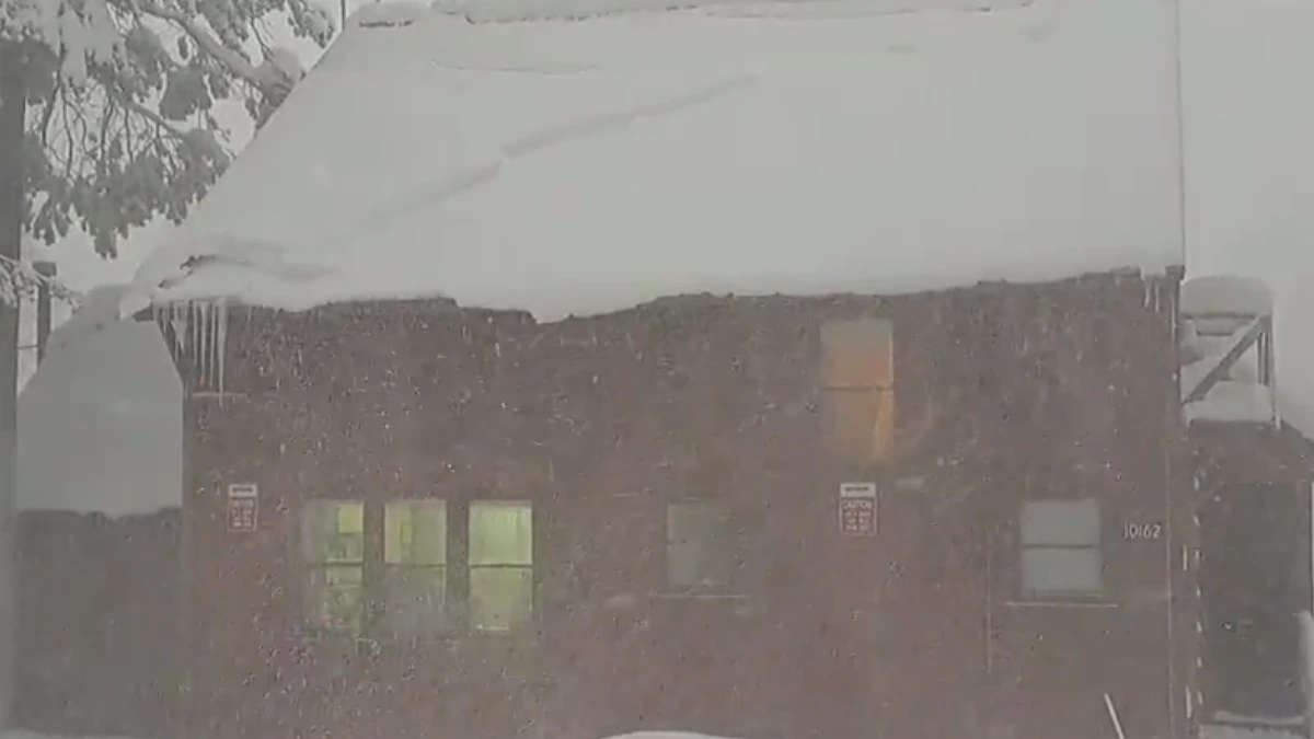
A winter storm blanketed southern California with snow and rain, disrupting mountain travel with forecasts of up to 36 cm (14 inches) of snow, slick roads, and wind gusts of up to 80 km/h (50 mph) in affected areas.
Snowfall in South California. Image Credit: UC Berkeley Central Sierra Snow Lab
- Heavy snow has fallen across southern California, with up to 36 cm (14 inches) forecast in the San Gabriel Mountains and 31 cm (12 inches) expected at Mt. Baldy Ski Area. Lower-elevation areas could also see snowfall as low as 914 m (3 000 feet).
- Roads in mountain communities, including the Tejon Pass on the I-5 Freeway, have become slick, with 2.5 – 5 cm (1 – 2 inches) of snow expected.
- The National Weather Service advises travelers to check road conditions and carry chains and emergency supplies.
A winter storm affecting much of southern California has brought rain and significant snow to the region. Heavy snow is still forecast for areas at elevations of 1 000 – 1 200 m (3 500 – 4 000 feet), with expectations of 8 – 20 cm (3 – 8 inches) in most locations.
Several areas in southern California reported significant snow by the end of Sunday, January 26, with 20.3 cm (8 inches) recorded at a ski resort in Heavenly.
Other ski resorts, such as Mammoth, recorded 10.4 cm (4 inches), while Kirkwood reported 5 cm (2 inches) of snow. Wolverton recorded significant snow accumulation of 17.8 (7 inches), while June Mountain reported 15.2 cm (6 inches) of snowfall.
Snow totals of up to 36 cm (14 inches) are forecast for the San Gabriel Mountains, according to the National Weather Service (NWS). Mt. Baldy Ski Area could see snow accumulations of up to 31 cm (12 inches), while Mammoth Mountain and Big Bear are both forecast to receive up to 10 cm (4 inches).
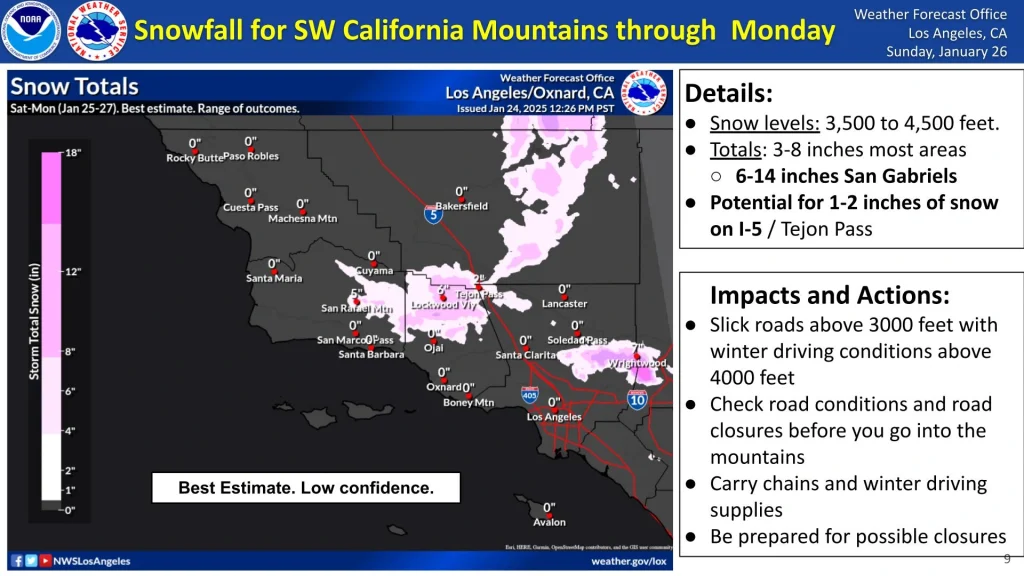
As snow levels drop to as low as 900 m (3 000 feet), roads in local mountain communities have become slick. Weather officials stated that there is the potential for 2.5 – 5 cm (1 – 2 inches) of snow in the Tejon Pass area of the I-5 Freeway, which could lead to traffic delays.
Snow totals of up to 31 cm (12 inches) are forecast for Mt. Baldy Ski Area, while the Mammoth Mountains could see accumulations of up to 20 cm (8 inches).
“Check road conditions and closures before traveling into the mountains,” the National Weather Service advised. “Carry chains, winter driving supplies, and prepare for potential road closures.”
The storm system prompted officials to issue a Winter Storm Warning lasting until Monday afternoon, with wind gusts expected to reach up to 80 km/h (50 mph) in communities along Angeles Crest Highway and near Mount Wilson and Mount Baldy.
Other higher-elevation communities are under a Winter Weather Advisory set to expire at 16:00 LT on Monday. “If you must travel, keep an extra flashlight, food, and water in your vehicle in case of an emergency,” the NWS stated.
The storm brought snowfall to the Central Rockies, affecting parts of Colorado and Utah over the weekend before spreading to the Sierra Range on Sunday.
References:
1 URGENT – WINTER WEATHER MESSAGE – NWS – January 27, 2025
2 SoCal Ski Resorts Celebrate First Storm of Season: 9-12″ Expected – Powder -January 26, 2025

I am an Assistant Editor and Severe Weather & Science Journalist at The Watchers, specializing in real-time severe weather coverage, geophysical event reporting, and research-driven scientific analysis. You can reach me at rishav(at)watchers(.)news.
Commenting rules and guidelines
We value the thoughts and opinions of our readers and welcome healthy discussions on our website. In order to maintain a respectful and positive community, we ask that all commenters follow these rules.