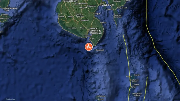
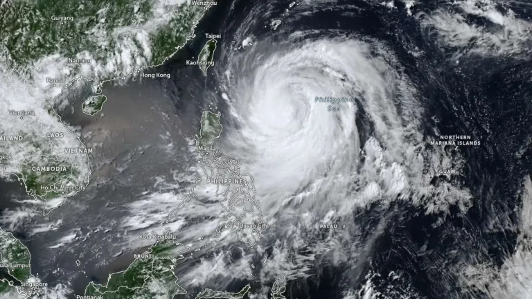
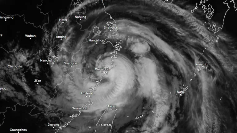
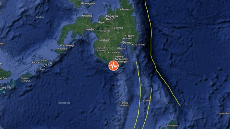
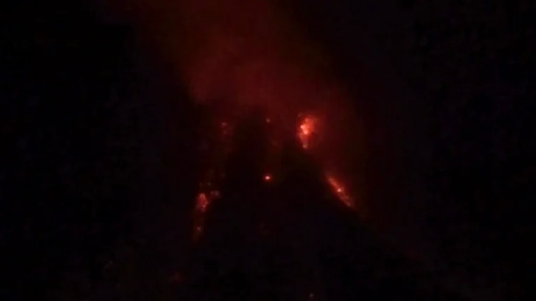
• Repeated lava-collapse pyroclastic flows continue at Mayon volcano, Philippines

    Mayon volcano remained under Alert Level 3 on Friday, May 8, 2026, with PHIVOLCS reporting lava flows in three gullies, elevated sulfur dioxide emissions, volcanic earthquakes, and repeated lava-collapse pyroclastic flow activity. Today’s observations follow a large eruption sequence on May 2, when collapse-generated pyroclastic flows traveled up to 5 km (3.1 miles), generating widespread ashfall across parts of Albay Province and prompting evacuations affecting thousands of residents.

  • Strong M6.0 earthquake hits Samar, Philippines

    A strong earthquake registered by the USGS as M6.0 hit Samar, Philippines, at 06:09 UTC (14:09 LT) on May 4, 2026. The agency is reporting a depth of 73.3 km (45.5 miles). EMSC is reporting M6.0 at a depth of 56 km (34.8 miles).

  • Strong eruption at Mayon volcano generates large pyroclastic flows, heavy ashfall in Albay, Philippines

    Pyroclastic density currents generated by a lava collapse at Mayon volcano in Albay, Philippines, on May 2, 2026, reached an estimated runout distance of 4 km (2.5 miles) along Mi-isi Gully and produced ashfall affecting 52 barangays across Guinobatan, Camalig, and Ligao City. Ashfall reduced visibility to near zero in parts of Camalig, blanketed homes, roads, crops, and grazing land, and prompted face mask distribution and health advisories.

  • Strong M6.0 earthquake hits near Sarangani, Philippines

    A strong earthquake registered by the USGS as M6.0 hit 90 km (56 miles) SE of Sarangani, Philippines at 10:34 UTC on April 4, 2026. The agency is reporting a depth of 99.6 km (61.9 miles). EMSC is reporting M6.0 at a depth of 100 km (62 miles).

  • Schools closed, ashfall reported after explosive eruption at Kanlaon volcano, Philippines

    An explosive eruption occurred at Kanlaon volcano on Negros Island, central Philippines, at 18:07 LT (10:07 UTC) on March 15, 2026, producing an ash plume rising more than 5 km (3.1 miles) above the summit and depositing ashfall across at least 54 barangays in 11 local government units. Monitoring data associated with the event recorded nine volcanic earthquakes and sulfur-dioxide emissions of about 1 085 tonnes per day. Authorities also reported vegetation fires on the volcano’s slopes and suspended classes in several municipalities on March 16 as a precaution.

  • Increased seismic activity recorded at Bulusan volcano, Philippines

    A total of 49 volcanic earthquakes were recorded at Bulusan Volcano in Sorsogon Province, Philippines, between 03:00 LT on February 26 and 11:00 LT on March 2, 2026, prompting authorities to issue an advisory on increased seismic activity. Sixteen of the events were classified as volcano-tectonic earthquakes occurring at depths of 3–6 km (1.9–3.7 miles) beneath the northern and southeastern flanks of the volcano. Alert Level 0 remains in effect, but officials warn of a possible sudden phreatic eruption.