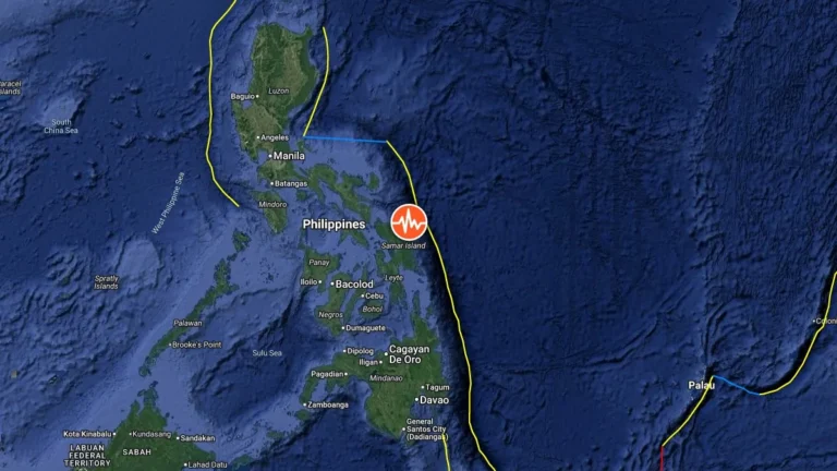
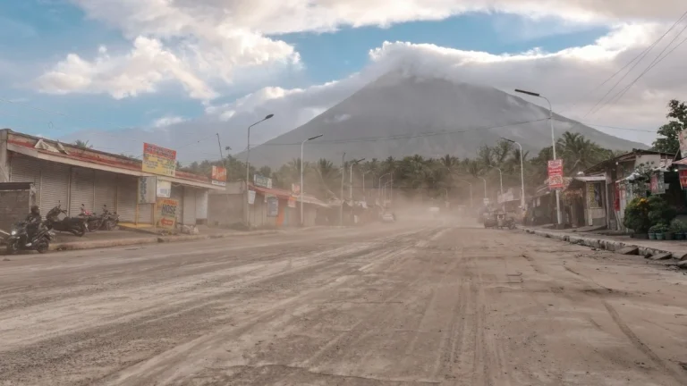
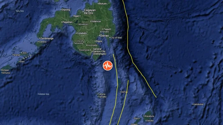
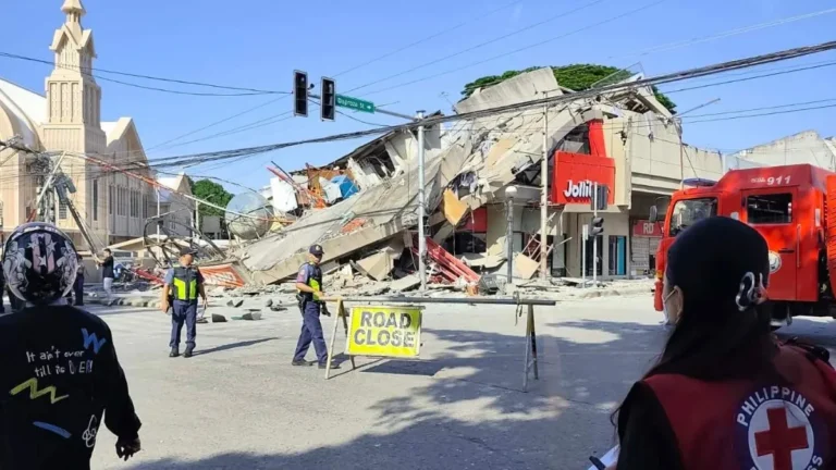
• Strong M6.0 earthquake hits Samar, Philippines

    A strong earthquake registered by the USGS as M6.0 hit Samar, Philippines, at 06:09 UTC (14:09 LT) on May 4, 2026. The agency is reporting a depth of 73.3 km (45.5 miles). EMSC is reporting M6.0 at a depth of 56 km (34.8 miles).

  • Strong eruption at Mayon volcano generates large pyroclastic flows, heavy ashfall in Albay, Philippines

    Pyroclastic density currents generated by a lava collapse at Mayon volcano in Albay, Philippines, on May 2, 2026, reached an estimated runout distance of 4 km (2.5 miles) along Mi-isi Gully and produced ashfall affecting 52 barangays across Guinobatan, Camalig, and Ligao City. Ashfall reduced visibility to near zero in parts of Camalig, blanketed homes, roads, crops, and grazing land, and prompted face mask distribution and health advisories.

  • Strong M6.0 earthquake hits near Sarangani, Philippines

    A strong earthquake registered by the USGS as M6.0 hit 90 km (56 miles) SE of Sarangani, Philippines at 10:34 UTC on April 4, 2026. The agency is reporting a depth of 99.6 km (61.9 miles). EMSC is reporting M6.0 at a depth of 100 km (62 miles).

  • Schools closed, ashfall reported after explosive eruption at Kanlaon volcano, Philippines

    An explosive eruption occurred at Kanlaon volcano on Negros Island, central Philippines, at 18:07 LT (10:07 UTC) on March 15, 2026, producing an ash plume rising more than 5 km (3.1 miles) above the summit and depositing ashfall across at least 54 barangays in 11 local government units. Monitoring data associated with the event recorded nine volcanic earthquakes and sulfur-dioxide emissions of about 1 085 tonnes per day. Authorities also reported vegetation fires on the volcano’s slopes and suspended classes in several municipalities on March 16 as a precaution.

  • Increased seismic activity recorded at Bulusan volcano, Philippines

    A total of 49 volcanic earthquakes were recorded at Bulusan Volcano in Sorsogon Province, Philippines, between 03:00 LT on February 26 and 11:00 LT on March 2, 2026, prompting authorities to issue an advisory on increased seismic activity. Sixteen of the events were classified as volcano-tectonic earthquakes occurring at depths of 3–6 km (1.9–3.7 miles) beneath the northern and southeastern flanks of the volcano. Alert Level 0 remains in effect, but officials warn of a possible sudden phreatic eruption.

  • Kanlaon eruption sends ballistics 1.5 km high, triggers PDCs, forest fires and ashfall across 121 barangays

    A significant explosive eruption occurred at Kanlaon Volcano, Philippines, at 19:04 local time (LT) on February 26, 2026, sending a dense ash plume 2.5 km (1.6 miles) above the crater and producing pyroclastic density currents (PDCs) that descended its upper slopes. The eruption lasted two minutes and was followed by 77 minutes of continuous ash emission dispersed over southern Negros Island.

  • Heavy rains cause deadly landslides in Davao Region, Philippines

    At least seven people were killed in two rain-induced landslides in the Davao Region of southern Mindanao on February 19–20, 2026, after days of continuous rainfall generated by a persistent shear line and easterly winds. The fatal events occurred in Monkayo, Davao de Oro, and Mati City, Davao Oriental.

  • Explosive eruption at Kanlaon displaces over 30 families, ashfall blankets western areas, Philippines

    More than 30 families evacuated La Carlota City, Negros Occidental, Philippines, after an explosive eruption at Kanlaon volcano at 16:39 LT (08:39 UTC) on February 19, 2026. The eruption generated a 2 000 m (6 562 feet) ash plume, pyroclastic density currents within 2 km (1.2 miles) of the crater, and ashfall across 41 barangays in six cities and municipalities.

  • Tropical Storm Penha leaves 8 dead and 645 612 affected after crossing southern-central Philippines

    Tropical Depression Penha crossed southern-central Philippines from February 5–7, 2026, leaving at least eight people dead and 645 612 affected across six regions, according to the National Disaster Risk Reduction and Management Council (NDRRMC) as of February 10. More than 86 000 people were displaced, including nearly 60 000 staying in 438 evacuation centres, while enhanced rainfall from a shear line continues to affect central and southern parts of the country.