Skip to content !– Comets and asteroids –>
watchers.news
  • EarthExpand
    • Earth system monitoring

      Earth

      Monitoring significant geologic, atmospheric, hydrological, and surface hazards worldwide.

      View Earth coverage →
      Geologic hazards
      • Earthquakes
      • Volcanoes
      • Tsunami
      • Landslides
      • Sinkholes
      Severe weather
      • Severe storms
      • Tropical cyclones
      • Tornadoes
      • Blizzards
      • Heat waves
      Surface hazards
      • Floods
      • Drought
      • Wildfires
      • Avalanches
      • Ice & snow
      Support Watchers
      Support our monitoring and reporting work.
      Subscribe →
      Newsletter
      Get curated updates on global hazards.
      Join newsletter →
      Report an event
      Share local event information with our editors.
      Send report →
      Article archive
      Browse the full article archive.
      View archive →
  • SpaceExpand
    • Space environment

      Space

      Monitoring near-Earth space, celestial objects and orbital activity.

      View Space coverage →
      Solar System objects
      • Comets and asteroids
      • Near-Earth Objects
      Sky observation
      • Meteor activity
      • Night Sky
      Support Watchers
      Support our monitoring and reporting work.
      Subscribe →
      Newsletter
      Get curated updates on global hazards.
      Join newsletter →
      Report an event
      Share local event information with our editors.
      Send report →
      Article archive
      Browse the full article archive.
      View archive →
  • Space weatherExpand
    • Solar-terrestrial monitoring

      Space weather

      Monitoring solar activity, geomagnetic storms, radiation events, and near-Earth space conditions.

      View Space weather coverage →
      Space weather
      • Solar activity
      • Geomagnetic storms
      • Solar radiation storms
      SWX monitor

      Track solar activity, geomagnetic conditions, radiation storms, and near-Earth space weather signals in one place.

      Open SWX monitor →
      Support Watchers
      Support our monitoring and reporting work.
      Subscribe →
      Newsletter
      Get curated updates on global hazards.
      Join newsletter →
      Report an event
      Share local event information with our editors.
      Send report →
      Article archive
      Browse the full article archive.
      View archive →
  • Epicenter
  • ToolsExpand
    • Watchers tools

      Monitoring tools

      Operational tools supporting Watchers reporting, monitoring, and situational awareness.

      watchers.LIVE

      Near real-time hazard monitoring and situational intelligence.

      Open platform →

      SWX

      Space weather, solar activity, and geomagnetic conditions.

      Open SWX →

      SAM

      Earthquake monitoring and seismic signal tracking.

      Open SAM →

      StormWall

      Curated stormchaser videos documenting severe weather.

      Open StormWall →
  • ConnectExpand
    • Connect

      Support, updates, and contact

      Ways to support Watchers, receive updates, send event reports, and reach the editorial team.

      Subscribe

      A daily email edition from The Watchers on earthquakes, eruptions, extreme weather and space weather.

      Get the newsletter

      Newsletter

      Get curated updates on global hazards.

      Join newsletter →

      Report an event

      Share local event information with our editors.

      Report an event →

      Feeds and contact

      Follow Watchers by RSS or contact our editorial team.

      RSS feeds → Contact →
watchers.news
Home / jamaica - Page 2

jamaica

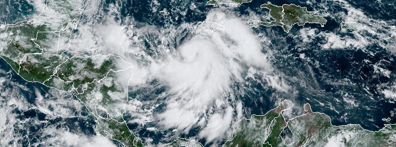
  • satellite image tropical storm melissa 1530 utc october 21 2052

    Tropical Storm Melissa forms over the Caribbean, forecast to reach hurricane strength

    ByRishav Kothari Tuesday, October 21, 2025Tuesday, October 21, 2025

    Tropical Storm Melissa, the 13th named storm of the 2025 Atlantic hurricane season, formed on Tuesday, October 21, 2025. A Tropical Storm Watch is in effect for Haiti, and a Severe Weather Alert remains active for Jamaica as the system brings the risk of heavy rainfall, flash floods, and landslides across both countries.

  • satellite image of tropical storm rafael 1300 utc on november 5 2024 f

    Western Cuba braces for Rafael’s destructive impact on Wednesday

    ByTW Tuesday, November 5, 2024Thursday, November 7, 2024

    Western Cuba braces for impact as Rafael nears hurricane strength, expected to bring destructive waves and a dangerous storm surge when it makes landfall on Wednesday, November 6, 2024.

  • hurricane beryl damage july 2024

    Hurricane “Beryl” leaves 12 people dead in the United States, 16 across the Caribbean

    ByRishav Kothari Wednesday, July 10, 2024Wednesday, September 25, 2024

    At least 12 people have been killed and millions were left without power in the United States after Category 1 Hurricane “Beryl” made landfall near Matagorda in Texas on July 8, 2024. This brought the total death toll caused by the system to 28, as of July 10.

  • hurricane beryl at 0840 utc on july 3 2024

    Hurricane “Beryl” to pass near or over Jamaica, life-threatening winds and storm surge forecast

    ByTeo Blašković Wednesday, July 3, 2024Wednesday, September 25, 2024

    Dangerous Hurricane “Beryl” is moving toward Jamaica and is expected to pass near or over the island nation later today (LT), July 3, 2024. Beryl’s center is expected to pass near or over the Cayman Islands later tonight or early Thursday, July 4, and approach the Yucatan Peninsula of Mexico on Thursday night.

  • m5.4 earthquake jamaica october 30 2023 location map

    M5.6 earthquake in Jamaica’ Hope Bay leads to building collapse and emergency service strain

    ByTeo Blašković Tuesday, October 31, 2023Wednesday, September 25, 2024

    A shallow earthquake registered by the Earthquake Unit of the University of West Indies as M5.6 hit Hope Bay, Jamaica at 15:57 UTC (10:57 LT) on October 30, 2023. The agency is reporting a depth of 18 km (11.2 miles). The USGS is reporting it as M5.4, EMSC as M5.5, and INGV and Ayiti-Seismes (Haiti) as M5.8.

  • tropical-storm-delta-2020

    Tropical Storm “Delta” forms near Jamaica, expected to move near or over the Cayman Islands early Tuesday

    ByTeo Blašković Monday, October 5, 2020Wednesday, September 25, 2024

    Tropical Storm "Delta" formed south of Jamaica at 12:00 UTC on October 5, 2020, as the 25th named storm of the 2020 Atlantic hurricane season. The current NHC forecast track takes Delta away from Jamaica today, near or over the Cayman Islands early…

  • tropical-storm-nana-forecast-track

    Tropical Storm “Nana” forms near Jamaica, forecast to make landfall in Belize

    ByTeo Blašković Tuesday, September 1, 2020Wednesday, September 25, 2024

    Tropical Storm "Nana" formed at 16:05 UTC on September 1, 2020, as the earliest 14th named storm in the Atlantic Ocean on record. The previous record was set by Nate on September 6, 2005. At the time it formed, Nana's center was about 195 km (120…

  • tropical-storm-laura-damage-dominican-republic-haiti-puerto-rico

    Tropical Storm “Laura” wreaks havoc across the Dominican Republic, Haiti and Puerto Rico

    ByTeo Blašković Monday, August 24, 2020Wednesday, September 25, 2024

    Tropical Storm "Laura" brought strong winds and heavy rain to Puerto Rico, the Dominican Republic, and Haiti over the weekend, August 22 into 23, 2020, leaving at least 11 people dead and more than 1 million without power. The storm is now dumping heavy…

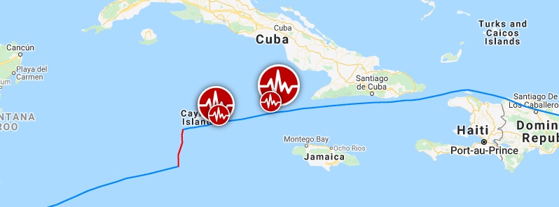
  • major-m7-7-earthquake-hits-between-cuba-and-jamaica-tsunami-warnings-issued

    Major M7.7 earthquake hits between Cuba and Jamaica, followed by M6.1 near Cayman Islands

    ByTeo Blašković Tuesday, January 28, 2020Wednesday, September 25, 2024

    A powerful earthquake registered by the USGS as M7.7 hit off the southern coast of Cuba at 19:10 UTC (14:10 LT) on January 28, 2020. The agency is reporting a depth of 10 km (6.2 miles). EMSC is reporting the same magnitude and depth. The epicenter was located 125.9…

  • deadly-floods-and-landslides-hit-haiti-dominican-republic-and-jamaica

    Deadly floods and landslides hit Haiti, Dominican Republic and Jamaica

    ByTeo Blašković Tuesday, May 8, 2018Wednesday, September 25, 2024

    Heavy rainfall affected the Dominican Republic, Haiti and Jamaica between May 2 and 7, 2018, causing floods and landslides and leaving at least 4 people dead. The Emergency Operations Center (COE) initially raised red alert level in San Cristóbal province,…

  • Page navigation

    Previous PagePrevious 1 2 3 Next PageNext

    The Watchers newsletter

    A daily email edition from The Watchers on earthquakes, eruptions, extreme weather and space weather.

    Sign up

    Latest articles

    CPC posts a slight risk of heavy rain from the Gulf Coast to the Northeast urban corridor November 25-29, and a moderate risk of West Coast wind and Sierra snow on November 25

    November 18, 2026

    Florida’s east coast faces a moderate flash flood risk Wednesday through Friday, with 4 to 8 inches of rain forecast and the St. Johns River near Cocoa already in major flood at 17.13 feet

    November 18, 2026

    Cyclone Akvan to make landfall between Nellore and Visakhapatnam around noon on November 20, IMD forecasts 120-130 km/h winds gusting to 145

    November 18, 2026

    Radio pulses every 7.9 minutes reveal binary with white dwarf and Sun-like star

    November 18, 2026

    Hera begins close survey to explain why DART deflected Dimorphos so strongly

    November 18, 2026

    NASA’s STRIVE mission targets long-standing 3D observing gap in the upper atmosphere

    November 18, 2026

    Three Australian estuarine fish species maintain performance across thermal extremes

    November 18, 2026

    From the same category

    FloodsSevere storms

    The storms drenching California this week are fed by a river in the sky, a band of water vapor that can carry up to 15 times the flow of the Mississippi River, and this winter’s near-record El Niño could keep aiming more of them at the West Coast

    November 17, 2026
    Severe storms

    Atmospheric river brings moderate risk of heavy rain, mountain snow and high winds to northern California and southwest Oregon on November 24-25

    November 17, 2026
    FloodsSevere weather

    El Niño floods kill 2 in Guayaquil as 172.8 mm of rain swamps Milagro, Ecuador’s toll rises to 14

    November 16, 2026
    FloodsSevere weather

    Southern Thailand braces for heavy rain, 15 provinces on flood and landslide alert for November 18-22

    November 16, 2026

    Most read

    • 24 hours
    • 7 days
    • 30 days

    Cyclone Akvan to make landfall between Nellore and Visakhapatnam around noon on November 20, IMD forecasts 120-130 km/h winds gusting to 145

    November 18, 2026

    Bay of Bengal system to become Cyclone Akvan, landfall forecast between Nellore and Tuni on November 20, India

    November 16, 2026

    The Leonid meteor shower peaks on the night of November 17, exactly 60 years after the 1966 storm, when some observers reported meteors falling at up to 40 a second, though this year’s show should be closer to 15 an hour

    November 15, 2026

    Cold wave brings 17°C temperature drops, blizzards and road closures to northern China, November 15-19

    November 16, 2026

    Southern Thailand braces for heavy rain, 15 provinces on flood and landslide alert for November 18-22

    November 16, 2026

    Second nationwide US flight halt since 9/11: how the November 13 FAA ground stop compares with September 2001 and January 2023

    November 13, 2026

    M6.6 earthquake hits the Banda Sea 148 km west-southwest of Tual, Indonesia, at 68 km depth, USGS issues Green alert

    November 17, 2026

    Huge waves pummel California coast during strong El Niño, flooding streets and closing piers from Pacifica to San Diego

    November 16, 2026

    NTSB examines weather and possible in-flight breakup after Learjet 60 crash kills nine in Florida

    November 3, 2026

    Polar vortex winds at 60°N drop from 22.13 to 5.44 m/s in eight days in rare November disruption; major SSW remains forecast

    November 5, 2026

    Florida’s east coast faces a moderate flash flood risk Wednesday through Friday, with 4 to 8 inches of rain forecast and the St. Johns River near Cocoa already in major flood at 17.13 feet

    November 18, 2026

    Northern lights are possible at high latitudes on November 17 and 18 as NOAA forecasts minor (G1) geomagnetic storms from coronal hole wind

    November 11, 2026

    Lake Worth Pier and South Port Everglades reach record water levels, King tides flood Florida’s Atlantic coast

    October 29, 2026

    G1 geomagnetic storm watch remains in effect as NOAA forecasts Kp 4.67 late on November 17 and early on November 18

    November 17, 2026

    • About us
    • Contact us
    • Updates & announcements
    • Terms & conditions
    • Privacy policy
    • Cookie policy
    • Editorial policy
    • Advertise
    • Support
    RSS X Facebook Telegram YouTube

    The Watchers — Watching the world evolve and transform

    Except where otherwise noted, content on this site is licensed under a Creative Commons Attribution-NonCommercial 4.0 International License - 2026

    Lost your password?


    Don't have an account yet? Sign up


    The Watchers
    Categories
    Earth
    Earthquakes Volcanoes Tsunami Landslides SinkholesSevere storms Tropical cyclones Tornadoes Blizzards Heat wavesFloods Drought Wildfires Avalanches Ice & snowView all Earth →
    Space
    Comets and asteroids Near-Earth Objects Meteor activity Night SkyView all Space →
    Space weather
    Solar activity Geomagnetic storms Solar radiation stormsView all Space weather →
    Epicenter
    Monitoring tools
    watchers.LIVE Near real-time hazard monitoring SWX Space weather monitoring SAM Seismic activity monitoring StormWall Severe weather video layer
    Get involved
    Report an event Report an event Share local event information with our editors. › Support Watchers Support Watchers Support our monitoring and reporting work. ›
    Email RSS X Facebook Telegram YouTube
    Search