
Major M7.7 earthquake hits between Cuba and Jamaica, followed by M6.1 near Cayman Islands
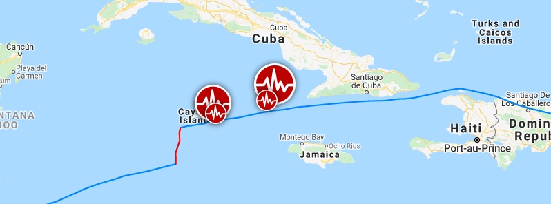
Image credit: Google, TW/SAM
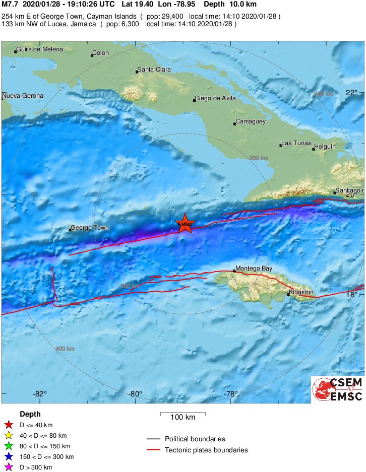
A powerful earthquake registered by the USGS as M7.7 hit off the southern coast of Cuba at 19:10 UTC (14:10 LT) on January 28, 2020. The agency is reporting a depth of 10 km (6.2 miles). EMSC is reporting the same magnitude and depth.
The epicenter was located 125.9 km (78.2 miles) NNW of Lucea (population 6 289), Jamaica, 139.1 km (86.5 miles) NW of Montego Bay (82 867), Jamaica, and 140.3 km (87.1 miles) WSW of Niquero (population 18 771), Cuba.
There are no people living within 100 km (62 miles).
1 000 people are estimated to have felt very strong shaking, 505 000 strong, 5 476 000 moderate and 13 962 000 light.
Based on all available data, hazardous tsunami waves are forecast for some coasts, PTWC said at 19:46 UTC.
Tsunami waves reaching 0.3 to 1 m (1 – 3.3 feet) above tide level are possible for some coasts of Belize, Cuba, Honduras, Mexico, Cayman Islands, and Jamaica.
Actual amplitudes at the coast may vary from forecast amplitudes due to uncertainties in the forecast and local features. In particular maximum tsunami amplitudes on atolls or small islands and at locations with fringing or barrier reefs will likely be much smaller than the forecast indicates.

Based on all available data, the tsunami threat from this earthquake has passed and there is no further threat, PTWC reported at 20:43 UTC.
The USGS issued a green alert for shaking-related fatalities. There is a low likelihood of casualties.
A yellow alert was issued for economic losses. Some damage is possible and the impact should be relatively localized. Estimated economic losses are less than 1% of GDP of Cuba. Past events with this alert level have required a local or regional level response.
Overall, the population in this region resides in structures that are resistant to earthquake shaking, though vulnerable structures exist. The predominant vulnerable building types are unreinforced brick masonry and reinforced masonry construction.
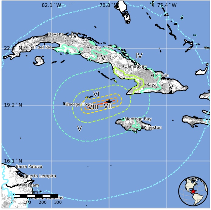
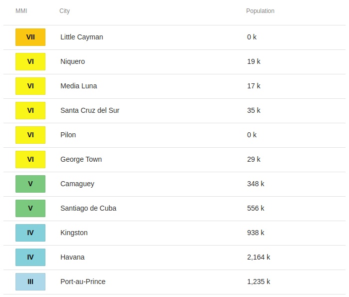
Images courtesy USGS

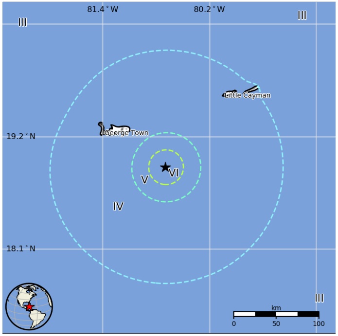
The quake was followed by M6.1 at 21:55 UTC, 57.7 km (35.8 miles) SE of East End, Cayman Islands – USGS, depth 10 km (6.2 miles). EMSC is reporting the same magnitude and depth.
There are about 54 000 people living within 100 km (62 miles).
The USGS issued a green alert for shaking-related fatalities and economic losses. There is a low likelihood of casualties and damage.
61 000 people are estimated to have felt light shaking.
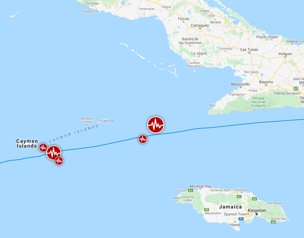
Image credit: Google, TW/SAM

Multimedia
I'm a dedicated researcher, journalist, and editor at The Watchers. With over 20 years of experience in the media industry, I specialize in hard science news, focusing on extreme weather, seismic and volcanic activity, space weather, and astronomy, including near-Earth objects and planetary defense strategies. You can reach me at teo /at/ watchers.news.
THE SUPREME GOD OF PHYSICS CANNOT BE WRONG
We are not even through the 1st month of the New Year and everyone can see what I stated will happen in 2020 is coming true. This is yet other colossal evidence about the physics knowledge of Jamal Shrair. You should listen to Jamal Shrair and believes him, when he tells you that he knows the physical reality of the Sun and how to replicate its primary energy source.
1-Iceland volcano alert: Is Mt Thorbjorn about to erupt? https://www.youtube.com/watch?v=B-fY9jQLhK4
2-Why Are Volcanoes All Over The Globe Suddenly Shooting Giant Clouds Of Ash Miles Into The Air? https://www.youtube.com/watch?v=7o_3XrwQMB4