
Ian strengthens into a major hurricane just before making landfall over western Cuba
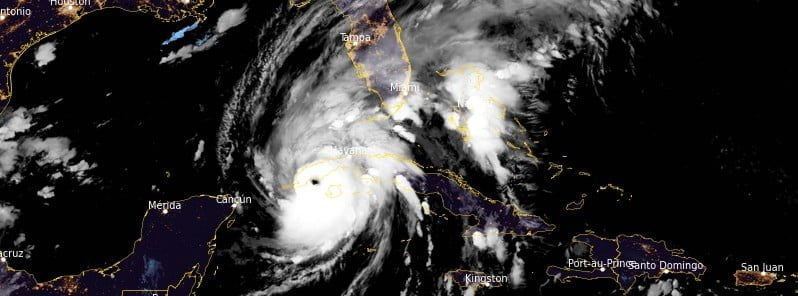
Featured image: Hurricane "Ian" at 07:50 UTC on September 27, 2022. Credit: NOAA/GOES-East, RAMMB/CIRA, The Watchers
Ian strengthened into a major hurricane (Category 3) at 06:30 UTC on September 27, 2022, just 2 hours before making landfall in western Cuba. Significant wind and storm surge are occurring over the region.
- Life-threatening storm surge, hurricane-force winds, flash floods and possible mudslides are expected in portions of western Cuba today, the National Hurricane Center (NHC) warns.
- Devastating wind damage is expected where the core of Ian moves across western Cuba this morning.
- There is a danger of life-threatening storm surge along much of the Florida west coast where a storm surge warning has been issued, with the highest risk from Fort Myers to the Tampa Bay region. Residents in these areas should listen to the advice given by local officials.
- Hurricane-force winds are expected in the hurricane warning area in west-central Florida beginning Wednesday morning with tropical storm conditions expected by late today.
- Heavy rainfall will spread across western Cuba through Tuesday. This will likely produce instances of flash flooding and possible mudslides in areas of higher terrain over western Cuba.
- Heavy rainfall will increase across the Florida Keys and South Florida Tuesday, spreading into central to northern Florida Wednesday and Thursday, and the Southeast by Friday and Saturday, likely causing flash, urban, and small stream flooding. Considerable flooding is expected across Central Florida into southern Georgia and coastal South Carolina, with significant, prolonged river flooding expected across central to northern Florida.
Satellite and radar data indicate that the center of Ian has made landfall just southwest of the town of La Coloma in the Pinar Del Rio Province of Cuba at 08:30 UTC on September 27.1
Maximum sustained winds at landfall were estimated to be 205 km/h (125 mph), making it a category 3 hurricane on the Saffir-Simpson Hurricane Wind Scale.
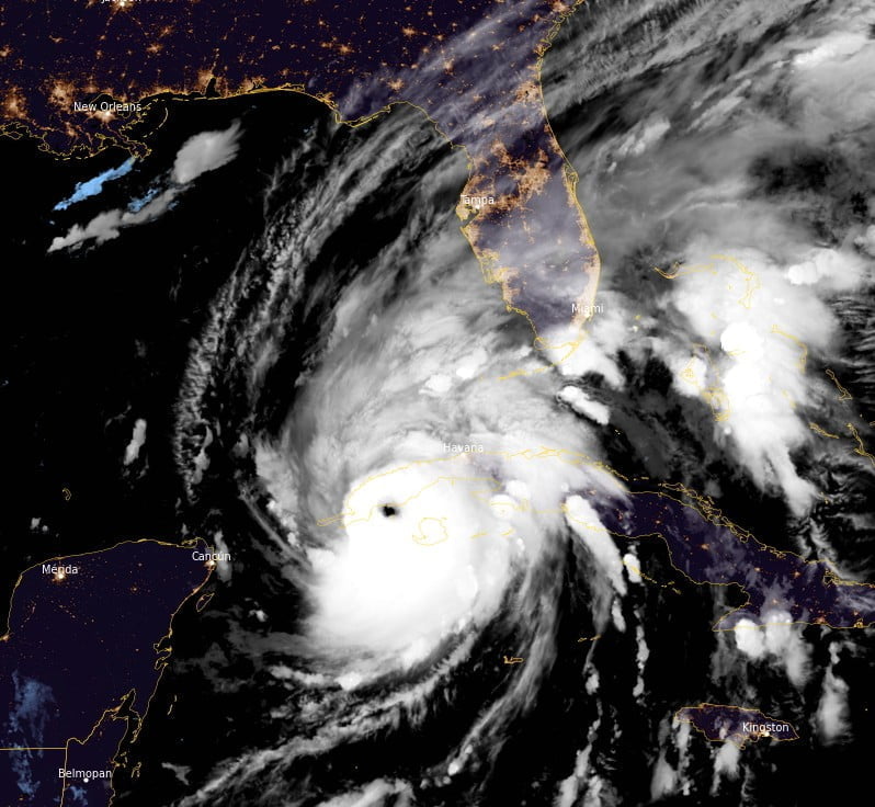
At 09:00 UTC, Ian’s center was located about 10 km (6 miles) S of the city of Pinar del Rio, Cuba, and 280 km (175 miles) SSW of the Dry Tortugas.2
It had maximum sustained winds of 205 km/h (125 mph) and a minimum central pressure of 952 hPa.
The system was moving N at 19 km/h (12 mph).
A turn toward the north-northeast with a reduction in forward speed is forecast tonight and Wednesday.
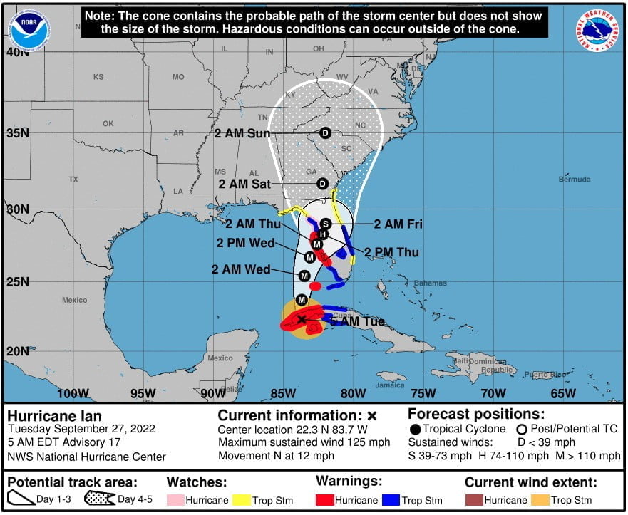
A Storm Surge Warning is in effect for Anclote River southward to Flamingo, Tampa Bay.
A Tropical Storm Warning is in effect for Cuban provinces of La Habana, Mayabeque, and Matanzas; Lower Florida Keys from Seven Mile Bridge westward to Key West; Flamingo to Bonita Beach; Suwannee River to the Anclote River; Volusia/Brevard County Line south to Jupiter Inlet; Lake Okeechobee.
A Storm Surge Watch is in effect for Florida Keys from the Card Sound Bridge westward to Key West; Dry Tortugas; Florida Bay; Aucilla River to Anclote River; Altamaha Sound to Flagler/Volusia County Line; Saint Johns River.
A Hurricane Watch is in effect for the areas north of Anclote River to the Suwannee River.
A Tropical Storm Watch is in effect for the areas north of the Suwannee River to Indian Pass; Altamaha Sound to Volusia/Brevard County line; Deerfield Beach to Jupiter Inlet
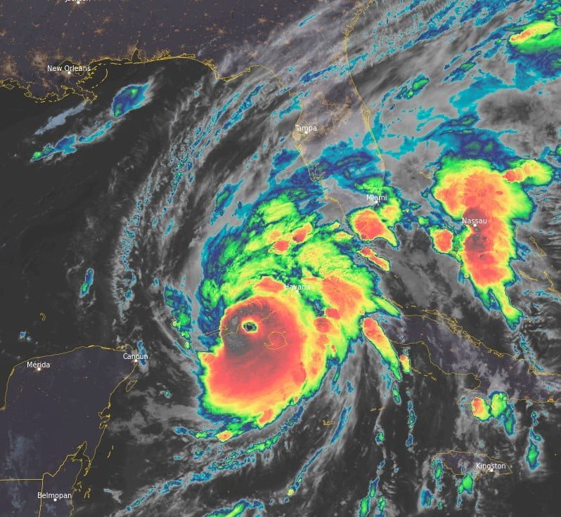
On the forecast track, the center of Ian is expected to move over western Cuba during the next few hours.
It will then emerge over the southeastern Gulf of Mexico later this morning, pass west of the Florida Keys later today, and approach the west coast of Florida within the hurricane warning area on Wednesday, September 28, and Wednesday night.
Little change in strength is expected while Ian moves over Cuba.
Strengthening is expected later this morning after Ian emerges over the southeastern Gulf of Mexico.
Ian is forecast to approach the west coast of Florida as a major hurricane.
Update
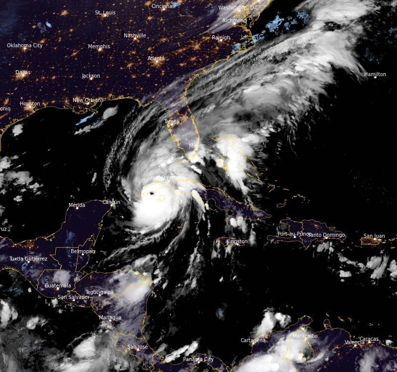
The system brought heavy rains, and significant wind and storm surge to the region, knocking down electricity to 1 million people. Soon after that, the entire electrical grid collapsed.3
Major damage to buildings and infrastructure, agriculture, and telecommunication was reported in Pinar del Rio.
The Provincial Defence Council confirmed two deaths due to collapsing buildings.
For the city of Pinar del Rio, the capital of Pinar del Rio Province, this was the strongest storm in 30 years. The city was in the eye of the hurricane for about 90 minutes.
References:
1 Hurricane Ian Tropical Cyclone Update – NWS National Hurricane Center Miami FL – 430 AM EDT Tue Sep 27 2022
2 Hurricane Ian Advisory Number 17 – NWS National Hurricane Center Miami FL – 500 AM EDT Tue Sep 27 2022
3 Cuba’s electrical grid collapses after Hurricane “Ian” – The Watchers – September 28, 2022
I'm a dedicated researcher, journalist, and editor at The Watchers. With over 20 years of experience in the media industry, I specialize in hard science news, focusing on extreme weather, seismic and volcanic activity, space weather, and astronomy, including near-Earth objects and planetary defense strategies. You can reach me at teo /at/ watchers.news.
Commenting rules and guidelines
We value the thoughts and opinions of our readers and welcome healthy discussions on our website. In order to maintain a respectful and positive community, we ask that all commenters follow these rules.