Tornadoes touch down near Bridgewater, Wall Lake, and Centerville, South Dakota
At least three tornadoes were reported across McCook, Minnehaha, and Lincoln counties in southeastern South Dakota on May 31, 2026.

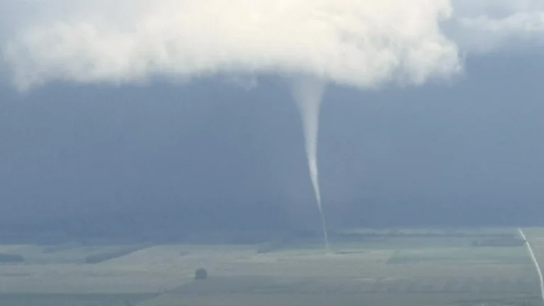
At least three tornadoes were reported across McCook, Minnehaha, and Lincoln counties in southeastern South Dakota on May 31, 2026.

An IF2 tornado damaged at least 18 structures, including 11 residential buildings, near the village of Balcarzowice in Opole Voivodeship, Poland, on May 30, 2026. Two homes were completely destroyed.

A rare dust storm accompanied by winds of up to 148 km/h (92 mph) struck Harbin, Heilongjiang Province, at around 17:00 LT on May 31, causing widespread damage, reducing visibility to less than 100 m (328 feet), and disrupting transportation and public events across the city. The same atmospheric setup also produced a tornado in Changling County, Jilin Province, as a broader outbreak of severe weather affected parts of Northeast China.
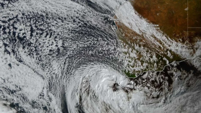
A rapidly deepening low-pressure system southwest of Western Australia is bringing damaging to destructive winds, severe thunderstorms, heavy rainfall, and coastal hazards to broad areas of the state’s southwest on Sunday, May 31, 2026. Wind gusts of up to 130 km/h (81 mph) are possible southwest of a line from Lancelin to Albany, including the Perth metropolitan area, while dangerous surf, coastal erosion, and inundation affect exposed sections of the coast.
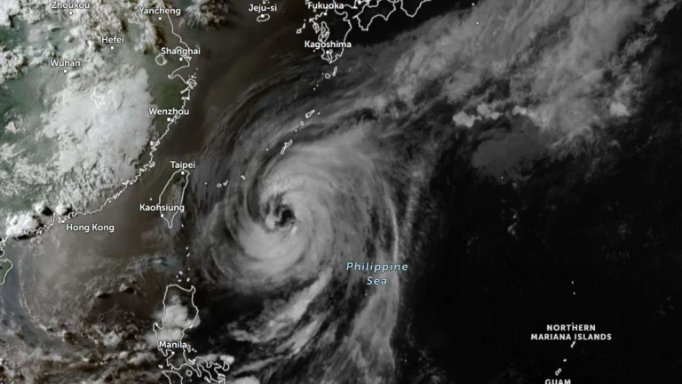
Typhoon Jangmi strengthened south of Okinawa on May 31, 2026, and is forecast to bring heavy rainfall to parts of Taiwan and southern Japan through June 3, prompting nearly 300 flight cancellations in Japan and warnings for hazardous seas, strong winds, flooding, and landslides in multiple regions.

Historic rainfall affected much of Yucatán on May 29, 2026, with Mérida setting a new all-time May rainfall record after 154 mm (6.1 inches) fell in 24 hours. Floodwaters inundated roads, stranded hundreds of vehicles, and caused significant disruptions across the city and surrounding areas.
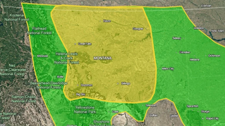
A storm system moving from the Great Basin into the Northern Rockies is expected to bring widespread rain, flooding concerns, and severe thunderstorms across multiple U.S. regions through June 1, 2026. The highest rainfall threat is forecast across portions of Montana on May 30, 2026, while severe storms capable of producing damaging winds and large hail are expected across parts of Nebraska and South Dakota.
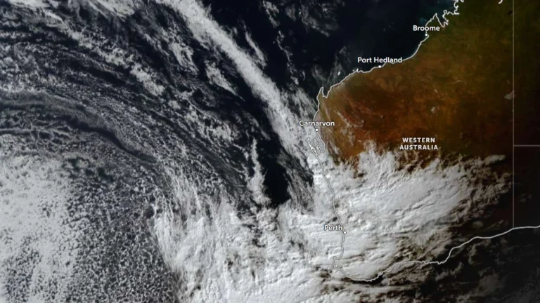
A Severe Weather Warning remains in effect across a large part of Western Australia as an unusually deep low-pressure system approaches the southwest coast, bringing the threat of damaging to destructive wind gusts, severe thunderstorms, heavy rainfall, isolated tornadoes and very large waves through Monday.
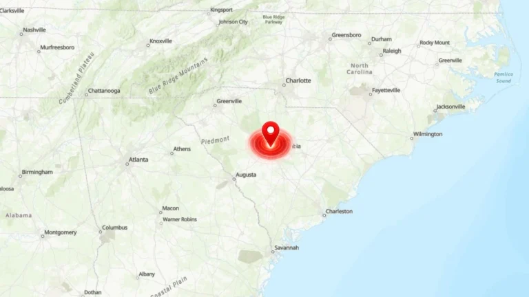
Residents across the South Carolina Midlands reported a loud boom and brief shaking late Thursday afternoon, May 28, 2026. The U.S. Geological Survey (USGS) later logged the event as an ‘M0.0 sonic boom’ near Saint Andrews, South Carolina.
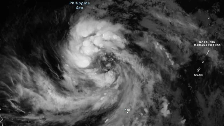
Tropical Storm Jangmi was located 1 245 km (774 miles) east of southeastern Luzon at 17:00 LT (09:00 UTC) on May 28, 2026 with PAGASA and JTWC forecasting continued intensification over the Philippine Sea during the next several days.
