
Subtropical Storm Karen forms in North Atlantic
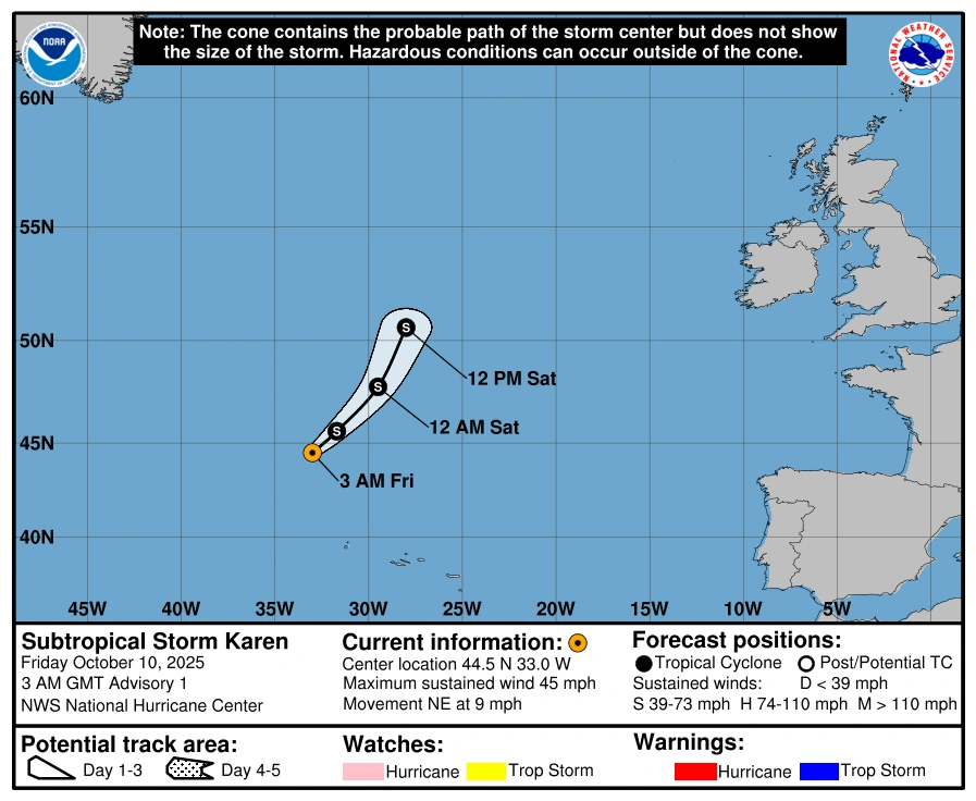
Subtropical Storm Karen formed in the North Atlantic on October 10, 2025. and was named by the National Hurricane Center (NHC) at 03:00 UTC. The system is expected to weaken and make its post-tropical transition in the next two days.
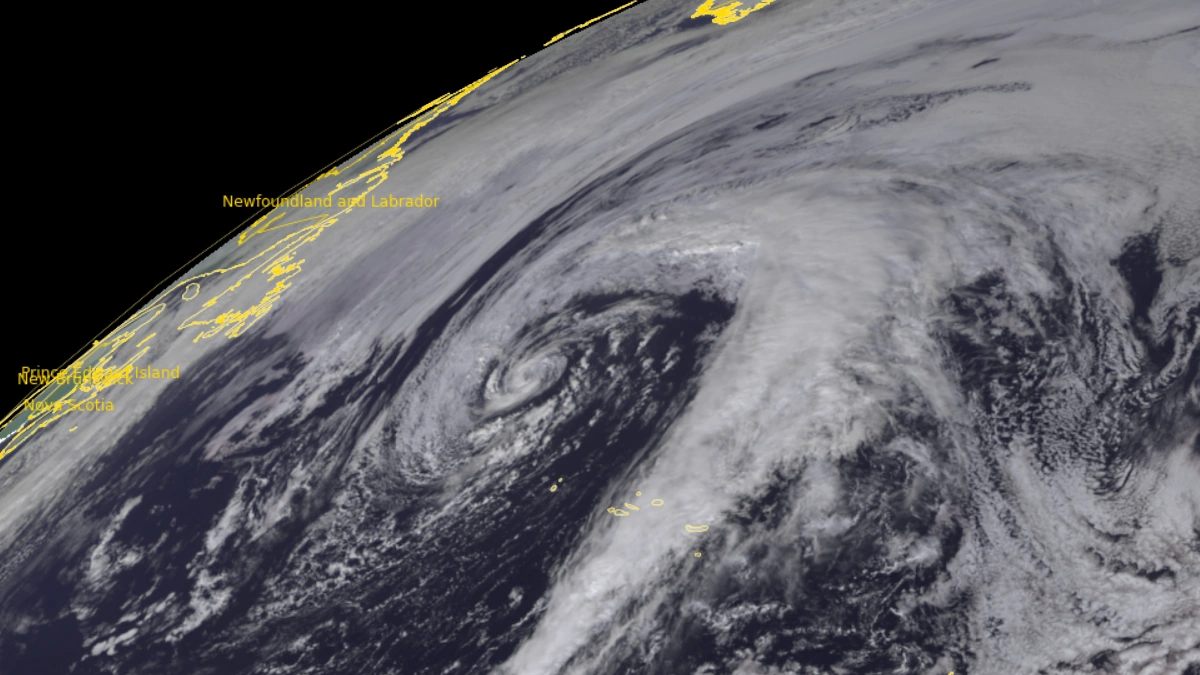
Satellite image of Tropical Storm Karen at 13:45 UTC on October 10, 2025. Credit EUMESAT/Meteosat-10, RAMMB/CIRA, The Watchers
Subtropical Storm Karen formed as the 11th named storm of the 2025 Atlantic hurricane season on October 10 in the far North Atlantic Ocean. As of 09:00 UTC, the center of Karen was located approximately 915 km (570 miles) north-northwest of the Azores.
Maximum sustained winds (averaged over 1-minute) reached 75 km/h (45 mph) and higher gusts. The storm was moving northeast at 15 km/h (9 mph) with an estimated minimum central pressure of 998 hPa. Winds of 60 km/h (40 mph) extend outward up to 95 km (60 miles) from the center.
According to the National Hurricane Center (NHC), little change in strength is expected during the next day or so. The system is forecast to gradually accelerate northeastward and open into a trough by the weekend.
Karen is currently sustained by its position within a large upper-level low, which has kept wind shear low and allowed thunderstorms to cluster near the center. The very cold air aloft is enhancing convection, producing strong, tall cloud tops around -50°C (- 58°F).
However, Karen is moving over colder waters and will soon be overtaken by another mid-latitude weather system, cutting off its energy source.
As a result, models predict that within about 48 hours of formation, Karen will lose its organized structure and likely transition into a post-tropical or open trough system, consistent with overall intensity forecasts.
No coastal watches or warnings are in effect, and there are currently no hazards affecting land.
A subtropical storm is a hybrid weather system that exhibits both tropical and extratropical characteristics. Unlike tropical storms, which derive nearly all their energy from warm ocean waters and feature a compact, symmetric core of deep convection, subtropical storms form over cooler or transitional waters and draw energy partly from atmospheric temperature contrasts.
Their strongest winds typically occur farther from the center, and convection is less organized. These systems often originate along upper-level troughs or decaying frontal boundaries, and may later evolve into fully tropical storms if sea surface temperatures and atmospheric conditions become more favorable.
References:
1 Subtropical Storm Karen Advisory Number 2 – NWS/NHC – October 10, 2025

I am an Assistant Editor and Severe Weather & Science Journalist at The Watchers, specializing in real-time severe weather coverage, geophysical event reporting, and research-driven scientific analysis. You can reach me at rishav(at)watchers(.)news.
Commenting rules and guidelines
We value the thoughts and opinions of our readers and welcome healthy discussions on our website. In order to maintain a respectful and positive community, we ask that all commenters follow these rules.