
Major eruption at Lewotobi Laki-laki ejects ash up to 19.2 km (63 000 feet) a.s.l., Indonesia
A major eruption took place at Lewotobi Laki-laki volcano in Indonesia’s East Flores Regency at 17:05 UTC on August 1, 2025, ejecting ash up to 19.2 km (63 000 feet) above sea level. The Aviation Color Code is at Red and the Alert Level at IV (the highest).

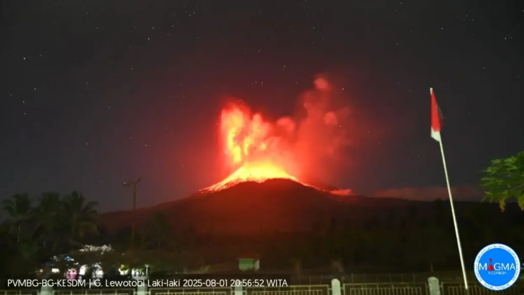
Lewotobi Laki-laki eruption on August 1, 2025. Credit: PVBGM
After three weeks of relative calm, a major explosive eruption started at Lewotobi around 12:48 UTC on August 1, ejecting ash up to 11.2 km (37 000 feet) above sea level (a.s.l.).
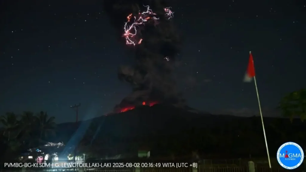
Ash cloud dispersed radially and was accompanied by visible volcanic lightning and lava emissions. The eruption was preceded by a sharp increase in seismic activity from 11:00 to 13:00 UTC, with instruments detecting upward magma migration and a buildup of volcanic gases over the preceding two weeks.
Ballistic ejecta reached distances of 3–4 km (1.8–2.5 miles) from the crater, according to the Center for Volcanology and Geological Hazard Mitigation (PVMBG).
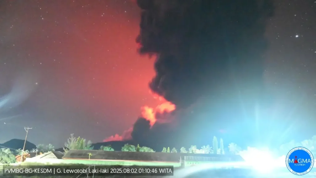
The explosion was followed by another, more powerful eruption at 17:05 UTC, with ash rising to an estimated 19.2 km (63 000 feet) a.s.l. Both eruptions ejected volcanic ash radially from the summit. Heights are based on ground reports and satellite IR temperature.
The Aviation Color Code remains at Red and the Alert Level at IV (Awas) — the highest.
Residents and tourists were advised to avoid a 6 km (3.7 miles) exclusion zone around the summit, and up to 7 km (4.3 miles) in the southwest–northeast sector.
Authorities issued lahar warnings for river valleys originating at the volcano, including Nawakote, Dulipali, Nobo, Hokeng Jaya, and Nurabelen, particularly in the event of heavy rainfall. Mask use was recommended for residents affected by ashfall to protect respiratory health.

No casualties or aviation disruptions were reported at the time of writing.
PVMBG said the event is a continuation of heightened activity at Lewotobi Laki-Laki, which has shown eruptive phases since early 2024.
The eruption follows multiple events in June and July 2025, some of which ejected ash plumes up to 18 km (59 000 feet) a.s.l. — causing significant disruptions across the region, including airport closures.
I'm a dedicated researcher, journalist, and editor at The Watchers. With over 20 years of experience in the media industry, I specialize in hard science news, focusing on extreme weather, seismic and volcanic activity, space weather, and astronomy, including near-Earth objects and planetary defense strategies. You can reach me at teo /at/ watchers.news.
Commenting rules and guidelines
We value the thoughts and opinions of our readers and welcome healthy discussions on our website. In order to maintain a respectful and positive community, we ask that all commenters follow these rules.