
Extreme heat wave places over 90 million under alerts across Mid-Mississippi Valley and Mid-South, U.S.
NOAA issued extreme heat alerts for over 90 million people across the Mid-Mississippi Valley and Mid-South, as a prolonged, dangerous heat wave continues across central and southeastern United States.
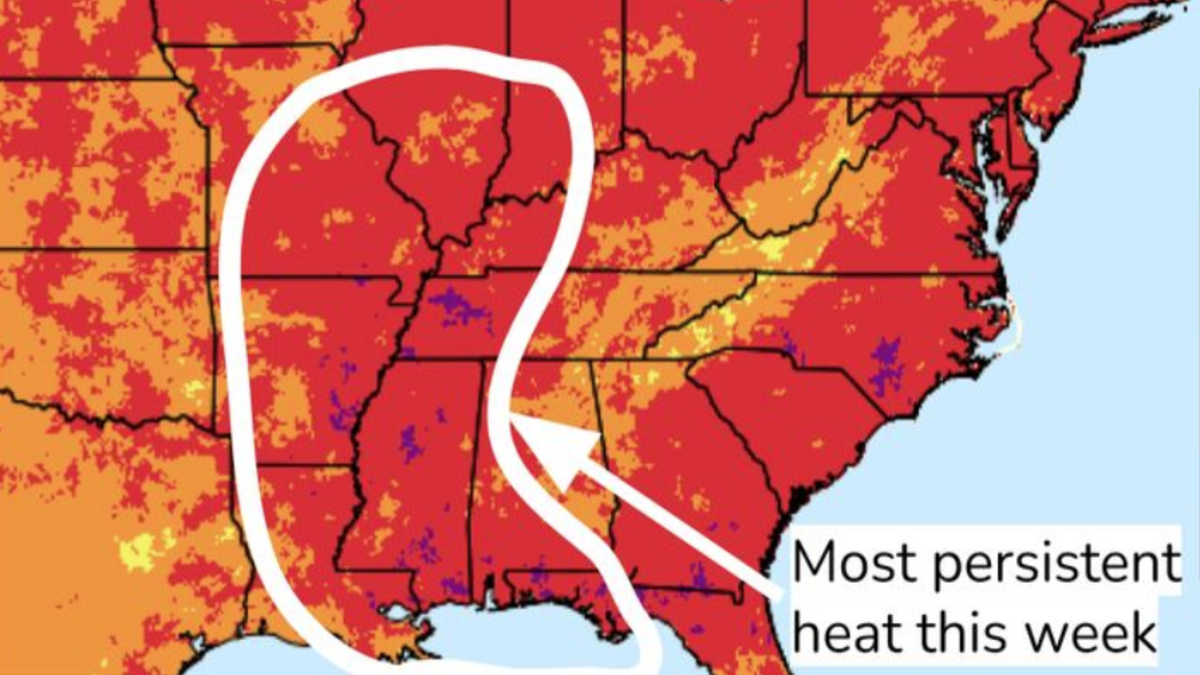
Image credit: NWS
National Oceanic and Atmospheric Administration (NOAA) issued extreme heat alerts for over 90 million people across the Mid-Mississippi Valley and Mid-South, as a prolonged, dangerous heat wave continues across central and southeastern United States.
A large and persistent upper-level ridge, commonly referred to as a heat dome, remains anchored over the region, trapping hot and humid air. This synoptic setup is producing widespread heat index values exceeding 43°C (110°F), with localized values reaching up to 46°C (115°F).
The greatest impacts are expected from July 22–24, particularly across Arkansas, Mississippi, Tennessee, and surrounding states.
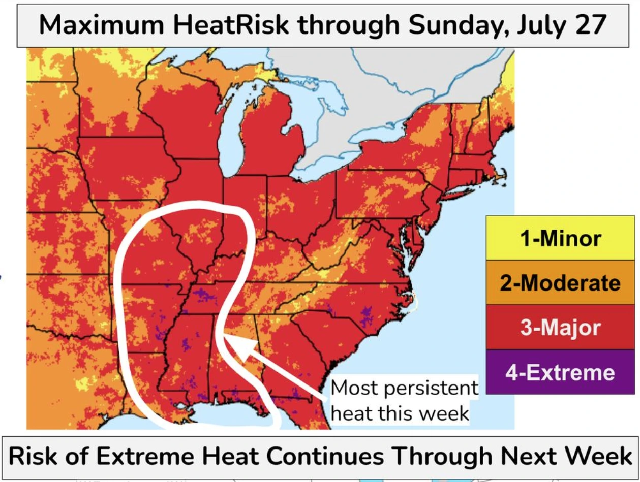
According to the National Weather Service (NWS), this heat wave will be most persistent and hazardous from the Lower Mississippi Valley through the Mid-South.
The Weather Prediction Center (WPC) has categorized the event as carrying a Major to Extreme HeatRisk, indicating a high probability of adverse health outcomes without adequate cooling or hydration.
HeatRisk Level 3 (Major) and Level 4 (Extreme) are forecast across much of the central U.S., especially the Mid-Mississippi Valley. The combination of high temperatures and elevated humidity levels is particularly dangerous due to limited overnight relief.
Minimum nighttime temperatures are expected to remain between 24°C–28°C (75–82°F), breaking numerous high-minimum temperature records and significantly increasing heat stress on exposed individuals.
Contributing to the intensity of the event is widespread evapotranspiration from maturing corn crops across the Midwest. This phenomenon, known as corn sweat, releases large volumes of moisture into the atmosphere, further elevating dew points and amplifying heat index values.
This effect is particularly notable across Missouri, Iowa, Illinois, and parts of Wisconsin, where dew points in the upper 20s °C (mid- to upper-70s °F) are forecast to persist throughout the week.
The Climate Prediction Center indicates that the high risk of extreme heat will continue through at least July 29.
A greater than 60% probability of Level 4 HeatRisk extends across the Mid-South and Lower Mississippi Valley into the Southern Plains. Moderate risk, defined as a 40–60% chance of significant heat impacts, covers a broad region from the Central Plains to the Mid-Atlantic through the remainder of July.

“We should experience some slight relief from the heat and humidity this weekend, before temperatures and humidity build back on Monday and Tuesday,” WPC meteorologists said.

I’m a science journalist and researcher at The Watchers, contributing to the Epicenter edition, where I cover peer-reviewed scientific research and emerging discoveries across Earth and space sciences. With a background in astronomy and a passion for environmental science, I’ve worked in shark and coral conservation in Fiji, conducting reef and shark-behavior research, contributing to mangrove restoration, and earning PADI Open Water and Coral Reef Certifications. I bring a blend of scientific rigor and storytelling to illuminate the discoveries shaping our planet and beyond.
Commenting rules and guidelines
We value the thoughts and opinions of our readers and welcome healthy discussions on our website. In order to maintain a respectful and positive community, we ask that all commenters follow these rules.