
6 rescued after mudslides trap vehicles in San Jacinto, California
At least 6 people were rescued on Thursday, March 13, 2025, after mudslides trapped multiple vehicles in San Jacinto City, California’s Riverside County, following two days of heavy rain.
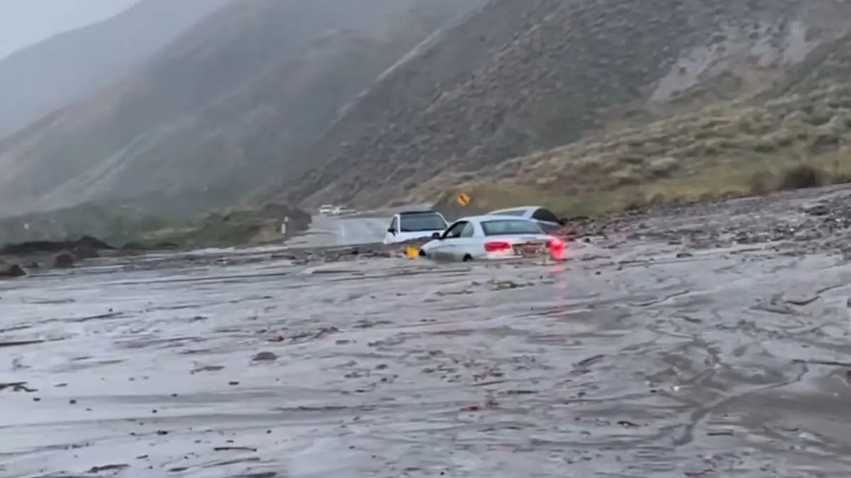
Vehicles stuck in San Jacinto in California’s Riverside County Thursday, March 13, 2025. Image credit: CalFire/Riverside County Fire Department
Heavy rainfall triggered mudslides that covered part of a roadway and trapped multiple vehicles in San Jacinto, Riverside County on Thursday, March 13. According to the county’s fire department, at least six people were rescued, evaluated by paramedics, and released.
Soboba Road will be closed between Chabela Drive and State/Gilman Springs Road, while road crews work to clear the mudflow and vehicles from the roadway.
The storm also produced a short-lived EF-0 tornado in Pico Rivera, southeast of Los Angeles, that uprooted trees and damaged homes.
Parts of Los Angeles, Ventura, and Orange counties were under flash flood warnings early Thursday. Although the heaviest rainfall in Southern California subsided by the afternoon, the risk of mudslides remains.
The rains were brought by an atmospheric river making landfall late Tuesday, March 11.
According to the Center for Western Weather and Water Extremes (CW3E), another atmospheric river (AR) is forecast to make landfall along the Oregon and Northern California coasts early on March 15 and continue through March 17.
The event will bring two pulses of integrated vapor transport (IVT), with the second and stronger pulse being driven by a shortwave trough and a surface low-pressure system. The AR is expected to reach AR 1–3 conditions on the Ralph et al. 2019 AR Scale, leading to significant precipitation and rising river levels.
The National Weather Service (NWS) Weather Prediction Center (WPC) anticipates 75–180 mm (3–7 inches) of precipitation over the Oregon Cascades, Oregon and Northern California Coast Ranges, and the Klamath Mountains.
Freezing levels are expected to rise in the Oregon Cascades and Klamath Mountains but remain low in the Washington Cascades. This will result in snowfall accumulation of 30–60 cm (12–24 inches) in the Oregon and Washington Cascades and 15–30 cm (6–12 inches) in the Klamath Mountains, primarily during the initial IVT pulse on March 15–16.
The NWS WPC has issued a marginal risk Excessive Rainfall Outlook (ERO) (level 1 of 4, 5% chance of flooding) for Western Oregon, the California Coast Ranges, the Klamath Mountains, and the Northern Sierra Nevada.
The Northwest River Forecast Center projects that five river stations in Oregon will exceed minor flood stage, while 12 stations across Washington and Oregon will surpass the action or bankfull stage between March 16–18.
References:
1 AR Outlook – CW3E – March 13, 2025

I am an Assistant Editor and Severe Weather & Science Journalist at The Watchers, specializing in real-time severe weather coverage, geophysical event reporting, and research-driven scientific analysis. You can reach me at rishav(at)watchers(.)news.
Commenting rules and guidelines
We value the thoughts and opinions of our readers and welcome healthy discussions on our website. In order to maintain a respectful and positive community, we ask that all commenters follow these rules.