
Atmospheric river forecast to stall as US West Coast braces for back-to-back ARs
Two atmospheric rivers (ARs) are forecast to bring significant rain to the U.S. West Coast on January 30 and 31, 2025, with the potential for heavy precipitation as a second AR overtakes the first and stalls into early next week.
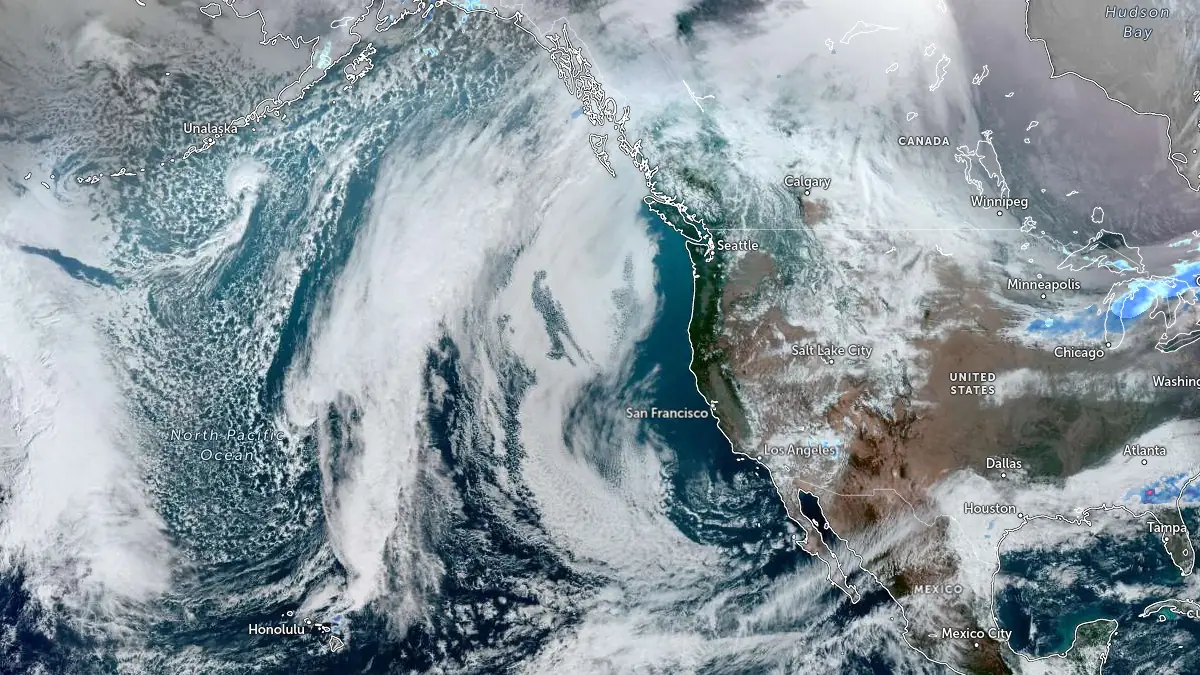
Satellite image acquired at 21:20 UTC on January 27, 2025. Credit: NOAA/GOES-West, Zoom Earth, The Watchers
- Back-to-back atmospheric rivers expected to impact the US West Coast from January 30, with one system potentially stalling and intensifying flood risks.
- CW3E warns of multiple tropical moisture exports (TMEs) fueling consecutive ARs, bringing prolonged rainfall to California and Oregon from January 30 to early February.
- Second AR may overtake the first and stall over the West Coast into early next week, increasing heavy precipitation and flood risks through early February.
The Center for Western Weather and Water Extremes (CW3E) at the Scripps Institution of Oceanography forecasts multiple tropical moisture exports (TMEs) developing over the Northeast Pacific this week, leading to landfalling atmospheric river (AR) activity along the US West Coast.
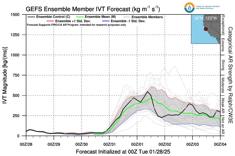
According to CW3E, the first AR is expected to bring weak AR conditions—with integrated vapor transport (IVT) values below 500 kg m⁻¹ s⁻¹ — to Oregon and Northern California from late Thursday, January 30, into Friday, January 31.
Following this initial landfall, a second AR is projected to overtake the first and could potentially stall over the region into early next week, significantly increasing the risk of heavy precipitation, flooding, and hydrologic impacts.

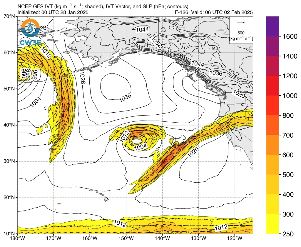
Ensemble and deterministic models show considerable uncertainty regarding the evolution of these ARs and the associated precipitation after the initial landfall.
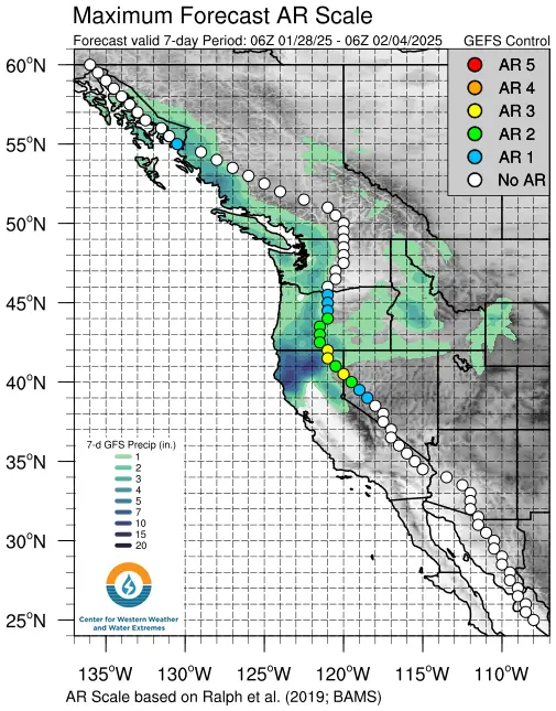
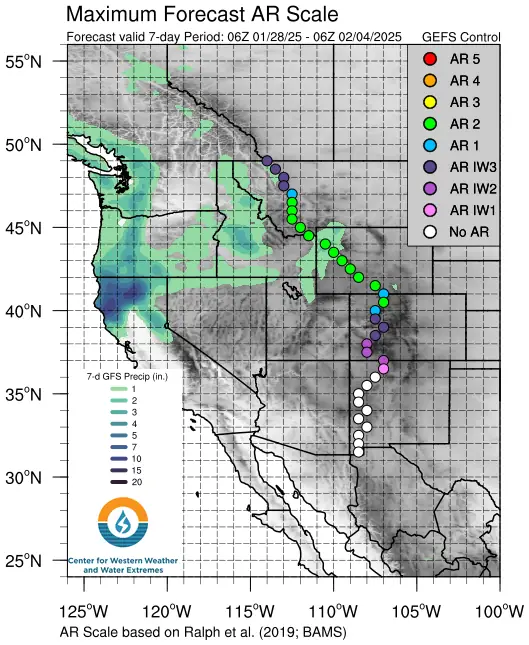
The EPS indicates a higher likelihood of landfalling AR activity continuing into early next week compared to the GEFS. The EPS control run predicts an AR 3 in Northern California (based on the Ralph et al. 2019 AR Scale), while the GEFS control forecasts an AR 1.
Compared to the deterministic GFS, the deterministic ECMWF predicts stronger moisture transport over Oregon and Northern California following the initial AR landfall, as well as a more northerly track for the second AR.
Overall, the EPS forecasts higher precipitation totals across western Oregon and Northern California over the next 10 days compared to the GEFS. The deterministic ECMWF predicts less than 254 mm (10 inches) of total precipitation near the Oregon/California border through the middle of next week.
An atmospheric river (AR) is a narrow, elongated corridor of concentrated moisture in the atmosphere that transports large amounts of water vapor from tropical or subtropical regions toward higher latitudes. These systems can stretch for thousands of kilometers and are typically a few hundred kilometers wide.
When an atmospheric river makes landfall, it releases moisture in the form of heavy precipitation, often causing intense rainfall or snowfall, particularly along coastal and mountainous regions.
One of the most well-known types of atmospheric rivers is the “Pineapple Express,” which transports warm, moisture-laden air from the tropical Pacific near Hawaii to the US West Coast.
While ARs are crucial for replenishing water supplies in regions like California, they can also lead to extreme weather events, including flooding, landslides, and strong winds, especially when they stall over a region or interact with existing weather systems.
The intensity of an atmospheric river is often measured using integrated vapor transport (IVT), which quantifies the total amount of water vapor moving through the atmosphere in a given area.
Update
21:00 UTC on January 29
Since the previous forecast, confidence in the intensity of the incoming atmospheric river (AR) event has increased significantly and CW3E now warns that this AR is likely to reach AR 4 or greater along the California coast from Santa Cruz to Mendocino Counties.
Forecast models indicate the potential for more than 250 mm (10 inches) of rainfall in parts of Northern California, including the Coast Ranges and Sierra Nevada, increasing the risk of flooding.
The Weather Prediction Center (WPC) has identified this as the most significant weather event in the United States for the forecast period of February 1 – 5.
References:
1 CW3E AR Update – CW3E – January 27, 2025

I am an Assistant Editor and Severe Weather & Science Journalist at The Watchers, specializing in real-time severe weather coverage, geophysical event reporting, and research-driven scientific analysis. You can reach me at rishav(at)watchers(.)news.
Commenting rules and guidelines
We value the thoughts and opinions of our readers and welcome healthy discussions on our website. In order to maintain a respectful and positive community, we ask that all commenters follow these rules.