
Major atmospheric river to impact California coast this weekend
Forecast confidence in a high-impact atmospheric river (AR) event has steadily increased since January 27, 2025, and CW3E is now warning about a major AR event expected to begin this Friday, January 31 along the U.S. West Coast, and potentially continue into early next week. The most recent forecast from the NCEP Global Ensemble Forecast System (GEFS) is showing >50% probability of an AR 4 or greater over along the California coast between Santa Cruz and Mendocino Counties.
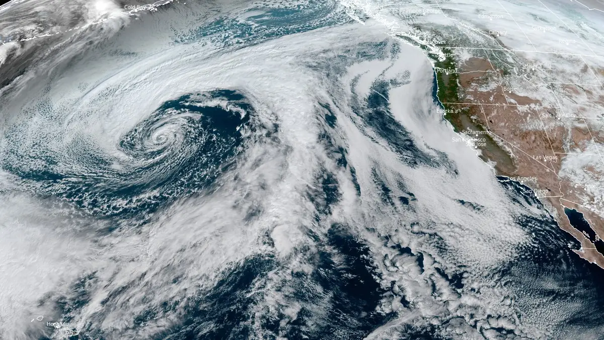
Image credit: NOAA/GOES-West, RAMMB/CIRA, The Watchers. Acquired at 20:00 UTC on January 29, 2025
- A major AR is expected to begin on February 2, with a high probability of AR 4 or greater conditions along the California coast from Santa Cruz to Mendocino Counties, according to CW3E.
- Forecast models indicate the potential for more than 250 mm (10 inches) of total precipitation over the next seven days in Northern California, including the Coast Ranges and Sierra Nevada. A stronger pulse of AR conditions on February 3 could lead to hydrologic impacts, including flooding.
- The GFS model suggests the heaviest precipitation could fall over the Northern and Central Sierra Nevada, while the ECMWF model forecasts it over the Northern California Coast Ranges, Klamath Mountains, and southern Cascades.
The Center for Western Weather and Water Extremes (CW3E) is warning about a major atmospheric river (AR) event expected to begin on Friday, February 2, bringing heavy precipitation to California.
This prolonged atmospheric river is now the most significant weather event in the United States for the forecast period of February 1–5, according to the Weather Prediction Center’s Extended Forecast Discussion issued on January 29.
Forecast models indicate a high probability of AR 4 (on a scale of 1 – 5) or greater conditions along the coast between Santa Cruz and Mendocino Counties. Rainfall totals could exceed 250 mm (10 inches) in parts of Northern California, including the Coast Ranges and Sierra Nevada, raising concerns about potential flooding.
The initial landfall of the AR system is expected on the night of February 1, bringing light to moderate precipitation to western Washington, Oregon, and Northern California.
A second and much stronger pulse is forecast to arrive on February 3, significantly increasing rainfall and the potential for hydrologic impacts. The Weather Prediction Center (WPC) has already identified a slight risk of rainfall exceeding flash flood guidance in Del Norte, Humboldt, and Mendocino Counties from February 3 into early February 4.
Forecast models from the National Centers for Environmental Prediction (NCEP) and the European Centre for Medium-Range Weather Forecasts (ECMWF) show some uncertainty regarding the AR’s trajectory beyond February 2.
The GFS model suggests heavier precipitation over the Northern and Central Sierra Nevada, while the ECMWF model predicts the heaviest rainfall over the Northern California Coast Ranges, Klamath Mountains, and southern Cascades.
Residents in affected areas are advised to monitor National Weather Service (NWS) forecasts, watches, and warnings.
Read our previous article about this event:
References:
1 Major Atmospheric River Event Likely This Weekend – CW3E – Released at 19:24 UTC on January 29, 2025
I'm a dedicated researcher, journalist, and editor at The Watchers. With over 20 years of experience in the media industry, I specialize in hard science news, focusing on extreme weather, seismic and volcanic activity, space weather, and astronomy, including near-Earth objects and planetary defense strategies. You can reach me at teo /at/ watchers.news.
Commenting rules and guidelines
We value the thoughts and opinions of our readers and welcome healthy discussions on our website. In order to maintain a respectful and positive community, we ask that all commenters follow these rules.