
Taupō Volcano – Volcanic Alert Level raised to Level 1, New Zealand
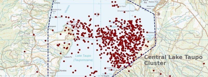
Image credit: GeoNet
The Volcanic Alert Level (VAL) for Taupō Volcano, New Zealand was raised to 1 (minor volcanic unrest) on September 20, 2022. The unrest is causing earthquakes and ground deformation at the volcano. The last eruption of this volcano took place in 260 CE.
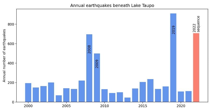
GNS Science, through the GeoNet program, reports an increase in earthquakes and deformation (ground movement) at Taupō since May 2022, indicating volcanic unrest is occurring.1
Volcanic unrest is when magma or magma-heated hot water and steam force their way through the ground beneath a volcano, producing earthquakes, ground movement, and changes in hydrothermal systems.
“The Volcanic Alert Level (VAL) change this week has been informed by our ongoing analysis of monitoring data, increased knowledge of Taupō Volcano from research programmes and new knowledge of causes of past unrest at Taupō Volcano,” said Steven Sherburn, GeoNet’s Duty Volcanologist.
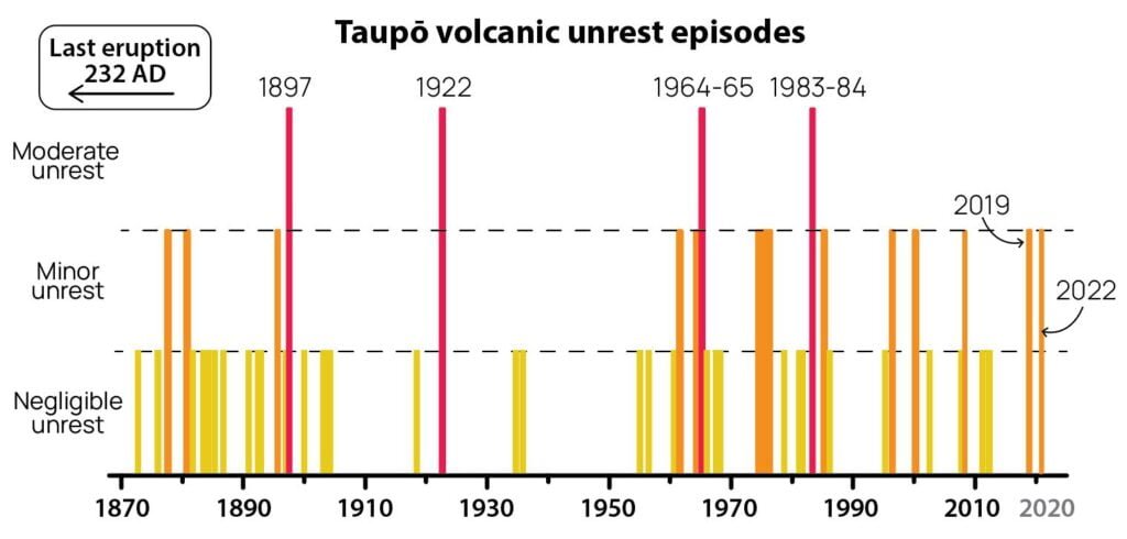
“Although this is the first time we have raised the VAL to 1, this is not the first volcanic unrest at Taupō,” Sherburn noted.
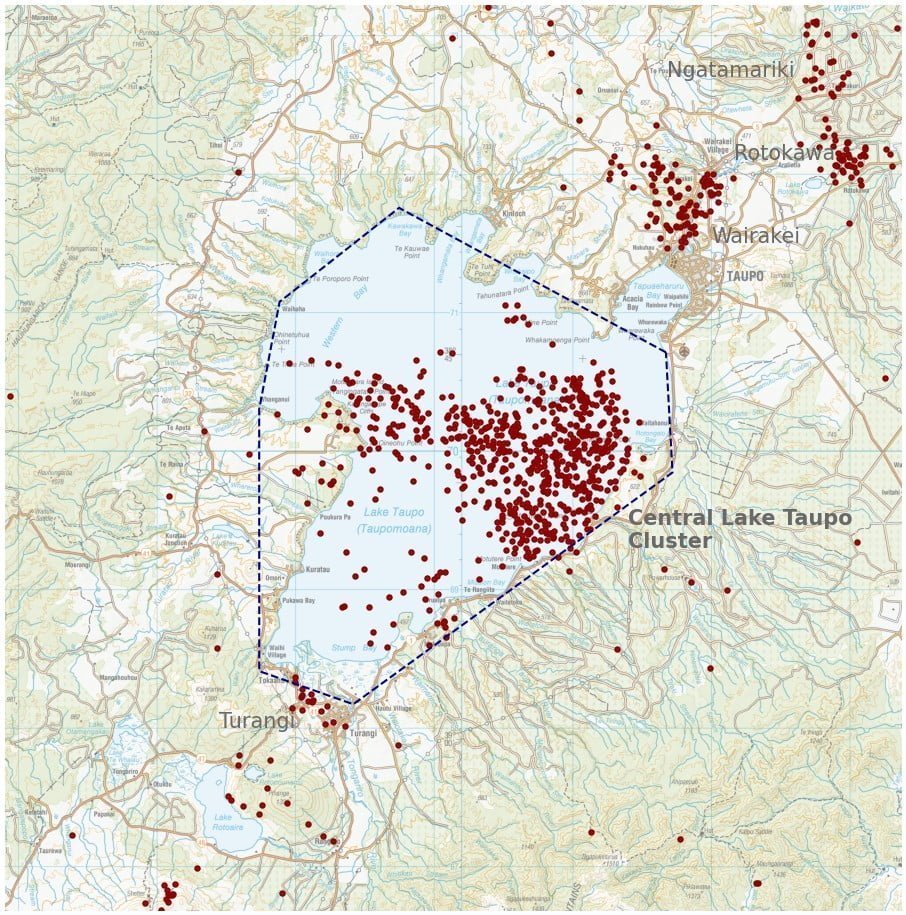
“There have been 17 previous episodes of unrest over the past 150 years. Several of these were more severe than what we are currently observing at Taupō. None of these episodes, or the many other episodes which would have occurred over the past 1 800 years before written records were kept, ended in an eruption. The last eruption at Taupō volcano was in 232 AD ± 10 years. The chance of an eruption at Taupō remains very low in any one year.”
The earthquakes and deformation could continue for the coming weeks or months.
While some of the earthquakes may be felt in areas around Lake Taupō, the deformation is currently only detectable by sensitive monitoring instruments. GNS Science continues to actively monitor the volcano.
Geological summary
Taupo, the most active rhyolitic volcano of the Taupo volcanic zone, is a large, roughly 35 km (21 miles) wide caldera with poorly defined margins. It is a type example of an “inverse volcano” that slopes inward toward the most recent vent location.
The caldera, now filled by Lake Taupo, largely formed as a result of the voluminous eruption of the Oruanui Tephra about 22 600 years before the present (BP).
This was the largest known eruption at Taupo, producing about 1 170 km3 (281 mi3) of tephra. This eruption was preceded during the late Pleistocene by the eruption of a large number of rhyolitic lava domes north of Lake Taupo.
Large explosive eruptions have occurred frequently during the Holocene from many vents within Lake Taupo and near its margins.
The most recent major eruption took place about 1 800 years BP from at least three vents along a NE-SW-trending fissure centered on the Horomotangi Reefs. This extremely violent eruption was New Zealand’s largest during the Holocene and produced the thin but widespread phreatoplinian Taupo Ignimbrite, which covered 20 000 km2 (7 722 mi2) of North Island.2
References:
1 Taupō Volcano: Volcanic Alert Level raised to Level 1. Ongoing earthquakes and deformation indicating minor volcanic unrest – GeoNet – September 19, 2022
2 Taupo – Geological summary – GVP
I'm a dedicated researcher, journalist, and editor at The Watchers. With over 20 years of experience in the media industry, I specialize in hard science news, focusing on extreme weather, seismic and volcanic activity, space weather, and astronomy, including near-Earth objects and planetary defense strategies. You can reach me at teo /at/ watchers.news.
Commenting rules and guidelines
We value the thoughts and opinions of our readers and welcome healthy discussions on our website. In order to maintain a respectful and positive community, we ask that all commenters follow these rules.