
Shallow M6.8 earthquake hits Easter Island region
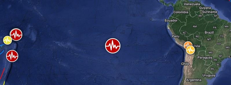
Image credit: TW/SAM, Google
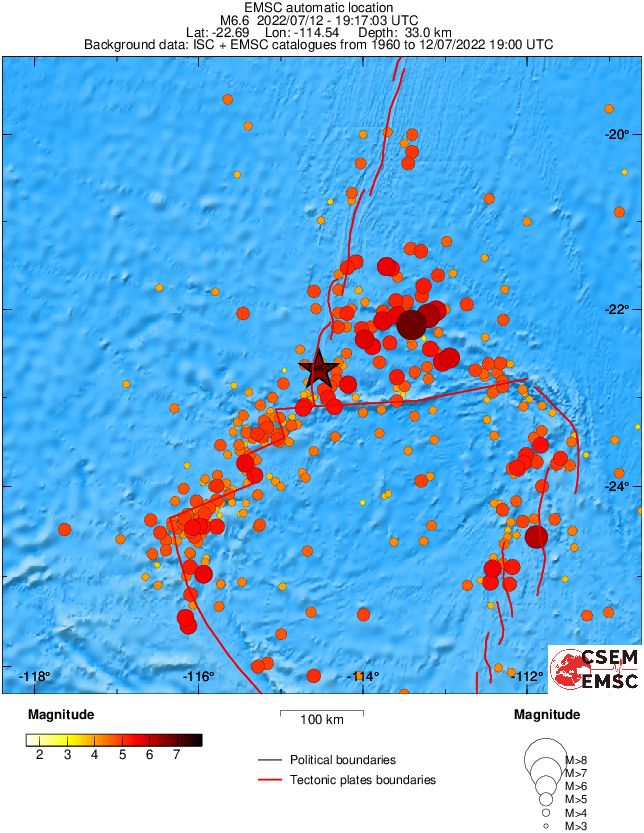
A strong and shallow earthquake registered by the USGS as M6.8 hit the Easter Island region at 19:17 UTC on July 12, 2022. The agency is reporting a depth of 10 km (6.2 miles). EMSC is reporting M6.6 at depth of 10 km (6.2 miles).
The epicenter was located about 698.2 km (433.8 miles) NW of Hanga Roa, Chile.
There are no people living within 100 km (62 miles).
The USGS issued a Green alert for shaking-related fatalities and economic losses. There is a low likelihood of casualties and damage.
Based on all available data, there is no tsunami threat from this earthquake, PTWC said.
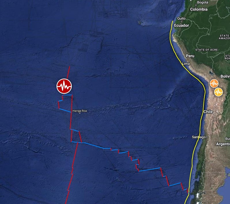
Regional seismicity
I'm a dedicated researcher, journalist, and editor at The Watchers. With over 20 years of experience in the media industry, I specialize in hard science news, focusing on extreme weather, seismic and volcanic activity, space weather, and astronomy, including near-Earth objects and planetary defense strategies. You can reach me at teo /at/ watchers.news.
Commenting rules and guidelines
We value the thoughts and opinions of our readers and welcome healthy discussions on our website. In order to maintain a respectful and positive community, we ask that all commenters follow these rules.