
Shallow M6.9 earthquake hits southeast of Easter Island
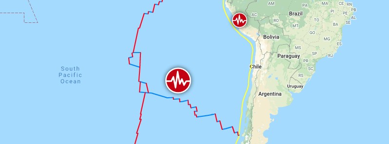
Image credit: TW/SAM, Google
A very strong earthquake registered by the USGS as M6.9 hit southeast of Easter Island, South Pacific Ocean at 05:23 UTC on February 3, 2021. The agency is reporting a depth of 10 km (6.2 miles). EMSC is reporting M6.6 at a depth of 15 km (9 miles).
The epicenter was located 1 480 km (920 miles) SE of Hanga Roa, Valparaiso, Chile and 2 160 km (1 345 miles) W of Lebu, Biobio, Chile.
There are no people living within 100 km (62 miles).
Based on all available data, there is no tsunami threat from this earthquake, PTWC said.
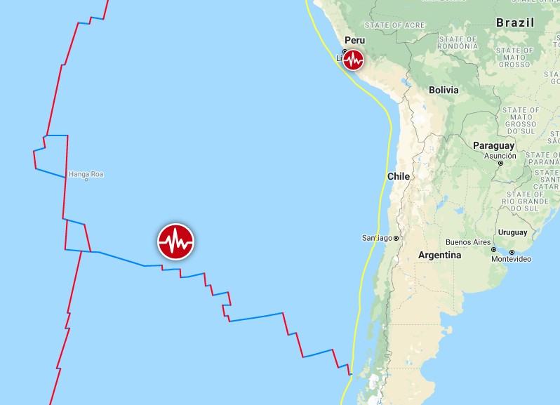
Image credit: TW/SAM, Google
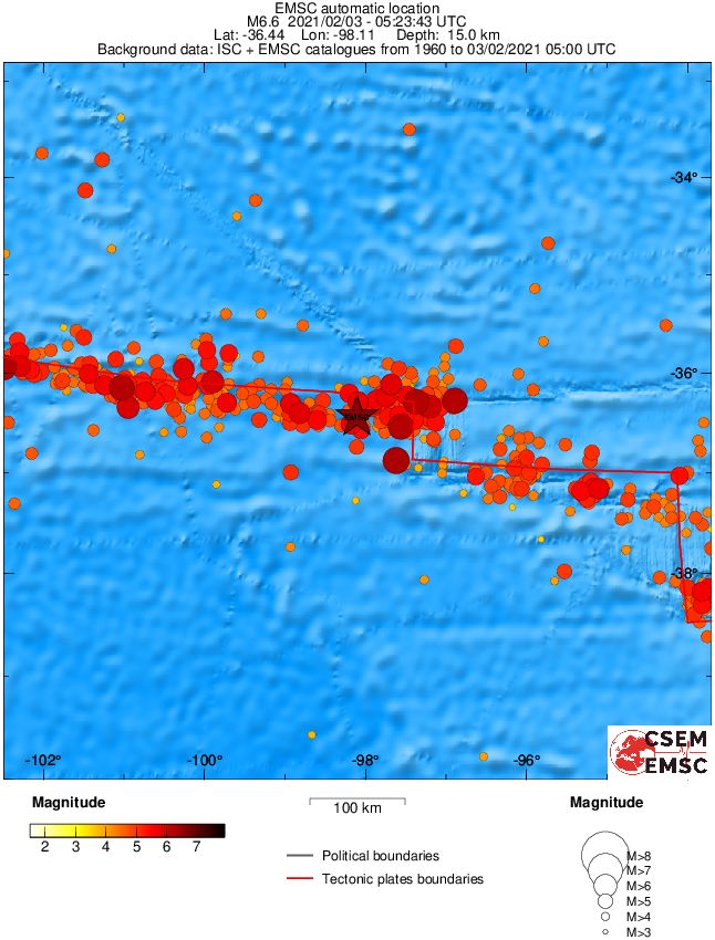
Regional seismicity
I'm a dedicated researcher, journalist, and editor at The Watchers. With over 20 years of experience in the media industry, I specialize in hard science news, focusing on extreme weather, seismic and volcanic activity, space weather, and astronomy, including near-Earth objects and planetary defense strategies. You can reach me at teo /at/ watchers.news.
You will understand why this happen this https://spaceweather.com/archive.php?view=1&day=03&month=02&year=2021 when you read https://astronomy.com/news/2020/07/powerful-eruptions-on-the-sun-might-trigger-earthquakes.