
Major M7.3 earthquake hits Flores Sea, Indonesia – 7 people injured, 346 homes damaged
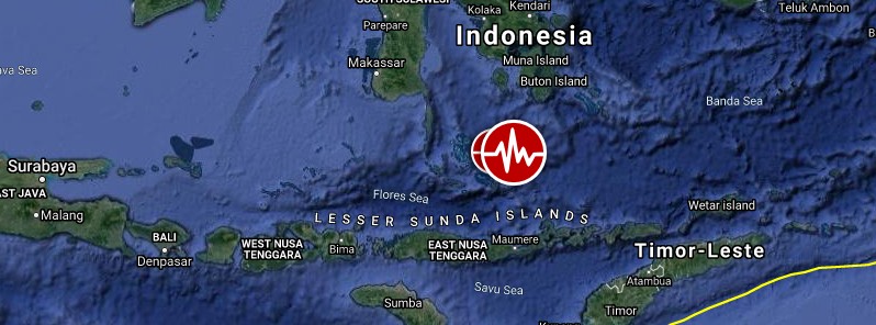
Image credit: TW/SAM, Google
A very strong and shallow earthquake registered by the USGS as M7.3 hit Flores Sea at 03:20 UTC on December 14, 2021. The agency is reporting a depth of 18 km (11 miles). EMSC is reporting M7.3 at a depth of 12 km (7 miles).
The epicenter was located about 113 km (70 miles) N of Maumere, Indonesia and 299 km (186 miles) NW of Pante Makasar, Timor Leste.
There are about 40 000 people living within 100 km (62 miles).
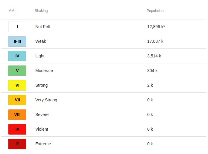
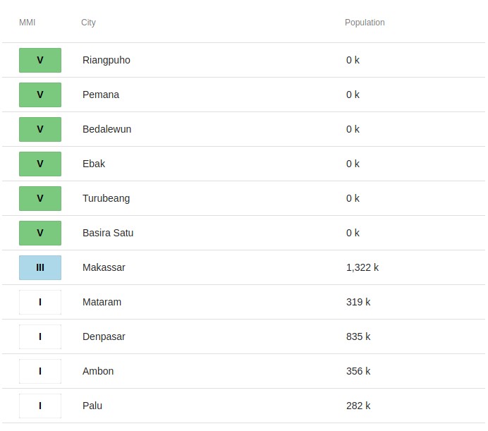
2 000 people are estimated to have felt strong shaking and 304 000 moderate.
Based on the preliminary earthquake parameters (M7.6), hazardous tsunami waves are possible for coasts located within 1 000 km (620 miles) of the earthquake epicenter, PTWC said at 03:28 UTC. The tsunami threat from this earthquake has now passed, the center said at 04:13 UTC.
Minor sea level fluctuations may occur in some coastal areas near the earthquake over the next few hours.
The USGS issued a Green alert for shaking-related fatalities and economic losses. There is a low likelihood of casualties and damage.
Overall, the population in this region resides in structures that are vulnerable to earthquake shaking, though resistant structures exist. The predominant vulnerable building types are unreinforced brick with concrete floor and precast concrete frame with wall construction.
Recent earthquakes in this area have caused secondary hazards such as tsunamis and landslides that might have contributed to losses.
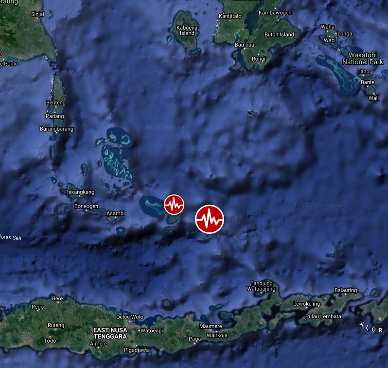
Image credit: TW/SAM, Google
BMKG and local media report damage to buildings in Selayar Islands Regency, South Sulawesi, and a tsunami about 7 cm (2.7 inches) in height. This area has a high tsunami potential at the coastline of about 2.9 m (9.5 feet).
Based on data on the location of the earthquake center, depth, and focal mechanism from the BMKG, the USGS, and the German GFZ, this earthquake was caused by active fault activity with a horizontal fault mechanism trending northwest to east southeast. This horizontal fault has not previously been identified as a source of earthquakes, BMKG said.
At least 7 people were injured and 346 homes damaged (134 heavily), 3 schools, 2 worship places and 1 port.
In addition, BNPB reports more than 1,550 evacuated people across the Sikka Regency.
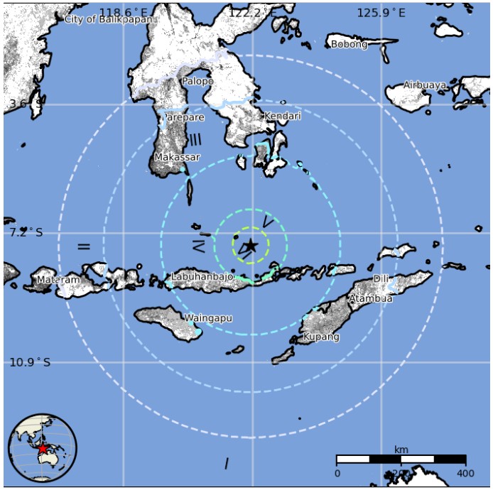
Estimated population exposure to earthquake shaking
Selected cities exposed
Regional seismicity

I'm a dedicated researcher, journalist, and editor at The Watchers. With over 20 years of experience in the media industry, I specialize in hard science news, focusing on extreme weather, seismic and volcanic activity, space weather, and astronomy, including near-Earth objects and planetary defense strategies. You can reach me at teo /at/ watchers.news.
Commenting rules and guidelines
We value the thoughts and opinions of our readers and welcome healthy discussions on our website. In order to maintain a respectful and positive community, we ask that all commenters follow these rules.