
Typhoon “In-Fa” nearing Okinawa, forecast to rapidly intensify on its way toward Taiwan and China
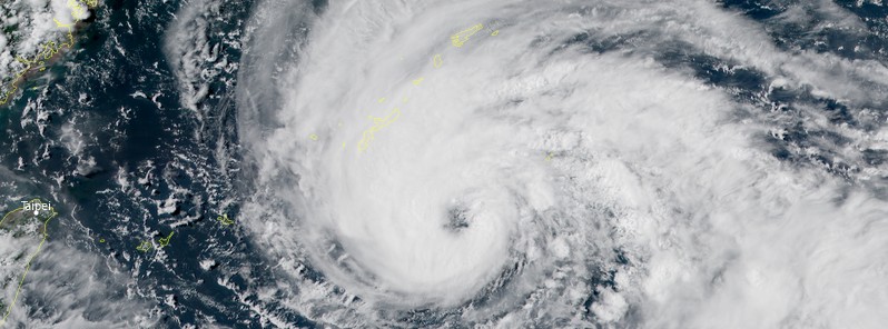
Featured image: Typhoon "In-Fa" at 06:10 UTC on July 20, 2021. Credit: JMA/Himawari-8, RAMMB/CIRA, TW
Typhoon "In-Fa" — the 6th named storm of the 2021 Pacific typhoon season — is approaching Okinawa, Japan on its way toward Taiwan and China. In-Fa will continue strengthening today and possibly rapidly intensify by July 22 while passing south of Okinawa. The current forecast track takes it along the northern tip of Taiwan on July 23 and into mainland China by July 25.
At 09:00 UTC on July 20, its center was located about 275 km (170 miles) SE of Kadena Air Base, Okinawa, Japan. In-Fa's maximum 10-minute sustained winds were 110 km/h (70 mph), with gusts up to 155 km/h (100 mph).
Its maximum 1-minute sustained winds were 120 km/h (75 mph). The minimum central barometric pressure was 980 hPa and the system was moving W at 13 km/h (8 mph).
Animated multispectral satellite imagery depicts deep convection, robust poleward outflow in the upper levels, and a ragged 65 km (40 miles) wide eye.
The typhoon will continue its westward track through 09:00 UTC on July 23 under the influence of the steering ridge, according to JTWC.
The system will intensify only slightly over the next 6 hours due to a slight increase in vertical wind shear and the entrainment of dry air along the southern and southeastern periphery of the system. After that, a repositioning of the upper-level ridge positioned to the north of the system will allow for enhanced poleward outflow.
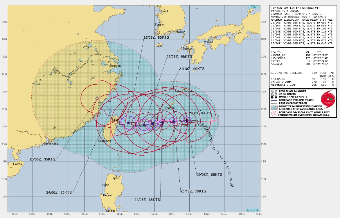
Image credit: JTWC
This repositioning, along with decreasing vertical wind shear and continued warm sea surface temperatures, will allow In-Fa to intensify, possibly rapidly, to 175 km/h (110 mph) by 09:00 UTC on July 22 at which time it will have passed south of Okinawa, Japan.
The system will then gradually weaken to 160 km/h (100 mph) by 09:00 UTC on July 23 due to an erosion of the favorable upper-level pattern. Thereafter, the typhoon will begin a northwestward track as it begins to round the steering ridge.
This track will bring it along the northern tip of Taiwan on July 23 and into mainland China late July 24 or early July 25 (UTC).
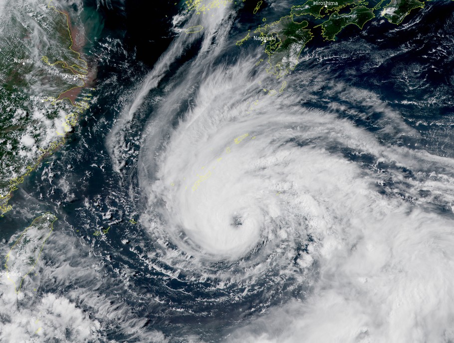
Typhoon "In-Fa" at 06:10 UTC on July 20, 2021. Credit: JMA/Himawari-8, RAMMB/CIRA, TW
I'm a dedicated researcher, journalist, and editor at The Watchers. With over 20 years of experience in the media industry, I specialize in hard science news, focusing on extreme weather, seismic and volcanic activity, space weather, and astronomy, including near-Earth objects and planetary defense strategies. You can reach me at teo /at/ watchers.news.
Commenting rules and guidelines
We value the thoughts and opinions of our readers and welcome healthy discussions on our website. In order to maintain a respectful and positive community, we ask that all commenters follow these rules.