
TC Claudette – Heavy rainfall and gusty winds expected along the northern Gulf Coast, landfall on June 19
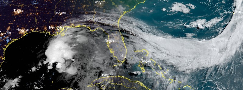
Featured image: Potential Tropical Cyclone Three at 13:10 UTC on June 18, 2021. Credit: NOAA/GOES-East, RAMMB/CIRA, TW
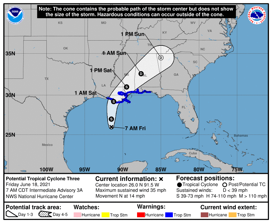
A new tropical cyclone — currently designated Potential Tropical Cyclone Three — is expected to form in the Gulf of Mexico on June 18, 2021, and make landfall along the north-central Gulf Coast by early Saturday, June 19 (LT). The National Hurricane Center has issued Tropical Storm Warning for Intracoastal City, Louisiana to the Okaloosa/Walton County line, as well as Lake Pontchartrain, Lake Maurepas, and Metropolitan New Orleans. The next (third) name on the 2021 Atlantic hurricane list is Claudette.
- The system is expected to produce heavy rainfall, considerable flash, urban and small stream flooding beginning today and continuing through the weekend along the Central Gulf Coast with flood impacts spreading northeastward into the Southern Appalachians.
- Tropical storm conditions are expected to begin today in areas near and well to the east of the center along portions of the central Gulf Coast from Intracoastal City, Louisiana, to the Okaloosa/Walton County line, Florida, including New Orleans.
The center of PTC3 was located about 410 km (255 miles) N of Morgan City, Louisiana, and 620 km (385 miles) NNE of Mobile, Alabama at 12:00 UTC (07:00 CDT) on June 18, 2021.
The system had maximum sustained winds of 55 km/h (35 mph) and minimum central pressure of 1 007 hPa. It was moving N at 22 km/h (14 mph).
This general motion is expected to continue for the next day or so.
On the current forecast track, the system will approach the north-central Gulf Coast tonight (LT) or early Saturday, June 19.
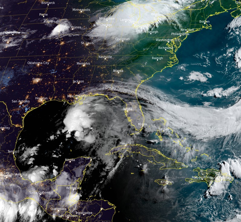
Potential Tropical Cyclone Three at 13:10 UTC on June 18, 2021. Credit: NOAA/GOES-East, RAMMB/CIRA, TW
A slow NE motion across the SE United States is likely after landfall through the weekend.
Additional strengthening is forecast and a subtropical or tropical storm is likely to form over the central or northern Gulf of Mexico later today (June 18).
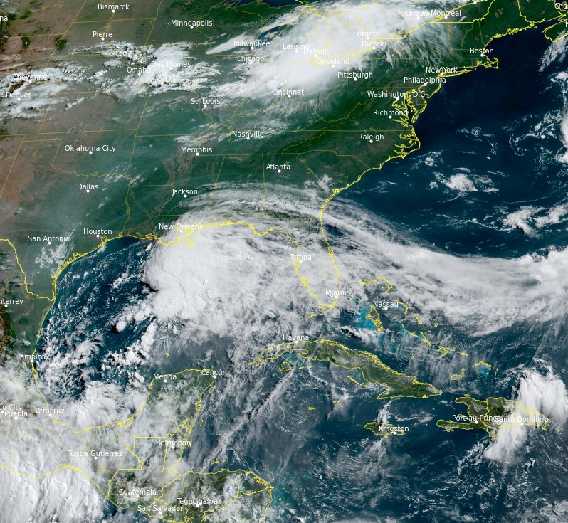
Potential Tropical Cyclone Three at 09:30 UTC on June 18, 2021. Credit: NOAA/GOES-East, RAMMB/CIRA, TW
The system is somewhat hybrid in nature and wind shear over the Gulf of Mexico shouldn't prevent its intensification to a tropical storm later today (possibly with subtropical characteristics), NHC forecaster Blake said.
Model guidance is consistent with slow strengthening until landfall, and the new forecast is close to the previous one. After landfall, most of the global models show a strong band of heavy rain and tropical-storm-force winds persisting on the southeastern side.
The expected large distance from the center necessitates extending the Tropical Storm Warning into the northwestern Florida panhandle.
"Given the current and anticipated structure of this system, users should not focus on the exact track of the center, as rainfall and wind hazards are likely to extend well east of the center and arrive well in advance of landfall," Blake said.
Claudette will likely dissipate in about 3 days over the southeastern United States.
Hazards affecting land
Rainfall
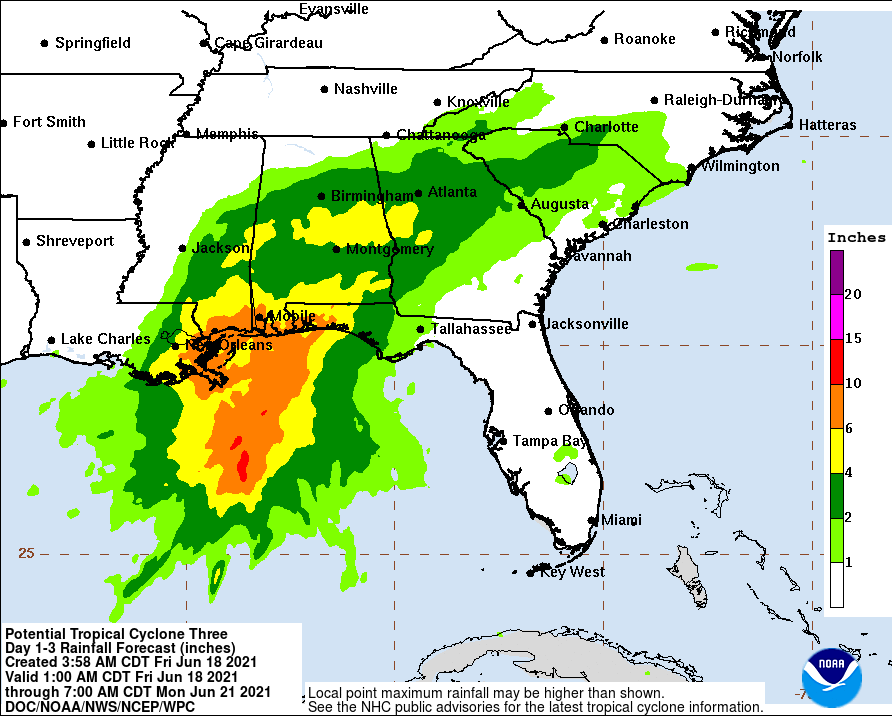
Rainfall totals of 100 – 200 mm (4 to 8 inches) with isolated maximum amounts of 305 mm (12 inches) are expected across portions of the Central Gulf Coast beginning today.
Considerable flash, urban and small stream flooding impacts, as well as new and renewed minor to isolated moderate river flooding, are likely.
As the system continues to lift northeast through the weekend, anticipate heavy rain to expand across southeastern Mississippi, southern and central Alabama, and central Georgia resulting in rainfall totals of 75 – 130 mm (3 to 5 inches) with isolated maximum amounts of 178 mm (7 inches).
Flash, urban, small stream and isolated minor river flooding impacts are possible.
The potential tropical cyclone is expected to produce total rainfall of 75 – 150 mm (3 to 6 inches) with isolated amounts of 200 mm (8 inches) across the Yucatan Peninsula of Mexico.
Storm surge
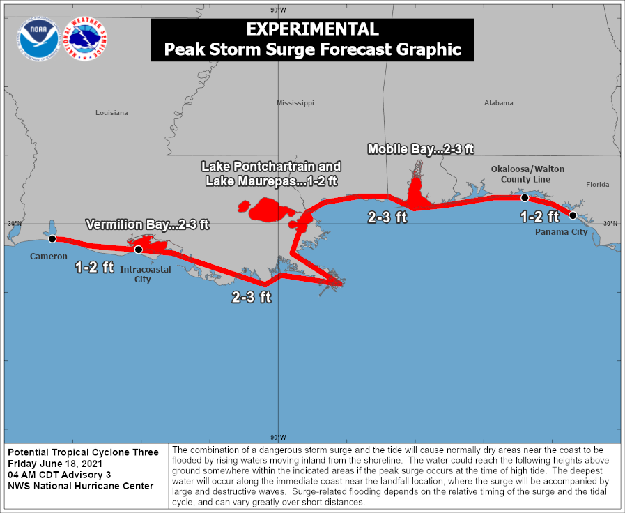
The combination of storm surge and the tide will cause normally dry areas near the coast to be flooded by rising waters moving inland from the shoreline.
The water could reach the following heights above ground somewhere in the indicated areas if the peak surge occurs at the time of high tide:
Intracoastal City, LA to Okaloosa/Walton County Line, FL: 0.6 – 0.9 m (2 – 3 feet)
Vermilion Bay, Lake Borgne and Mobile Bay: 0.6 – 0.9 m (2 – 3 feet)
Lake Pontchartrain and Lake Maurepas: 0.3 – 0.6 m (1 – 2 feet)
Okaloosa/Walton County Line, FL to Panama City, FL: 0.3 – 0.6 m (1 – 2 feet)
Cameron, LA to Intracoastal City, LA: 0.3 – 0.6 m (1 – 2 feet)
Surge-related flooding depends on the relative timing of the surge and the tidal cycle, and can vary greatly over short distances.
Wind
Tropical storm conditions are expected to first reach the coast within the warning area later today, making outside preparations difficult or dangerous.
Tornadoes
The threat for a tornado or two will begin this afternoon across coastal Louisiana, then spread overnight into Saturday across southern portions of Louisiana, Mississippi, and Alabama, to the western Florida Panhandle.
I'm a dedicated researcher, journalist, and editor at The Watchers. With over 20 years of experience in the media industry, I specialize in hard science news, focusing on extreme weather, seismic and volcanic activity, space weather, and astronomy, including near-Earth objects and planetary defense strategies. You can reach me at teo /at/ watchers.news.
Commenting rules and guidelines
We value the thoughts and opinions of our readers and welcome healthy discussions on our website. In order to maintain a respectful and positive community, we ask that all commenters follow these rules.