
Scientists discover east Antarctica’s magnetic link to its ancient neighbors in Gondwana
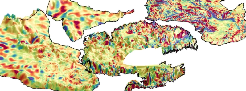
Image credit: Kiel University
An international team of scientists was able to determine where Antarctica has been linked to its former neighbors in the supercontinent Gondwana. Using geology and satellites, the researchers discovered high-resolution details about the missing links between Antarctica and its ancient neighbors.
Antarctica appears to be cut off from the rest of the world, separated by waters of the Southern Ocean. However, researchers found that this was not always the case as around 200 million years ago, Antarctica was connected to other continents, forming Gondwana.
The study shows that combining satellite and aeromagnetic data provides the key missing link to connect Antarctica's hidden geology with its former neighbors, namely Australia, India, and South Africa.
"We use the satellite data to its full spectral content, which helps to include India, where high-resolution aeromagnetic data are not publically available," the authors wrote. Furthermore, satellite data helped homogenize the airborne data, which were collected over a period of more than 60 years.
"With the available data, we only had pieces of the puzzle. Only when we put them together with satellite magnetic data, can we see the full picture," said author Jorg Ebbing from Kiel University.
The combined datasets provided a new tool for the scientific community to study Antarctica's geology, including its impact on the overlying ice sheets.
Gondwana was an amalgam of continents that included South America, Africa, Arabia, Madagascar, India, Australia, New Zealand, and Antarctica. As the tectonic plates collided some 600-500 million years ago, during the Precambrian and early Cambrian times, they built massive mountain ranges similar to the modern Himalayas and Alps.
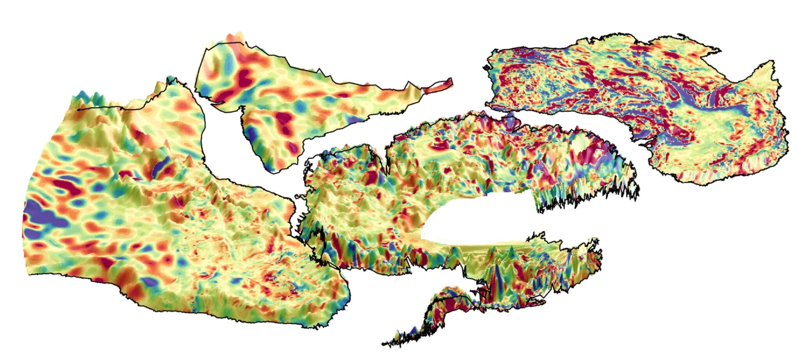
Image credit: Kiel University
The supercontinent began to break apart in the early Jurassic era, around 180 million years ago, leaving Antarctica isolated at the South Pole, blanketed in ice for around 34 million years.
"Using the new magnetic data, our animation illustrates how the tectonic plates have moved over millions of years after the breakup of Gondwana," explained co-author Peter Haas, a Ph.D. student at Kiel University.
"We have been trying to piece together the connections between Antarctica and other continents for decades," said Fausto Ferraccioli, Director of Geophysics at the National Institute of Oceanography and Applied Geophysics in Italy.
"We knew that magnetic data play a pivotal role because one can peer beneath the thick Antarctic ice sheet to help extrapolate the geology exposed along the coast into the continent interior."
"But now we can do much better. With the satellite and aeromagnetic data combined, we can look down deeper into the crust. Together with tectonic plate reconstructions, we can start building tantalizing new magnetic views of the crust to help connect geological and geophysical studies in widely separated continents."
He continued, "Ancient cratons and orogens in Africa, India, Australia, and East Antarctica are now better connected magnetically than ever before."
ESA's Roger Haagmans added, "This research has been carried out within ESA's Science for Society 3D Earth study where we are using gravity data from the GOCE mission and magnetic data from the Swam mission to understand the structure and dynamic processes deep within Earth. In this instance, Swarm's magnetic data have played a starring role."
Reference
"East Antarctica magnetically linked to its ancient neighbours in Gondwana" – Ebbing, J., et al. – Scientific Reports – DOI: 10.1038/s41598-021-84834-1
Abstract
We present a new magnetic compilation for Central Gondwana conformed to a recent satellite magnetic model (LCS-1) with the help of an equivalent layer approach, resulting in consistent levels, corrections that have not previously been applied. Additionally, we use the satellite data to its full spectral content, which helps to include India, where high resolution aeromagnetic data are not publically available. As India is located north of the magnetic equator, we also performed a variable reduction to the pole to the satellite data by applying an equivalent source method. The conformed aeromagnetic and satellite data are superimposed on a recent deformable Gondwana plate reconstruction that links the Kaapvaal Craton in Southern Africa with the Grunehogna Craton in East Antarctica in a tight fit. Aeromagnetic anomalies unveil, however, wider orogenic belts that preserve remnants of accreted Meso- to Neoproterozoic crust in interior East Antarctica, compared to adjacent sectors of Southern Africa and India. Satellite and aeromagnetic anomaly datasets help to portray the extent and architecture of older Precambrian cratons, re-enforcing their linkages in East Antarctica, Australia, India and Africa.
Commenting rules and guidelines
We value the thoughts and opinions of our readers and welcome healthy discussions on our website. In order to maintain a respectful and positive community, we ask that all commenters follow these rules.