
Strong and shallow M5.9 earthquake hits Turkey, leaving 1 person dead and 18 injured
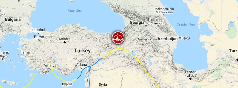
Image credit: TW
A strong and shallow earthquake registered by the USGS as M5.9 hit eastern Turkey's Bingol province at 14:24 UTC (17:24 local time) on June 14, 2020. The agency is reporting a depth of 10 km (6.2 miles). Turkey's Disaster and Emergency Management Authority reported the quake as M5.7 at a depth of 5 km (3.1 miles).
The epicenter was located 15 km (9 miles) E of Yedisu (population 1 771), 50 km (30 miles) SE of Tercan (population 12 235), 55 km (34 miles) S of Aşkale (population 15 462), 59 km (36 miles) NNW of Solhan (population 15 303), and 62 km (38 miles) NNE of Bingöl (population 80 568).
There are 1 370 000 people living within 100 km (62 miles).
Hundreds of aftershocks were registered by 07:14 UTC on June 15, including four significant — M4.5, M4.5, M5.4, and M4.3.
7 000 people are estimated to have felt strong shaking, 53 000 moderate, and 1 538 000 light.
According to Bingol Governor's Office, one person — a village guard — was killed, and two others injured after two observation towers collapsed. Seven others were rescued from the wreckage, the Daily Sabah reports.
In total, 18 people were injured but no one critical.
10 houses were damaged in the Elmalı and Dinarbey villages of the Yedisu district.
The tremor reportedly lasted 8 to 10 seconds.
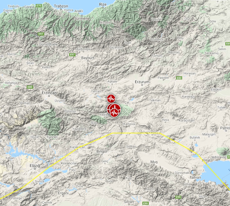

Image credit: TW/SAM, Google
Director of the Dokuz Eylül University Earthquake Research Center, Hasan Sözbilir, said that the two eastern branches of the North Anatolian Fault (NAF) started to trigger earthquakes, adding that the fault has the potential to create earthquakes up to a magnitude of 6.9.
"Faults were triggered. Aftershocks resumed along the Elmalıdere line, which began to break with Sunday’s 5.7 magnitude earthquakes. It is crucial not to enter houses with serious damages. There has been a dangerous degree of seismic activity in the region located between Erzincan and Karlıova," Sözbilir said.
The right-lateral, strike-slip North Anatolia Fault accommodates much of the westwards motion between the Anatolia Block and Eurasia Plate. Between 1939 and 1999, a series of devastating M7.0+ strike-slip earthquakes propagated westwards along the North Anatolia Fault system. The westernmost of these earthquakes was the 17th August 1999, M7.6 Izmit earthquake, near the Sea of Marmara, which killed approximately 17 000 people.
Featured image credit: TW/SAM, Google
I'm a dedicated researcher, journalist, and editor at The Watchers. With over 20 years of experience in the media industry, I specialize in hard science news, focusing on extreme weather, seismic and volcanic activity, space weather, and astronomy, including near-Earth objects and planetary defense strategies. You can reach me at teo /at/ watchers.news.
Commenting rules and guidelines
We value the thoughts and opinions of our readers and welcome healthy discussions on our website. In order to maintain a respectful and positive community, we ask that all commenters follow these rules.