
Typhoon “Mitag” about slam into South Korea, residents warned to take extra precautions against landslides and flooding
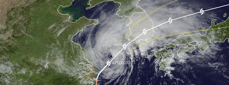
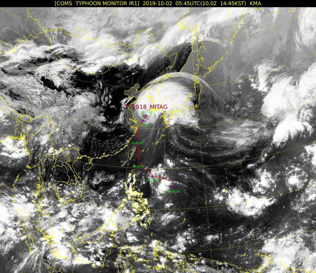
Image credit: UW-CIMSS
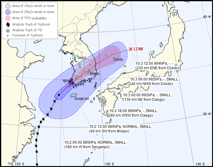
After lashing Taiwan and parts of eastern China with heavy rains and strong winds, Typhoon "Mitag" is now approaching southern South Korea. Landfall is expected around 12:00 UTC on October 2, with maximum sustained winds of 90 km/h (58 mph) and very heavy rain. After exiting into the Sea of Japan on October 3, Mitag will head towards Japan where it is expected to make landfall on October 4.
Mitag is expected to have a stronger influence on the country than Tapah, which left at least 3 people dead, because it will 'come directly over us,' an official with the Korea Meteorological Administration (KMA) said.
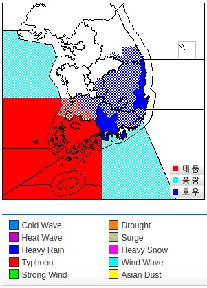
Serious damage is expected. Weather officials advise people to take extra precautions against landslides and flooding.
Mitag injured 12 people in NE Taiwan, and possibly led to a collapse of a bridge in which 6 people are feared to have lost their lives, and forced at least 23 000 people to evacuate in Chinese provinces of Zhejiang and Fujian.
Heavy rain and strong winds left at least 3 people injured and forced dozens to evacuate on South Korea's Jeju Island, Ministry of Interior and Safety reported on October 2.
Dozens of buildings were damaged and more than 300 flights canceled. More than 300 schools were closed or had their hours shortened.
According to the KMA, Mitag is the season's 18th typhoon and the seventh to affect the country this year. It is expected to land on Mokpo, Gwangju and other cities in South Jeolla Province around midnight (LT) before affecting Busan, Daegu and other cities in Gyeongsang provinces.
At 09:00 UTC on October 2, the center of Typhoon "Mitag" was located about 195 km (120 miles) SW of Jindo, South Korea. Its maximum sustained wins were 85 km/h (52 mph). Over the past 6 hours, Mitag was moving NNE at 28 km/h (17 mph).
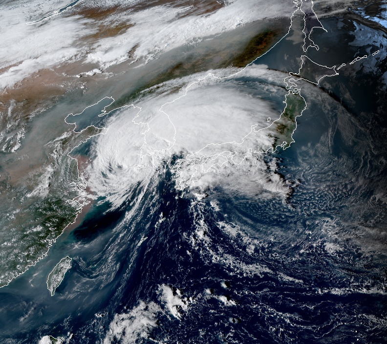
Typhoon "Mitag" at 07:00 UTC on October 2, 2019. Credit: JMA/Himawari-8
Mitag is currently in an area of strong southerly vertical wind shear and non-conductive sea surface temperatures, allowing it to further weaken as it approaches South Korea landfall, JTWC forecasters noted.
Over the next 48 hours, Mitag will transform into a gale-force cold core low. Interaction with northern Honshu, Japan will degrade it down to 65 km/h (40 mph).
I'm a dedicated researcher, journalist, and editor at The Watchers. With over 20 years of experience in the media industry, I specialize in hard science news, focusing on extreme weather, seismic and volcanic activity, space weather, and astronomy, including near-Earth objects and planetary defense strategies. You can reach me at teo /at/ watchers.news.
Commenting rules and guidelines
We value the thoughts and opinions of our readers and welcome healthy discussions on our website. In order to maintain a respectful and positive community, we ask that all commenters follow these rules.