
Storm Lorenzo to hit Ireland with disruptive winds and heavy rain
Featured image: Storm Lorenzo at 18:00 UTC on October 2, 2019. Credit: UW-CIMSS, SSEC, TW
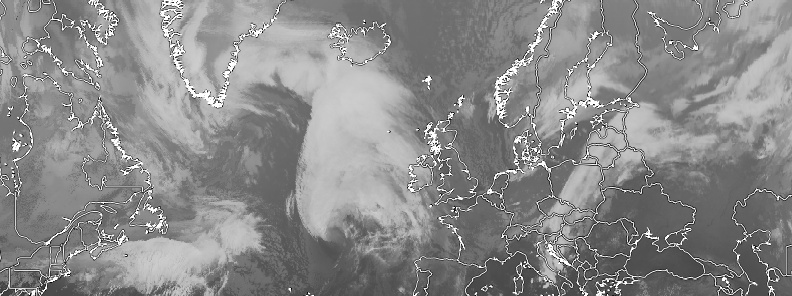
Post-Tropical Cyclone "Lorenzo," now known as Storm Lorenzo, is moving toward Ireland and the United Kingdom, bringing disruptive winds and heavy rain. Lorenzo is still a powerful and very large cyclone. Hurricane-force winds extend outward up to 240 km (150 miles) from the center and tropical-storm-force up to 630 km (390 miles).
- Lorenzo rapidly strengthened into a Category 5 hurricane on September 28 and 29, 2019, and became the strongest hurricane this far north and east in the Atlantic basin on record.
- Lorenzo is now the first named storm of the 2019/20 European windstorm season. This is the fifth instance of seasonal European windstorm naming in Europe. This will be the first season in which the Netherlands will participate, joining the United Kingdom and Ireland's meteorological agencies. The season runs from September 1, 2019 – September 1, 2020.
The hurricane brought hurricane-force winds to the Azores on the morning of October 2, with gusts to 145 km/h (90 mph). Damage and power outages were reported throughout the islands.
"This might be the strongest hurricane in the last 20 years," said Carlos Neves, head of the Azores’ civil protection authority. "Although it shifted slightly in recent days to the west, it has affected us in a very aggressive way."
Lorenzo is now a powerful Atlantic storm heading toward Europe.
Its center will move east to south-eastwards over Ireland on Thursday night with the strongest winds situated to the south of the storm center, Met Eireann meteorologists noted.
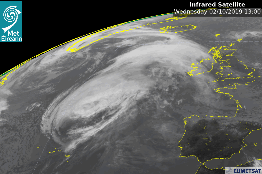
At 15:00 UTC (11:00 AST), Lorenzo's center was located 1 525 km (945 miles) WSW of Cork and 1 565 km (970 miles) WSW of Galway, Ireland. Its maximum sustained winds were 130 km/h (80 mph) and minimum central pressure 962 hPa.
The storm was moving NE at 69 km/h (43 mph).
A continued fast motion toward the northeast is expected through Thursday morning, October 3, NWS NHC said.
The cyclone is forecast to slow down and turn eastward and then southeastward Thursday night and Friday.
On the forecast track, the center of Storm Lorenzo will move near western Ireland on Thursday, then pass over Ireland and England on Thursday night and Friday.
The exact track over Ireland is still subject to change. The most severe winds associated with Lorenzo are likely in Atlantic coastal parts on the southern flank of the storm, however strong winds are possible in all areas.
.png)
Only slow weakening is forecast during the next day or so, and the system is expected to be a strong extratropical cyclone when it approaches Ireland Thursday afternoon and evening.
A faster rate of weakening is expected when the cyclone moves over Ireland and England. The low should dissipate over southeastern England by late Friday.
A Status Orange – Wind warning was issued for Galway, Mayo, Clare, Cork, Kerry and Limerick. The warning is valid 09:00 LT, October 3 through 09:00 on October 4.
Our warnings for #Lorenzo have been issued.
All warnings can be viewed here:https://t.co/ozrQHtoOkt
An explanation of our warning levels can be found here:https://t.co/Cr9ukyJgun
Our Meteorologist's Commentary has been updated and can be viewed here:https://t.co/ktXtWjbfIg pic.twitter.com/QhemlD7hX5
— Met Éireann (@MetEireann) October 2, 2019
"The effects of 'Storm Lorenzo' will begin to be felt across Ireland from Thursday morning, easing Friday morning. The main impacts will include disruptive winds, falling trees and flooding," Met Eireann meteorologists said.
"In early October, trees are mostly in full leaf with a large surface area, so even moderate strength winds can bring down weakened trees and/or tree limbs. In addition, some trees may be compromised due to saturated soils at the moment, and with more rain forecast with Storm Lorenzo some disruption due to falling trees/branches is likely. Heavy rain, coupled with falling leaves may block drains and gullies, leading to surface flooding."
- Lorenzo will produce significant swell, high waves and sizeable storm surges. This will lead to wave overtopping, some coastal flooding and damage, especially along western and southern coasts.
- Saturated soils and the expected heavy/thundery rainfall may lead to surface flooding.
- River levels are currently elevated across the country and the rainfall may lead to river flooding, especially in parts of the midlands and west. River levels will continue to rise after Storm Lorenzo has passed.
This low-pressure system is forecast to reach storm thresholds for the Republic of Ireland, but not elsewhere in the UK, the UK Met Office said.
A Yellow wind warning is in effect for parts of Northern Ireland from 15:00 to 22:00 LT on Thursday. A separate Yellow wind warning has been issued for Cornwall and most of Devon and coastal parts of south-west Wales. This warning runs from 04:00 to 16:00 LTon Friday.
"By the time Lorenzo reaches our latitudes it will be a low-pressure system that we're accustomed to seeing at this time of year, but our partner Met Éireann is expecting impacts from the strong winds and heavy rain to affect the Republic of Ireland. Across much of the rest of the UK we’re anticipating the impacts will be minimal, but we have issued yellow wind warnings for Northern Ireland and parts of southwest England and south Wales," said Andy Page, Chief Meteorologist with the Met Office.
#Lorenzo has now lost its tropical characteristics, and is classed as a Post Tropical Cyclone by @NHC_Atlantic. However some very windy and wet weather is in store for Ireland and parts of the UK, stay #weatheraware pic.twitter.com/hG58STFsHv
— Met Office (@metoffice) October 2, 2019
"At the moment, the strongest winds are expected in western Ireland, with a risk of coastal gales developing in Northern Ireland on Thursday and south Wales and south-west England on Friday. Storm Lorenzo will also bring a spell of heavy rain to much of the UK mainly during Thursday night and the first half of Friday.
"Our advice is to pay close attention to the weather forecast over the next couple of days and to keep an eye out for any weather warnings that may be issued in your area."
I'm a dedicated researcher, journalist, and editor at The Watchers. With over 20 years of experience in the media industry, I specialize in hard science news, focusing on extreme weather, seismic and volcanic activity, space weather, and astronomy, including near-Earth objects and planetary defense strategies. You can reach me at teo /at/ watchers.news.
Commenting rules and guidelines
We value the thoughts and opinions of our readers and welcome healthy discussions on our website. In order to maintain a respectful and positive community, we ask that all commenters follow these rules.