
Rapid intensification of Storm Ashley forecast with hurricane-force winds set to hit Ireland and Scotland
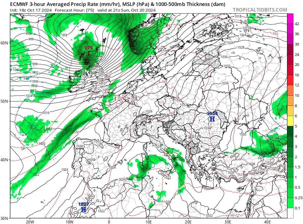
Storm Ashley, Europe’s first storm of the season, was officially named on Friday, October 18, 2024, and is on track to explode in power, with coastal Ireland bracing for hurricane-force winds and rain by Saturday and Sunday. Forecast models take Ashley’s center over Scotland on Sunday afternoon (LT) before the storm races toward Norway and Sweden.

Image credit: EUMETSAT/Meteosat-11, Zoom Earth, The Watchers. Acquired at 06:40 UTC on October 18, 2024.
- Storm Ashley is expected to rapidly intensify as it approaches Ireland and the UK on Saturday, October 19, bringing hurricane-force winds to the region through Sunday.
- As the system moves toward Ireland and Scotland, high waves will likely strike the region on Sunday, with western Ireland, Northern Ireland, and western Scotland seeing the greatest risk. The Outer Hebrides could also be heavily impacted. Coastal flooding and hazardous conditions are likely in these regions.
Storm “Ashley” — the first named storm of the 2024/25 storm season in Europe, was named by Met Eireann early Friday morning, October 18.
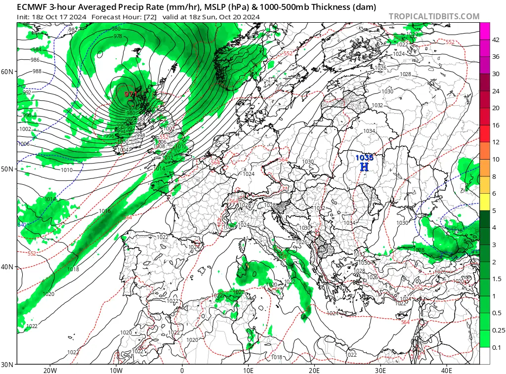
Ashley is expected to explosively deepen on Saturday as it crosses the jet stream, impacting western coastal areas of Ireland with heavy rains and gale-to-hurricane-force winds before its center moves over Scotland on Sunday.
Met Eireann warned the system could bring “very strong and gusty winds”, “widespread, heavy rainfall” and the potential for coastal flooding.
The alignment of high tides due to the supermoon event during the weekend with the incoming storm could lead to greater than-usual coastal flooding. Large waves generated by the storm could significantly affect the western coasts of Ireland, Northern Ireland, and Scotland. Waves reaching up to 10 – 12 m (33 – 39 feet) are possible.
On Saturday, the cold push will strengthen the southern part of the trough, intensifying the storm and causing a rapid pressure drop. The system’s central pressure could fall as low as 950 hPa by Sunday morning, possibly even lower.
A drop in pressure of 24 hPa or more in 24 hours is known as explosive cyclogenesis or bombogenesis. This process can produce extremely strong winds, and models are predicting wind gusts exceeding 150 km/h (90 mph), with some areas experiencing gusts as high as 180 km/h (110 mph).
One aspect of concern with systems like this is the possible development of a “sting jet.” This is a focused area of particularly intense winds within the storm that can cause localized damage. In addition to powerful winds, the storm will bring large swells and high waves to coastal areas.
Waves generated by this type of storm can be devastating, especially when combined with the full Moon’s high tide.
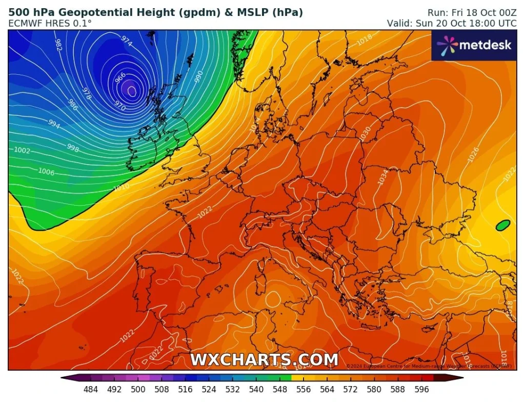
According to the latest weather models, Ashley’s center will approach Northern Ireland on Sunday morning and move up toward Scotland, making landfall late Sunday afternoon before racing toward Norway and Sweden.
Met Eireann issued an extremely rare weather advisory for high tides in the coastal regions of Ireland. “Exceptionally high supermoon spring tides with coastal flooding possible. Wind warnings expected Saturday night and into Sunday,” stated the advisory.
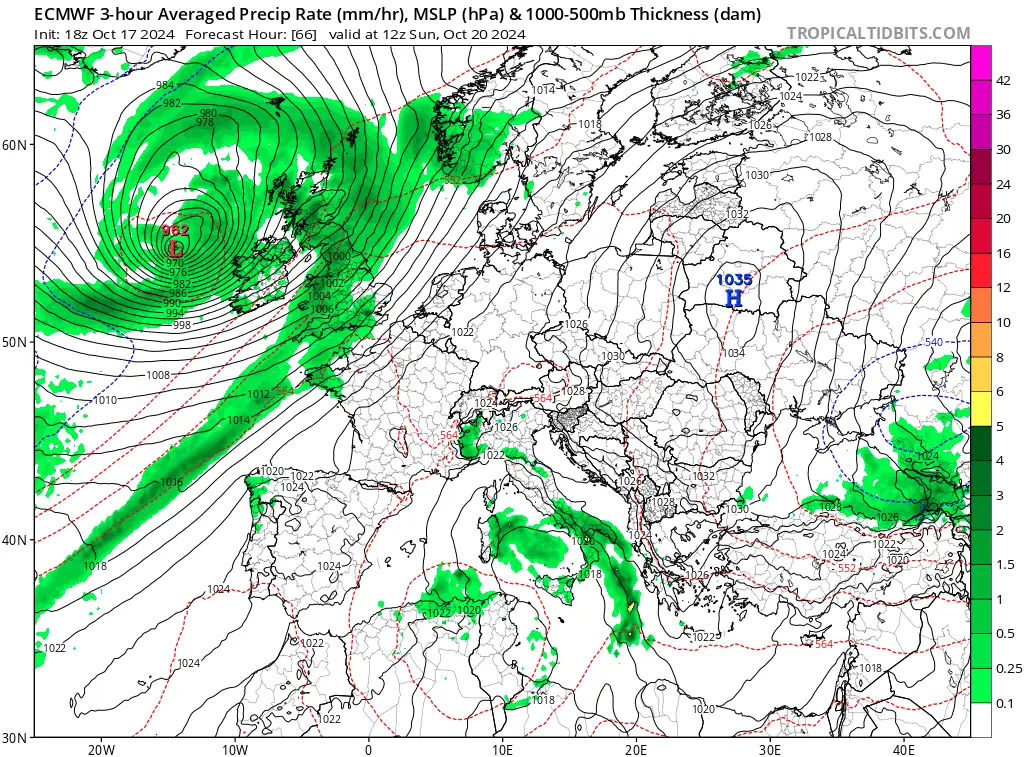
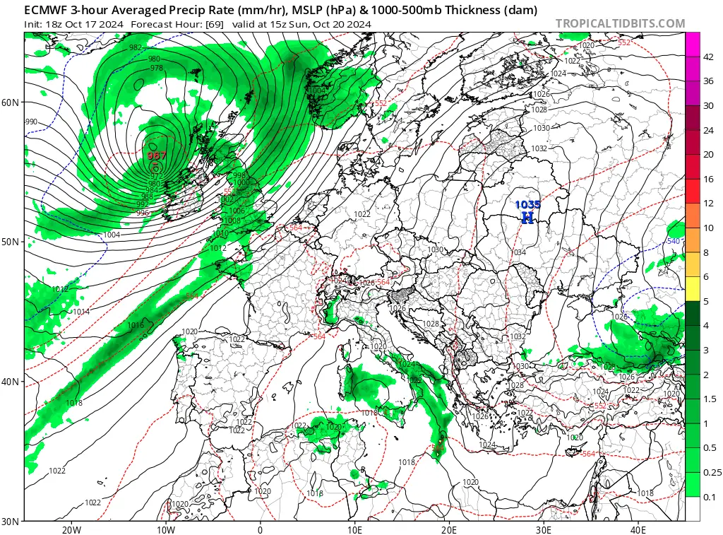
Although the system is not expected to bring excessive rainfall to the UK, western Scotland could see 60 – 100 mm (2.4 – 4 inches) of rain over the weekend. Strong southwesterly winds, combined with the region’s higher terrain, could result in orographic rainfall, increasing precipitation totals in mountainous areas.
As the storm tracks across northwestern Scotland, it is expected to gradually weaken and move towards the Faroe Islands and the Shetlands by late Sunday. While the primary threat remains the strong winds and high waves, residents of affected areas should still prepare for heavy rainfall and localized flooding.
One minor benefit of the system’s powerful winds will be felt by those flying eastbound from the United States to Europe. Planes traveling in this direction will experience shorter flight times due to the strong upper-level winds. However, flights heading westward may face longer durations as they move against these winds.
References:
1 Potentially impactful weather Friday 18th October and over the weekend (19th- 20th October) – Met Eireann – October 16, 2024
2 An explosive development of storm Ashley will blast into Ireland and Scotland on Sunday – SWE – October 17, 2024

I am an Assistant Editor and Severe Weather & Science Journalist at The Watchers, specializing in real-time severe weather coverage, geophysical event reporting, and research-driven scientific analysis. You can reach me at rishav(at)watchers(.)news.
Commenting rules and guidelines
We value the thoughts and opinions of our readers and welcome healthy discussions on our website. In order to maintain a respectful and positive community, we ask that all commenters follow these rules.